

Arrowhead Fal
We settled in for a long drive of about six hours from east of Butte, Montana to Big Creek Campground in the Flathead National Forest near the west entrance to Glacier National Park. Montana is a big state and distances on a map can be very deceiving. We chose to stay at the National Forest rather than at a campground in the park as we are on the upper limit for the park campgrounds. After looking at the sites later we were very glad we made that decision. Our site at Big Creek was large, wooded, private and offered lots of free firewood. The only downside was a two mile stretch of very rough road. Later we found another way in that while longer only had a short stretch of rough road. We are still dry camping but came in with a full tank of water. Good thing as the water connection was a long way from the trailer. The campground is along Big Creek, a major tributary of the Flathead River. The Flathead is a National Wild and Scenic River. The whole area is a fisherman’s and rafter’s dream.
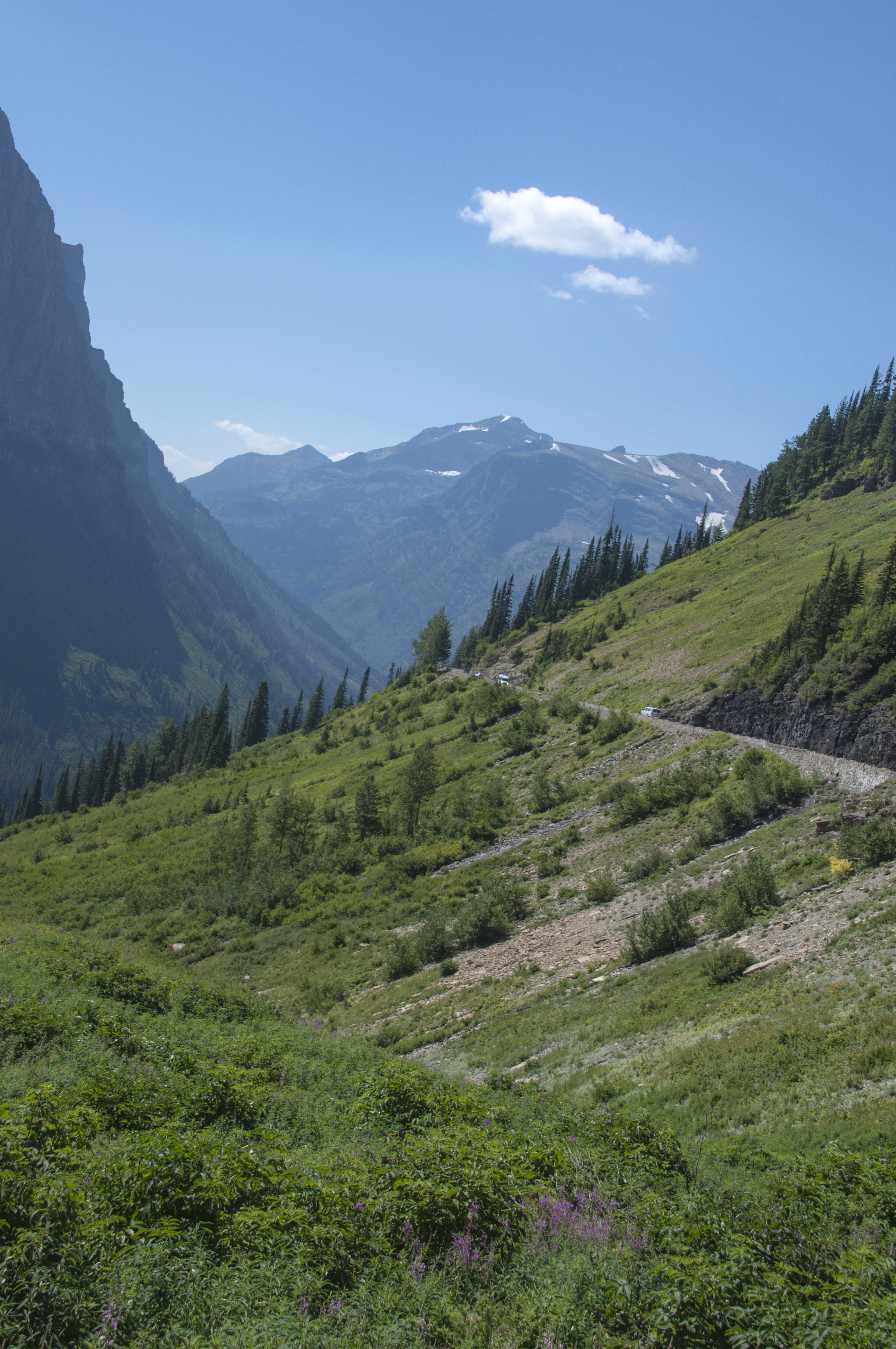
Along The Going-To-The-Sun Road
Glacier NP is half of what is called the Glacier-Waterton International Peace Park. This is the only park in the world dedicated to long standing peace between two countries. We didn’t get to Waterton this time but “when we come back… Glacier NP has been on my bucket list longer than I care to admit. I wasn’t disappointed. While I haven’t been to Machu Pichu (not yet anyway!) this is what I imagine it will look like. At over a million acres this is a huge park. There is only one road running through the park from east to west, The Going-To-The-Sun Road. It is 50 miles of the most gorgeous scenery we’ve seen since the Beartooth Highway. Completed in 1932 it is considered an engineering marvel and is a Civil Engineering National Landmark. On average it opens about mid June and is passable until mid or late September. This year it had opened only to be closed again by 2′ of snow, the same snow storm on June 17 that gave us a dusting at Red Rock Lakes NWR. The park averages 25′ of snow a year so plowing the GTTS is difficult and dangerous. Just east of the high point at Logan Pass drifts can be 80′ deep!
The drive , if you don’t stop, would take about an hour and a half. So for us, it was an all day trip on day one and about 3 hours on subsequent drives. From an area called The Loop to Rising Sun the road is cut into overhanging rock on one side and a low (18″) guardrail overlooking a steep (1,000-2,000′) valley on the other. I felt so small and insignificant in this vast wilderness. So you tend to crowd the middle line. We didn’t think about pulling in our mirrors and there was no warning sign. On the way back to camp we clipped mirrors with another truck and the driver’s side mirror shattered. From then on we pulled mirrors in! A bit like closing the barn door after the horse is out! Fortunately we were able to get repairs made in Whitefish about 20 miles away.

Silent Sentinels From Fires In 2003

Fireweed In Bloom

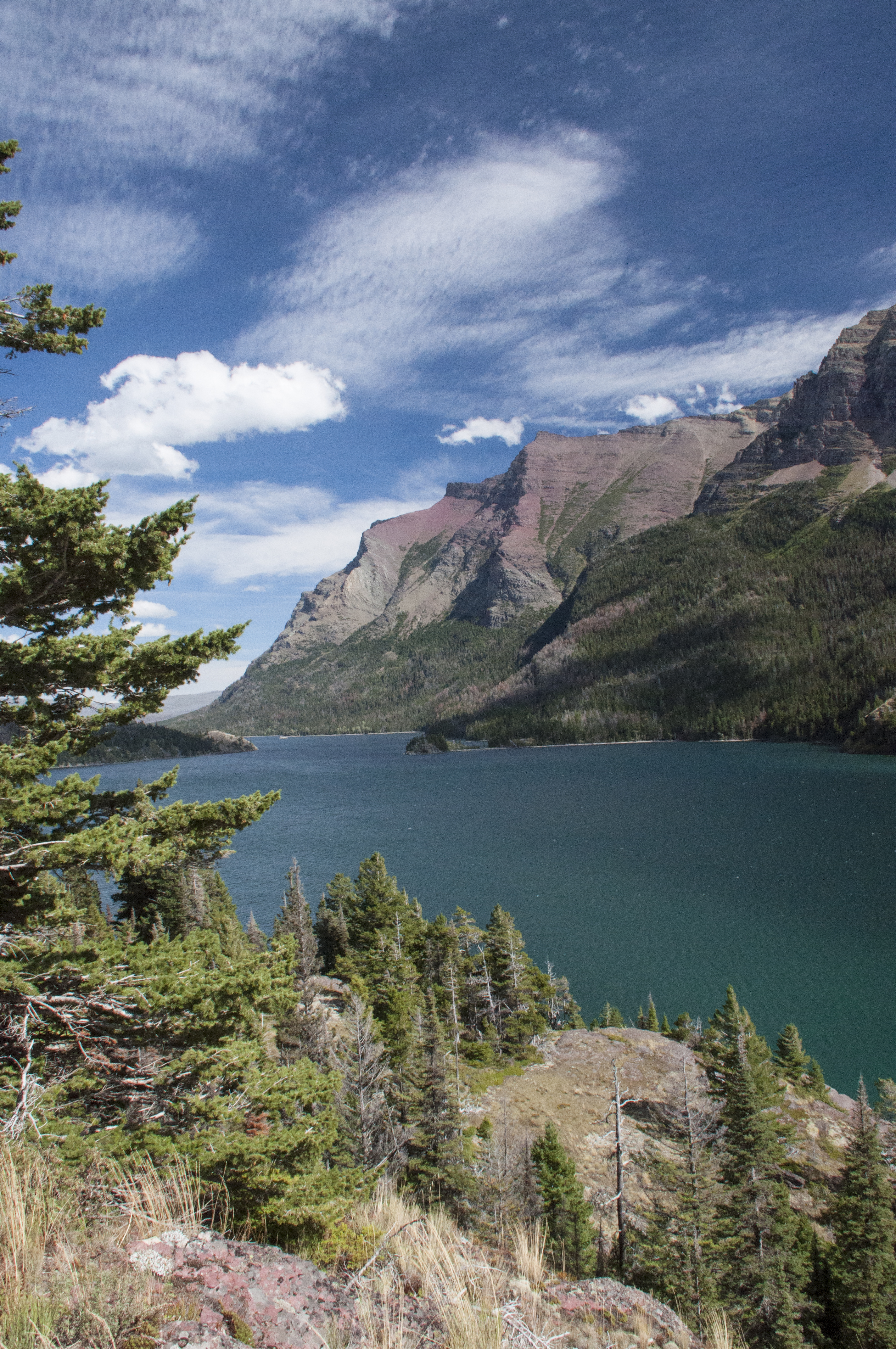
Glacier Blue
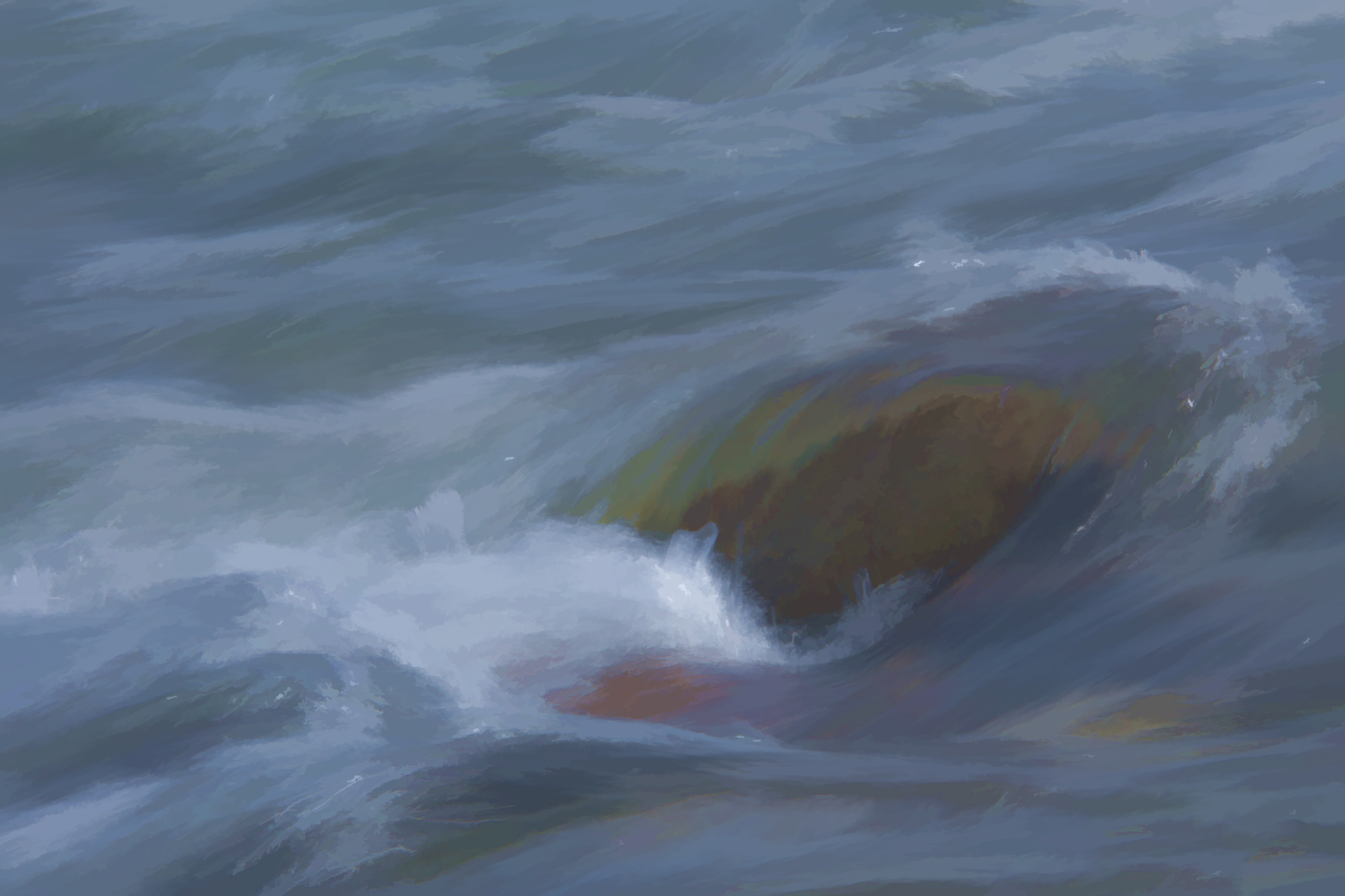
Soft Water

Late Summer Wildflowers At Glacier

Our Only Bear

View Looking Up Lunch Creek
We’d expected gorgeous scenery but we weren’t expecting so many fabulous waterfalls. Lunch Creek is a favorite stopping spot both for a hike uphill to the falls and for sitting, wading and picnicking. Day two we had planned to take a boat ride on St. Mary’s Lake to other falls and go on a Ranger led hike. I say planned because after we got there and got unpacked, Steve couldn’t find the car keys. He tore the truck apart. Realizing we were not going to make the trip today, I changed reservations to the next day. He was going crazy and still not finding the keys when I returned. I started looking too. I went through my purse and…you guessed it, there they were. I don’t remember picking them up but obviously I did thinking they were my set. You know your husband loves you if ……. I do love her EVEN when she does things like this!

Swiftcurrent Falls
So what to do the rest of the day? We drove over to another area that is not on the GTTS Road called Many Glacier. Glacier NP is not named for the glaciers that used to be there but for the action of the glaciers on the landscape. As of now, it is expected that all of the glaciers will have melted by 2030. A glacier by definition must be 25 acres in area, 100 feet deep and be moving. We spent time along rushing streams, took photos along Swiftcurrent Creek and walked part of the Ptarmigan Trail. We’d started too late to get all the way to Iceberg Lake but met several people who were on their way back. All said it was well worth the hike. Another thing for when we come back. By the time we got to the truck it was dinner time and we still had a two hour drive back. It was getting dark and rainy. So we grabbed pizza to go and took the “long” way around rather than drive the GTTS in the dark and fog. We kept saying “bet this is beautiful if we could see it!” Opal was very glad to see us after 12 hours in the trailer. They keep telling me how beautiful it is but all I see is the inside of the trailer.”

Scenery In Many Glacier Area

Steve On The Ptarmigan Trail

Against The Wind
We made the drive back to St. Mary’s Lake on Friday and took the 2pm boat trip. A ranger was on board and explained a lot of park history. We especially liked learning about the early period when the railroad had built an exclusive resort on the lake. We cruised by Little Goose Island. There is an overlook for the island on the GTTS that is the most photographed place in Glacier NP. We tried to get sunset pictures after the cruise but Mother Nature only gave us thick clouds and no sun. After docking we took a 3 mile hike to two waterfalls; Barring Falls and St. Mary’s Falls. The scenery from the trail was spectacular! On the ride back we saw Triple Divide Peak. This is only one of two places in North America where water flows in three directions: to the Mississippi on the east, to the Pacific via the Columbia River on the west and to Hudson’s Bay to the north.

Cruise Aboard The Little Chief

Beautiful Day On The Water

Barring Falls

St. Mary’s Falls

Approaching Little Goose Island
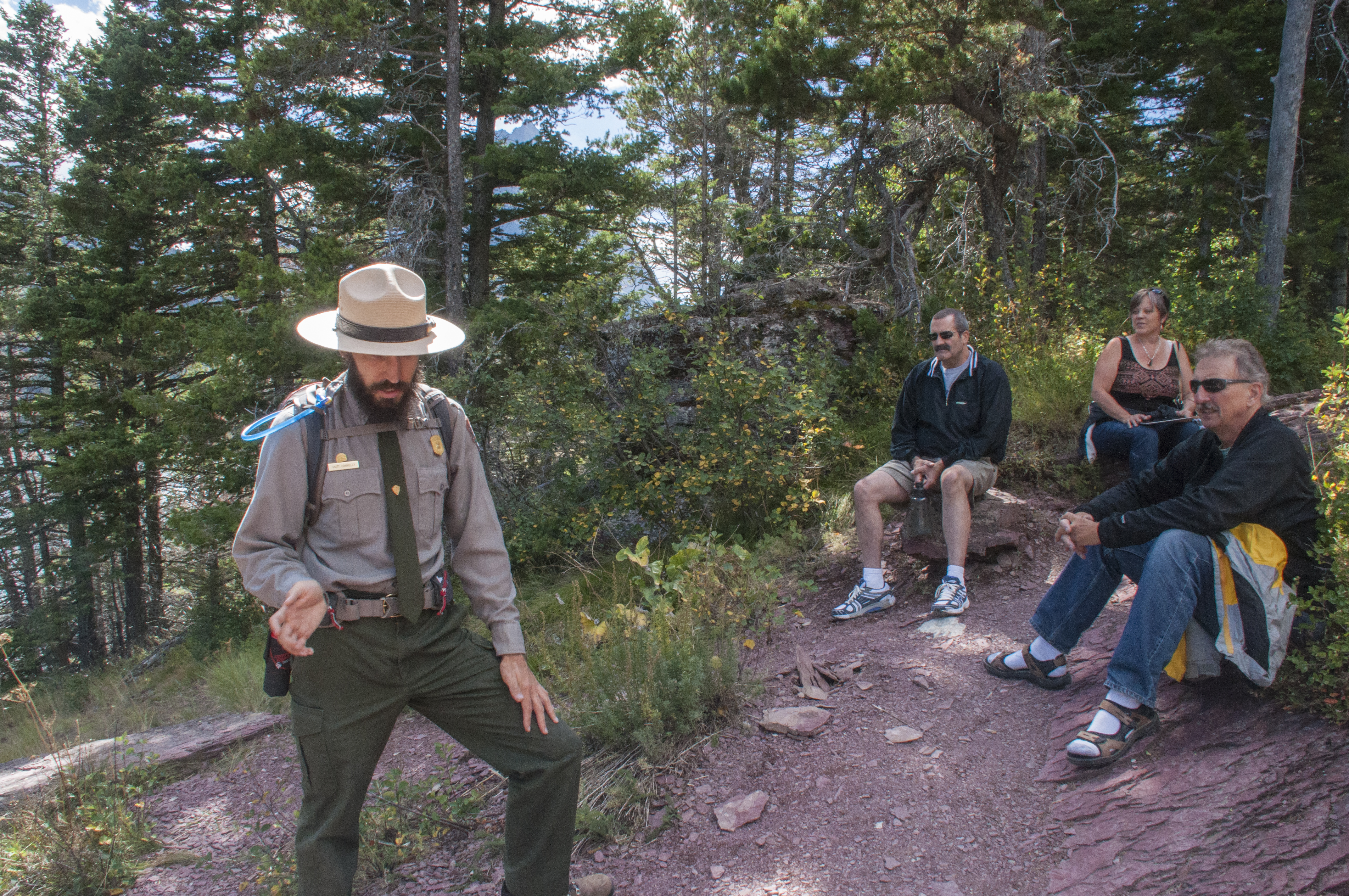
Ranger Talks About Medicinal Use Of Plants

Triple Divide Peak
View From Waterfall Hike
We finally got to Logan Pass for the much heralded hike to Hidden Lake. Believe them when they say that the parking lot fills early. When we arrived at 9:45 we got one of the last parking spots. After that, getting a spot is like going to the mall the week before Christmas. Logan Pass is the highest point on the GTTs road. If you do no other hike, plan on this one. It’s about 3 miles to the Hidden Lake Overlook and 7 to the lake roundtrip. The scenery, the wildflowers and most of all the symbol of Glacier itself, the mountain goats make it very special. I only wish the guy that made the boardwalk had thought about people with short legs when he built the steps! At about 8,000 feet it was much colder. I was glad I had a pair of fingerless mittens in my camera bag. Just when we reached Hidden Lake a few raindrops fell. We didn’t stay long as we could see the storm coming. About halfway down it really began raining and sleeting. Sleet doesn’t feel good on a bald head! Steve cut a black plastic trash bag and slid it over himself and his camera. Fine except that it was so tight he couldn’t move his arms. If he’d fallen he’d probably kept bouncing all the way to the bottom! My jacket was water resistant but by the time I got to the Visitor Center I was soaked through to the skin and very, very cold. I made a quick stop at the bathroom and when I came out the sun was shinning. People just arriving looked at me like I’d just gone overboard and been rescued. It was a long, cold ride back to the trailer.

Wildflowers At Logan Pass

Hiking To Hidden Lake

Ahhhhhhh!!
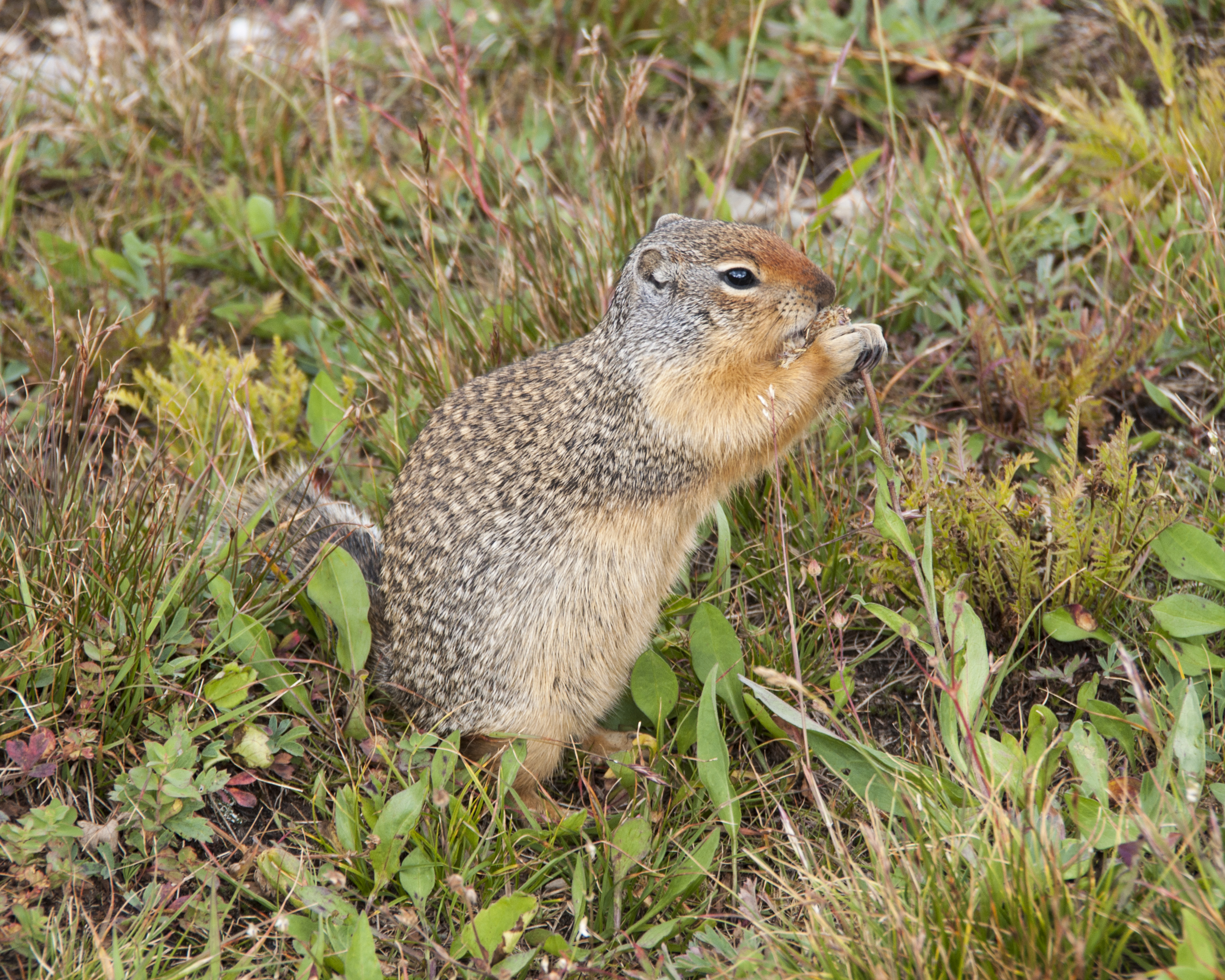
Time For A Snack
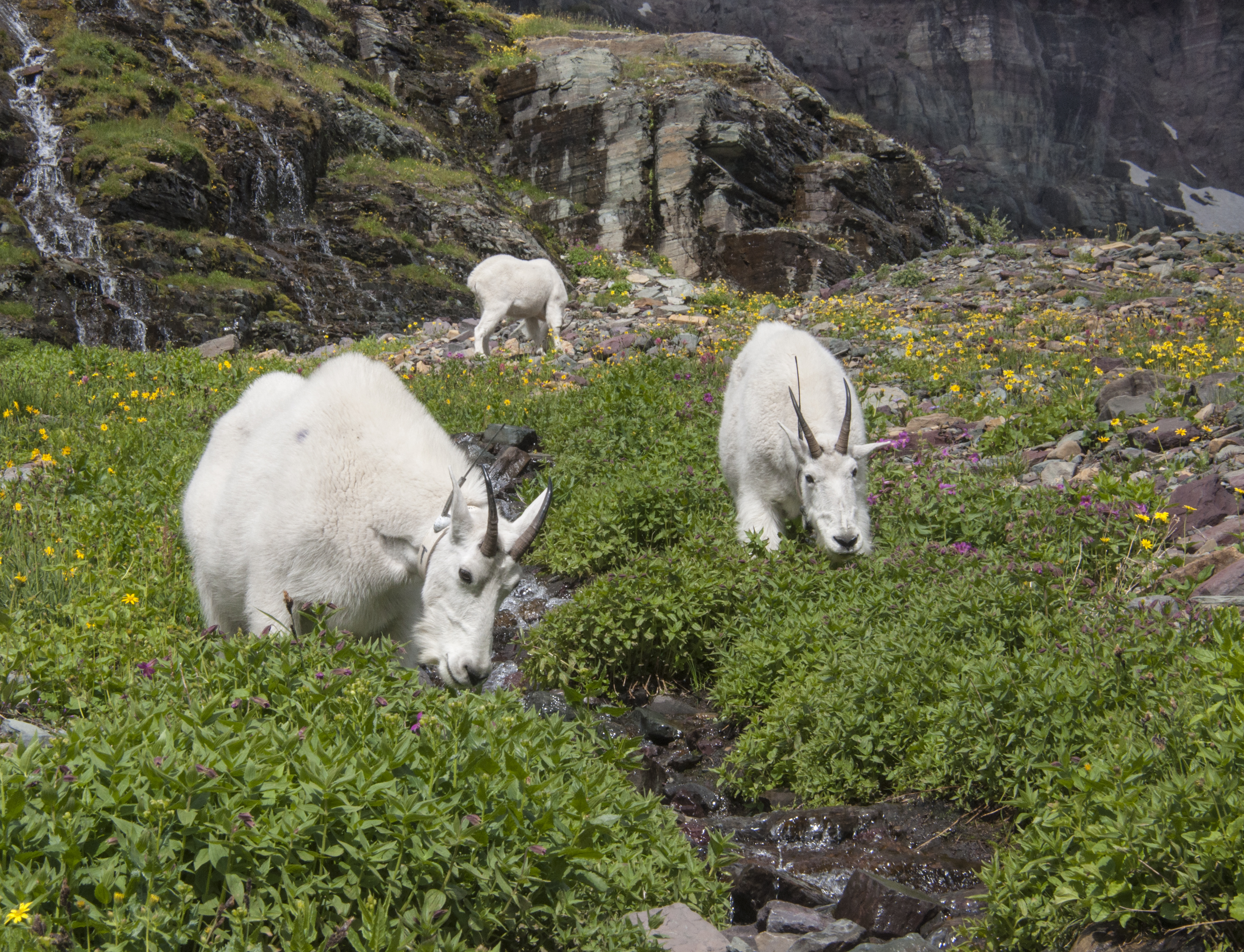
Three Mountain Goats Along A stream

Hidden Lake Overlook
We’d hoped to do some kayaking but by the time we finished sightseeing and hiking the weather had become overcast and rainy with a “winter comes early” feel to the air. Guess we will just have to come back! We did drive up to one of the smaller lakes on the west side called Bowman Lake. The access is good until you start up toward the campground. This is suitable only for tents and truck campers. A rough, narrow dirt road but worth the effort as the lake is gorgeous. The rocks just below the water at the lake’s edge have so many colors. On the way back we stopped at the Polebridge Mercantile, a general store/bakery. We loaded up with cinnamon huckleberry bread (made great french toast), huckleberry bear claws and eclairs. Polebridge was one of the first commercial enterprises near Glacier NP. It still has cabins and a bar/restaurant with local musicians. A few buildings are from the original homestead.

Bowman Lake

Color Under The Surface

Delicious Bakery!
These pictures barely do this park justice. You really need to come see for yourself. Have we just found a new favorite national park?
