Summer 2017 And The River Of No Return

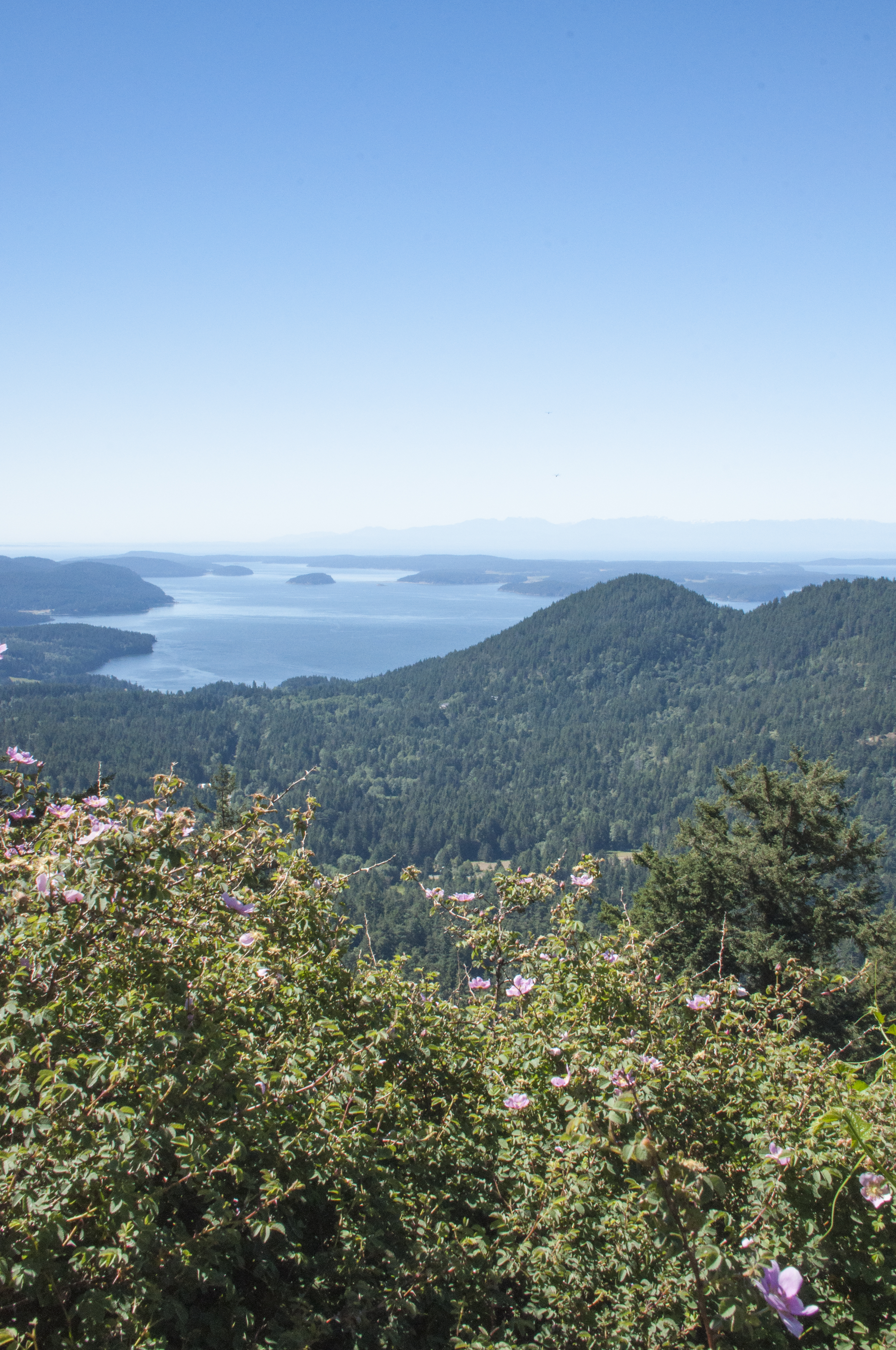
Our four months in central Idaho are coming to a close so it is time to get a post up on our wonderful summer. We’d been in most other areas of Idaho but never the center of the state. When we saw a volunteer position for the Sacajawea Center in Salmon, Idaho we applied and were accepted for Summer 2017. Not only was this a gorgeous area but a stop along the Lewis and Clark Trail, a favorite subject of ours. If you like mountains, small western towns and free running rivers then the Lemhi Valley is for you. The town of Salmon has a population of about 3,000. Community pride and a high percentage of resident involvement is reflected by volunteerism and community participation. The major businesses are cattle ranching and ecotourism. Salmon is located at the confluence of the Lemhi and Salmon Rivers. In the past it was an area of mining and timber harvesting so it is rich in history as well. Today a large percentage of the valley is either land managed by BLM or the Salmon-Challis National Forest. The valley is surrounded to the east by the Beaverhead Mountains, to the south by the Lost River Range, to the north and west by the Bitterroot Mountains. Also to the west is the the largest wilderness area in the lower 48, the Frank Church River of No Return Wilderness Area.

The Sacajawea Center was built through the cooperation of federal, state and local groups for the Lewis and Clark Bicentennial Celebration in 2004-2006. Then it was turned over to the City of Salmon and is run by the city today. The Lemhi Valley is the traditional homeland of the Agaidika (Lemhi Shoshone), Sacajawea’s people. Agaidika, in the Shoshone language, means “salmon eaters” and refers to one of their main food sources. The Interpretive Center where we worked tells the story of Sacajawea from living in the valley to her capture by the Hidatsa,  her role with the Corps of Discovery, after the expedition and the removal of the Shoshone to the Fort Hall Reservation. The valley is referred to by the Lemhi Shoshone as Agai Pah. We researched and developed Discovery Center talks: (Steve) Mapping the West and The Language Chain, (Chari) Medicine Along The Lewis and Clark Trail and a Trivia Quiz. We erected a traditional tipi, worked in the native plant and community garden and did light maintenance. One of our projects was a slideshow for the Interpretive Center. It runs about 26 minutes but you can forward through the sections for a shorter time. This captured the feel of the area and many of the sights we enjoyed so we are posting it here for you to view in lieu of still photos. As with most videos it is a good idea to let it load at least 3/4 of the film before viewing so you will have a smooth playback. That may take some time so please be patient (or it may just be our wifi connection).

We were asked by the Sacajawea manager to film our Discovery Center talks as tutorials for future volunteers. We include them here so that if you have interest in the topics you can watch. Chari’s talk runs about 30 minutes. Steve’s talk involved more technical material about using navigational equipment and required more detail. His talk runs about an hour and is split into two parts.

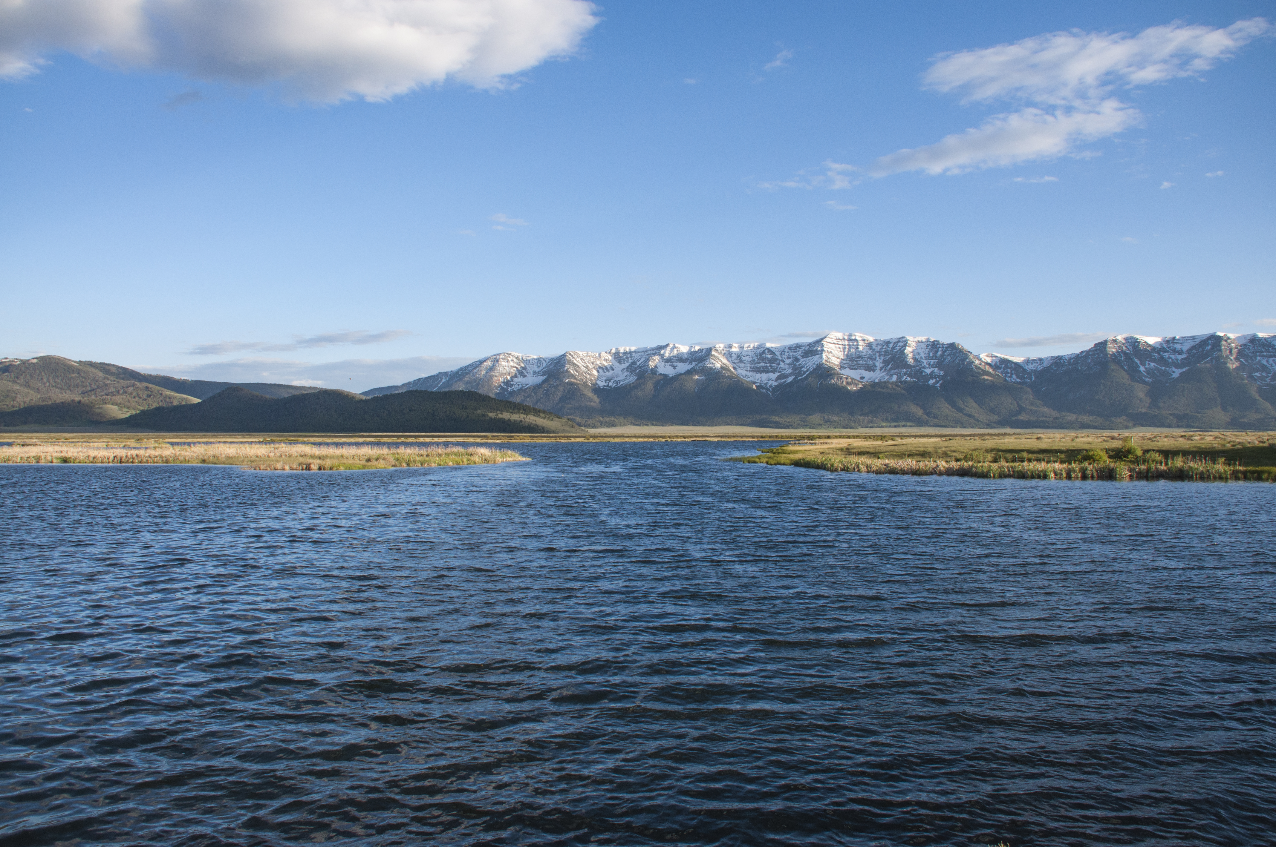
We haven’t had time to do a video for our out of Lemhi County trips so it is back to still photos. The star of our days off trips was the Sawtooth National Recreation Area. We packed up our tent and what seemed a ridiculous amount of other stuff for two wonderful trips there. After all, we are at the age where comfort is primary! The mountains, lakes/rivers and wildflowers were breathtaking! We took the Custer Motorway on the way back home locating both tent and RV camping spots and seeing the Custer and Bonanza ghost towns.

A Favorite Sawtooth Scene

Along The Custer Motorway

Reflection of The Sawtooths

For our wedding anniversary this year (that’s number 8), we took a rafting trip with Rawhide Outfitters. This was a 3 hour trip with a short gold mine stop and BBQ lunch. The day use stretch of the Salmon River has up to Class 3 rapids. We had a wonderful guide and enjoyed ourselves. I don’t know if I can work up courage to do the multi-day trip with level 4 and 5 rapids through the Frank Church Wilderness on the Middle Fork of the river. I’m ready to go. What are you waiting for? That’s why the Salmon River is called The River of No Return. Until the invention of jet boats and powerful gasoline engines the Salmon River current was too strong for men to paddle or row back upstream. Traffic could only go downstream. 

Floating On The Salmon River

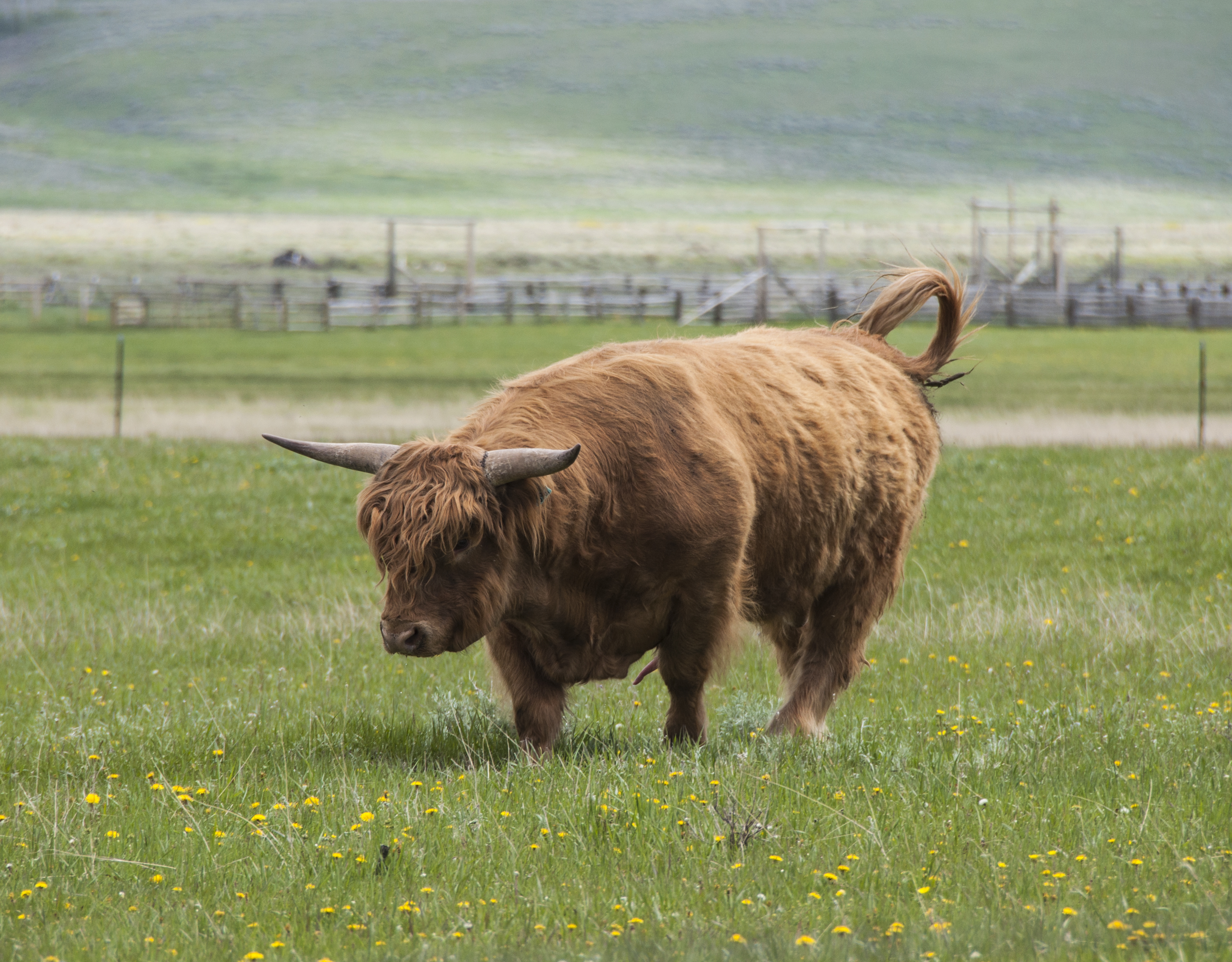
Steve “Riding The Bull”


Anniversary Rafting Trip

Another favorite area was the Spar Canyon Road south of Challis, Idaho, nearby Herd Lake and oddly named Road Creek Road. On our first trip here we found a new to us plant. It took me a long time to identify it. Now we know it is called Sobol, a member of the agave group and in the asparagus family. This is BLM land and great for rockhounding. We returned here for the Eclipse 2017 and had no crowds. Steve has written an account of this which we’ll post separately. To say it was a National Geographic moment is an understatement! Also in the area and worth a mention is Land of the Yankee Fork State Park. The park is devoted to mining history of the area and a visit to the Bayhorse Ghost Town in the park is a must.

Driving Spar Canyon Road

The Many Colors Found In Spar Canyon


Sobol Growing In Spar Canyon

We attended two festivals: Bannack Days at Bannack State Park (old mining ghost town) and Logger Days in Darby, MT. We’d been to Bannack in 2014 but it was fun to see the town “come alive” through living history. They had everything from pack mules to an old mining stamp machine and a “shoot out”.  Steve spent a long time talking to a surveyor about historical instruments and was able to use this information in his talk.

Bannack Scene

Living History Brings Town To Life

The Dentist


The Shoot Out

The Darby, Montana Logger Festival was the first of its type that we had attended. Just as a rodeo is a competition based on skills a cowboy uses, the Logger Festival uses a chainsaw and skills loggers need. There were several events but our three favorites were the Cookie Stack, the Obstacle Pole and one we call the Climb and Cut.

In the Cookie Stack a beer mug of water is placed on an upright log. Then the logger cuts several slices aka cookies. The stack is then picked up on the chainsaw blade and moved to an adjacent log. Lastly the chainsaw is removed. All of this without spilling the mug! The gal who won was amazing. She placed in every event.

After Cutting The Cookies

Moving The Stack


Removing The Saw


Success!

The Obstacle Pole starts when the logger picks up the saw and runs around the obstacle. Then he/she runs up an angled log to the end. They balance on the end, start the saw and then lean over the end and cut off a section. Lastly they turn and run down the log to the ground.

Off And Running


Start Your Saw


Starting To Cut


Don’t Fall Now!


Turn And Run!

We don’t know the official name of this event but it involves making an axe cut about 4′ off the ground and inserting a board. Then the logger jumps up on the board and repeats the process. Standing on the second board and bouncing a lot the logger chops thru the top log. The man shown here was a former World Champion Logger. While he didn’t win, he did place well… at age 75! No more excuses! You rest… you rust.


Strong At 75


Up On The First Board


Now On The Second Board


Chopping Away At The Top


Lest we forget to mention our visit to Craters of the Moon National Monument. We’d made a quick visit in 2011 but always wanted to spend more time and see wildflowers growing in the lava. A great photo opportunity. The plants are all low growing so some shots required us to sprawl on our tummies. Bet that was a curious sight to other visitors!

June Wildflowers At Craters of the Moon

Nature As Sculptor


Time as usual has gone all too fast. We will miss the wonderful staff at the Sacajawea Center and the local volunteers who devote so much time year after year. We explored only some of the backroads. Of course, it is our stomachs that will miss 80 mile bread from Odd Fellows Bakery, free range eggs bought roadside on the honor system, Sacajawea Stout from Bertram’s Brewery and the huge ice cream cones at the Baker Country Store.

Now on to new adventures!

Evening Blues On The Salmon River


Paradise Is Summer In The San Juan Islands

Orcas Island, Mount Constitution

The View From The Summit Of Mount Constitution On Orcas Island

We are now in the last week of our time in the San Juan Islands. It will be with mixed emotions that we board the ferry from Friday Harbor for the last time. How do we find words for this place? Magical. Enchanting. Romantic. Musical. Breathtaking. We may return some day but for now it’s on to another adventure. When we made the video we had to leave out several things or risk turning it into a mini series! So the still photos touch on a few of the places we had to exclude.

A bit to familiarize you with the islands before you view our video. San Juan Island is the second largest of this 85 island archipelago. The Washington ferry system serves only four islands so private boat transportation are like cars here. The only town on the island is Friday Harbor. It was named for one of the Hawaiian shepherds who worked for the Hudson’s Bay Company Bellevue Sheep Farm. His name meant Friday in his native language. So yes, there was a man Friday. It was originally called Friday’s Harbor but in the 1950s when the post office changed to automated address readers the machines couldn’t handle apostrophes. So all towns with ‘s had to change their names. Same with Vancouver Island which was originally Vancouver’s Island. On the north end is Roche Harbor. Originally it was the company village for the Lime Kilns. They were the largest lime works west of the Mississippi River. After the 1906 earthquake in San Francisco, lime from San Juan was used in the concrete to rebuild the city. In the late 1800s the Hotel Haro was built. Today you can tour the lobby and see the guest register signed by Theodore Roosevelt. Today, Roche Harbor is a resort, marina and very upscale housing area. The Madrona Grill was one of our favorite restaurants. The mussels in Thai curry coconut milk are to die for!Mount Baker, Washington, scenic drive

When we came to the islands, we thought we might get island fever. For folks who think a day trip is 250 miles we wondered if we’d tire of a 16.5 by 6 mile area. Nothing could be farther from the truth. We only returned to the mainland twice in four and a half months. Now we see why the islanders average mainland voyages only 2-3 times a year. When we did get back, besides running errands, we visited Mount Baker, North Cascades National Park and met up with a fellow Red Rock Lakes volunteer who lives in La Conner.

The people you see in the video are Rangers from San Juan Island National Historical Park, fellow volunteers or visitors. Events range from the Memorial Day and July 4th parades to the annual Encampment weekend, weekly Living History and/or our off time activities. On July 4th you are either in the parade or watching it. This year’s theme was Hollywood movies. I’m sure you won’t have trouble picking out our favorite entry. We hope you enjoy seeing the video. It’s no wonder we woke up every morning singing Camelot!

Out And About Red Rock Lakes NWR

Centennial Valley Panorama

Centennial Valley Panorama

What would it be like after two years of being on the move to “settle down” for two months? That’s what we wondered. Would we get itchy feet and want to move on or fall in love with the area and wish we could stay? We’d been in the general area before and knew we liked it. The verdict is in and we love it here! Yes, we are a long way from stores and other activities. What keeps us active and interested? Here’s a sampling of being out and about at Red Rock Lakes NWR.

Centennial Valley At Sunset

Centennial Valley At Sunset

On A Refuge Road

On A Refuge Road


Centennial Valley

North Valley Scene


Hiking In The Sandhills Of The North Valley

Hiking In The Sandhills Of The North Valley


We work four days a week but the evenings are long here and sunset isn’t until after 9pm. This gives us time to have dinner and then go fishing, go for a drive or take a bike ride. We’ve had good luck at being out when wildlife is on the move. Even when we don’t spot anything the scenery is amazing. Then there are new wildflowers replacing the early bloomers. Having visited several refuges for a few hours or even a day we now see how different it is when you can observe over a longer period. The Upper and Lower Red Rock Lakes are scenic but Widgeon Pond is one of our favorite spots. Sometimes we drive beyond the refuge borders which offer great scenery too of ranches or the Continental Divide.

Lower Red Rock Lake Is A Birder's Dream

Lower Red Rock Lake Is A Birder’s Dream

Upper Red Rock Lake and Campground Is Very Popular

Upper Red Rock Lake and Campground Is Very Popular


View From Widgeon Pond

View From Widgeon Pond

A Nearby Montana Barn

A Nearby Montana Barn

The Continental Divide Runs Along The Centennial Mountains

The Continental Divide Runs Along The Centennial Mountains


A Scottish Highland Bull At A Local Ranch

A Scottish Highland Bull At A Local Ranch

We have both had a chance to observe and assist with refuge projects such as tracking Arctic Grayling fry or monitoring mountain bluebird boxes. This has given us some fantastic photographic opportunities.

Naked As A Mountain Bluebird (5 days old)

Naked As A Mountain Bluebird (5 days old)

A Tree Swallow Sets Up Housekeeping In A Bluebird Box

A Tree Swallow Sets Up Housekeeping In A Bluebird Box


Arctic Grayling

Assisting With The Arctic Grayling Project On Elk Springs Creek

A Female Wilson's Phalarope On Elk Springs Creek

A Female Wilson’s Phalarope On Elk Springs Creek


An American Avocet

An American Avocet

Here are some of our recent wildlife encounters. Unfortunately the trumpeter swans are keeping the young cygnets well out of range for our lenses.

A Photogenic Beaver At Widgeon Pond

A Photogenic Beaver At Widgeon Pond

Sandhill Cranes In The Tall Grass

Sandhill Cranes In The Tall Grass


A Pair Of Curlews At Lower  Red Rock Lake

A Pair Of Curlews At Lower Red Rock Lake

A Mother Coot And Her Red Headed Offspring

A Mother Coot And Her Red Headed Offspring


A Mule Deer

A Mule Deer

Pronghorn Are Plentiful In The Valley

Pronghorn Are Plentiful In The Valley

Meeting A Moose Family

Meeting A Moose Family

Oh yes, there are new wildflowers popping out every week.

Pincushion Buckwheat In The North Valley

Pincushion Buckwheat In The North Valley

Stonecrop Is A Type Of Sedum

Stonecrop Is A Type Of Sedum


Elk Thistle

Elk Thistle


Green Gentian aka Monument Plant

Green Gentian aka Monument Plant


We thought we’d have time to include some history and other stories in this post but it is getting too long so we’ll end now with this beautiful sunset. Don’t miss this hidden gem.


sunset, Red Rock Lakes NWR, Montana

Sunset On Elk Lake Road


Best Of Times, Worst Of Times In Key West

Off we go to the southernmost point on the continental US, Key West, Florida. Finding an RV site nearby was a challenge.  We really wanted to stay at Bahia Honda State Park but that’s like winning the lottery. So we reluctantly settled for a commercial park, Boyd’s Campground, on Stock Island just north of Key West. This turned out to be every reason we hate commercial parks: overcrowded, expensive, unpleasant neighborhood and noisy. Had it been just us, we might have cancelled and walked away from our deposit but we had a good friend from Charlotte flying in to join us.

Boyds Campground in Key West

Too Close For Comfort

The site we were given was so tight that it took three park employees to guide Steve in and at least twenty back and forth moves to get in place. At one point our rig was so close to a palm tree that only the fronds kept us from rubbing against the trunk. If the site across from us hadn’t been empty we would never have gotten in. Once in our site, the box on the rear was in the bushes. We couldn’t have gotten our bikes off even if we wanted to ride them. The site was unpaved and unlevel. The “sitting area” barely held three chairs and our slide was only 18″ from our neighbor’s sewer connection. Oh yes, to add to the ambiance we were in the flight path for the Key West International Airport and Boca Chica Naval Air Station where they train the Top Gun pilots. The surrounding neighborhood was industrial buildings mixed with rundown mobile home parks (slums). Finding a place to walk Opal was a challenge for sure.  All this for four time so what we normally pay.

Having gotten most of “the bad” covered, we’ll go on to the “the best” part.

birds, Audubon, Key West

Audubon Print Of White Crowned Pigeon

birds, Audubon, print

Original Audubon Print Of A Cormorant

Key West today is geared to tourists but still has the flavor of bygone pirate and starving artist days mixed with “Margaritaville” and grand old homes. When you find a parking place (all are paid spaces) you stay there and walk…and walk…and walk. One of our first stops was the Audubon House. John James Audubon stayed here during his trip through Florida in 1832. At that time the property was owned by a wealthy harbor pilot and master wrecker, John H. Geiger. The property remained in the family for four generations but fell into disrepair by 1958 as the family fortune dwindled. When the last owner, a Howard Hughes type of recluse, died the property was scheduled for demolition. Through the efforts of a local benefactor the property was restored and now showcases life circa 1850 with eighteen original Audubon prints on display. One, the white crowned pigeon, was painted using the tree that still stands in the front yard. This painting had special memories for me as my Mother, an avid bird lover, had this print and the one of wild turkeys in the dining room of my childhood home. The gardens around the house are beautiful and a wonderful introduction to subtropical plants of the area. There is a brief docent lecture then you continue on a self-guided tour. Photography is allowed but no flash inside the home.

Audubon, Key West

Audubon’s Workshop

Audubon, garden, orchid, photography

Orchid In bloom In Audubon House Garden

Audubon, garden, fern

Backside Of Fern Leaf In Audubon House Garden

bromeliads, garden, Key West

Bromeliads In Bloom In Audubon House Garden

Key West, Mel Fisher, museum

Mel fisher Museum In Key West

Stop number two was the Mel Fisher Treasure Museum. Located in an old firehouse near the cruise ship pier it is a must see stop for anyone who has ever dreamed of finding buried treasure. Two ships of the Spanish treasure fleet, the Nuestra Señora de Atocha and the Santa Margarita were enroute from Havana to Spain in 1622 laden with gold and silver bars, coins and wealthy colonial passengers.  Their treasure was desperately needed by the royal treasury to offset the cost of the Thirty Years War and Court expenses. The two ships carried over a million and a half pesos which in today’s dollars would be over 400 million. The Atocha was fitted with twenty cannon and sailed in last position.  The fleet sailed in September, six weeks late, at the height of hurricane season. Caught in a storm just off present day Key West they sank taking their treasure with them. Of 265 passengers only five survived. The Atocha treasure would not see the light of day until relocated by Mel Fisher and his team on July 20, 1985, sixteen long years after the search started. If you want to read more about Mel Fisher or the treasure ships visit http://www.melfisher.com. If you are a certified scuba diver perhaps your bucket list would include the vacation package to dive The Atocha.

Atocha, sunken treasure

Photo Of Diver At Atocha Treasure Site

Mel Fisher, Spanish Treasure Fleet

Drawing of Mel Fisher At Work

For us landlubbers, a visit to the Mel Fisher Maritime Museum must suffice. There you will find conserved artifacts of gold, silver, porcelain, emeralds and religious items along with maps and photos of the recovery site. But we went further than just seeing the artifacts behind glass. We took the behind the scenes tour to the conservation lab. It costs ten dollars in addition to museum entry and is offered Monday-Friday. Schedule your visit ahead as only small groups are taken into the lab on each tour.

shipwreck, treasure, museum, behind the scenes, tour

Artifacts In Conservation Lab Tank

conservation lab, Mel Fisher museum

A Cast Being Made From A Horseshoe

shipwreck, artifact, tour

Tour Guide With Brain Coral Encrusted Hammer Artifact

No visit to Key West is complete without playing tourist as you stand in line waiting to take a picture of yourself at the Southernmost Point in the USA Marker. While there we learned about the cable hut in the same location. This was transported to Key West by Flagler’s railroad. Its job was to protect the connection between the land line and the 125 mile underwater telegraph line between Key West and Havana, Cuba.

Old Town is filled with funky shops, restaurants, sidewalk vendors and the ever present Key West chickens. Everyone gathers at Mallory Square and Sunset Pier for the spectacular orange sky sunsets.

Southernmost Point, Key West, Florida

Chari And Steve At The Southernmost Point

Key West ,Telegraph

Telegraph Cable Hut

lighthouse, Key West

Key West Lighthouse

KW Street Musician (aka "No, I don't know where you can get pot!."

KW Street Musician (aka “No, I don’t know where you can get pot!.”

museum, Key West

Hustle And Bustle In Old Town Key West

Key West, Mallory Square

Pier At Mallory Square In The Evening

jet ski, Key West

Jet Skis Along Harbor In Key West

Old Town Key West Evening

Old Town Key West Evening

Key West Cigar Store Indian

Key West Cigar Store Indian

sunset, Key WestView From Sunset Pier

Everyone Crowds Sunset Pier

Everyone Crowds Sunset Pier

Chari And Steve Swimming In January At Bahia Honda SP

Chari And Steve Swimming In January At Bahia Honda SP

The Wharf, Florida Keys, restaurant

Steve At The Wharf

To give ourselves a break from walking, we took a day and drove to Bahia Honda State Park. This is the closest state park to Key West and Florida’s most visited state park. The water temperature was listed as 73 but oh it felt a lot cooler than that going over your stomach. However we were not going to come to the Keys and not go in the water. Mind over matter!! Once in it wasn’t bad at all. We drove over to the campground and checked it out for future visits. On our way out we asked the gate volunteer for a restaurant suggestion. He said a place called The Wharf was good. We can second that. After a relaxing day on the beach a good meal on an outdoor terrace was the cherry on the sundae. We even watched an iguana have dinner on leftover veggies from the restaurant.

iguana, Florida Keys

Iguana Joined Us For Dinner

More sightseeing took us to the Truman Little White House and Ernest Hemingway’s home. The Truman Little White House is located in the Truman Annex neighborhood of upscale homes and condos in Old Town Key West. Originally the home was built as officer quarters for a submarine base. Although it bears Truman’s name because he visited here more than any other President he was not the only President to come here. President Taft came enroute to his inspection tour of the Panama Canal. Taft was known for his love of driving the countryside. Each year the museum crafts an original Christmas ornament. One year it used the car Taft drove loaded with presents.  Thomas Edison stayed for 6 months while developing new weapon systems. FDR visited here several times. The Department of Defense was created here by the Key West Agreement. President Eisenhower stayed here to recuperate from his heart attack in late 1955-early 1956. President Kennedy visited twice in 1961 and 1962. The base was closed in 1974. Other Presidents who have stayed here after their term of office include Presidents Carter and Clinton. The property was deeded to the State of Florida and opened as a museum and historic site in 1990. A list of the most popular Presidents was posted and Truman ranked #5 after Lincoln, Washington, FDR and Teddy Roosevelt. Rounding out the top ten were Kennedy, Thomas Jefferson, Dwight Eisenhower, Woodrow Wilson and Ronald Regan. Bringing up the five least popular were Harding, Harrison, Pierce, Andrew Johnson and  Buchanan. We were given guest passes because of our connection with Dr. Watson that we mentioned in an earlier post. The tour was very informative. Having read Truman’s biography, we enjoyed our visit very much.

Truman, Key West

Truman At Dedication Of Everglades NP 1947

Truman, Little White House

Truman At Little White House

Kennedy, Hugh McMillan, Key West

Kennedy And McMillan Meet In Key West

Jimmy Carter, Key West

The Carters Spend Christmas At Little White House

Our last sightseeing stop was at the Hemingway House. This was the best tour we took. The stories the guide told were funny and informative. Hemingway was an enigmatic character: handsome, hard drinking, outdoorsman and philanderer. His books are classics as are the movies made from them. His home is also the home of over thirty six toed cats. One of the stories told is about the cat’s water bowl. Hemingway was a frequent face at Sloppy Joe’s Bar. When the bar moved from its original location he brought home a urinal from the bar stating “he’d pissed enough of his money down it to buy it.” His then third wife took it and after cleaning it up made it the cat’s water dish. Another story relates to a penny buried in concrete at the home. When his wife (can’t remember if it was number 2 or 3) installed a pool over his objection he threw a penny into the concrete saying she now had his last cent. This visit made me want to read more about Hemingway and his books.

Hemingway, author

Portrait Of Hemingway At Age 35

Hemingway's Writing Studio

Hemingway’s Writing Studio

The Hemingway House In Key West

The Hemingway House In Key West

Hemingway, Old Man And The Sea

A Painting Of Hemingway’s Old Man And The Sea

The Unique Garden Fountain And Cat Water Bowl

The Unique Garden Fountain And Cat Water Bowl

We decided to have dinner at Sloppy Joe’s and enjoyed the fish tacos and nachos but the key lime pie was terrible. It was prepackaged and the sugar wasn’t dissolved giving it a granular texture. Find your key lime pie elsewhere. Be sure to locate the web cams and call a friend who can go online and see you.

restaurant, Key West

Restaurant Poster At Sloppy Joe’s

Sloppy Joe's, restaurant

Sloppy Joe’s Is A Key West Icon

Hemingway, Sloppy Joe's

Painting Of Hemingway Fishing

restaurant, sailfish

Mounted Sailfish At Sloppy Joe’s

Now we return to “the bad” part of our visit. Steve had realized that Boyd’s Campground was so crowded we would not be able to exit following the proper direction of the road. That should speak a bundle about the poor design and crowded conditions at Boyd’s. We spoke to two employees who after looking at the situation agreed we’d need to go out the “IN” route. They said “don’t worry, we’ll get you out OK. We do it all the time.” The next morning when we were ready to leave we got them to assist us. One man drove a golf cart ahead to make sure no one entered while we were exiting. The other employee walked ahead of our RV and at each and every turn faced our rig and gave Steve verbal and hand signals to ease us through the tight turns. We’d made it to the last turn but there were times we’d missed cars by just inches. The last turn took us out of the campground and past the office. There were two RVs parked on the left in the waiting area and another car parked on the right at the laundry. This forced us to make a sharper turn than we would have preferred. At no time did the employees try to open up space by asking the RVs to back up, move the parked car or ask campers to move the cars in front of their rigs parked just inches from the road.  Any one who knows anything about trailers knows the tighter the turn the more the rear end of the trailer will swing. We were 90% through the turn when we heard the sickening sound of metal scraping. The right corner of the box on the back of our trailer had sideswiped a car. We stopped of course. Police were called but no citation given because the accident occurred on private property. We claim that we were under the direction of the park employee and that the park is at fault for not giving enough clearance for safe exit. They are claiming no responsibility. How this will end is unknown. We can only warn anyone considering a stay at this park, DO NOT COME!

RV accident, Boyd's Campground, RV parks Key West

Running The Gauntlet Through Boyd’s Campground

RV accident

RVs To The Left Of Us

RV accident

Cars on The Right Of Us

RV accident, Boyd's Campground

All We Needed Was A Few Inches To Get Through Safely

Hidden Acadia On Isle Au Haut

When you talk to someone about Acadia National Park they naturally think of the park on Mt. Desert Island near Bar Harbor, Maine. We’d be going there next. On our first drive out to Stonington we learned that part of Isle Au Haut (pronounced like Isle  A Hoe) was also Acadia NP. In 1978 land was donated to the National Park Service. Residents of the island were not pleased and feared their piece of paradise would be ruined by “Coney Island types”. The NPS worked with the islanders and a compromise was reached. This area covers about half of the island and is kept as a wilderness park. No Visitors Center, no ranger led activities just pit toilets and a 5 site lean-to campground are all the facilities you’ll find. There are trails and a dirt road circling the island. You can reach the park by taking the Stonington ferry for five miles to either the town landing or Duck Cove. Compared to the three million people who visit Acadia on MDI, Isle Au Haut has an annual visitation of about 7,000.

Stonington, Maine, Isle Au Haut

Stonington Harbor From The Ferry

lobster boat, sepia photo

Lobster Boat Post Processed As A Sepia Photo

We had to get up early for the two hour drive out there to catch the 10 AM ferry. (Opal) This would be a record day in bladder control for me. I was alone for twelve hours. I hope they don’t do that very often! We’d decided to take our bikes with us. This meant that we had to get off at the town landing. The entrance to the park is about a half mile away. They don’t allow bikes or boats to come off the ferry at Duck Cove in order to preserve the wilderness setting. You can pedal and paddle in the park. The road was paved until the park boundary. Then it was a dirt road – so far so good. Gradually it became rocky until it was more than our street bikes could handle. Along the way we spotted an old truck just begging for a photo. I’ve done a few artistic post processing pictures. Which one do you like best? We did stop and take two short hikes. The mosquitos were biting and we’d forgotten to bring bug spray. We sat and took in the beauty as we (and the mosquitos) had lunch. Spending the day in such a pristine environment was terrific even if we didn’t get that far. Next time we’ll forego the bikes and take the ferry to the park landing and just do the trails.

Old Trunk HDR Vintage Colors

Old Trunk HDR Vintage Colors

Old Truck HDR Bleached Bypass With White Vignette

Old Truck HDR Bleached Bypass With White Vignette

Old Truck HDR B+W Soft Tint

Old Truck HDR B+W Soft Tint

Mossy Microcosom In The Woods

Mossy Microcosom In The Woods

Skunk Cabbage And Wetlands

Skunk Cabbage And Wetlands

View Of The Beach On Isle Au Haut

View Of The Beach On Isle Au Haut

Tidal Pool

Tidal Pool

deer

Deer-ly Missed

On our way back to the ferry we saw a deer on the road. It was in the same area as one we’d seen earlier in a field. The bikes didn’t scare her. She just looked at us, grazed, came closer and grazed until she was less than 50 feet away. Off she went. There was something so touching about being that close wildlife, being accepted by them and just enjoying the moment. Of course I’d put my camera in my backpack!

Once back in “town”, a collection of eight or so businesses, we stopped at a small gift shop. The owner, a fourth generation islander, opened the shop two years ago. It features items made on the island or in other areas of Maine. I’d been looking for a new compact wallet and found a pretty quilted one there. The other thing that attracted me was some jewelry made from gold wire and white birch bark. Very different. I resisted as I’m not wearing much jewelry these days. But when I come back … We spent about twenty minutes talking with the owner about life on the island. There are 30-40 year round residents but that swells to 300+ in the summer. She said if she were ever stranded somewhere she’d want to be with an islander. She said they are very resourceful folks, like “little Mc Guyvers” (hope you remember the TV show). We took the 4:30pm ferry back then drove straight home stopping only to snap a picture of the old Mobil station cum Lobster Co-op. 

We have such a beautiful world. Let’s all try to be good stewards wherever our travels take us.

Maine, Nik HDR, photography

Lobster Co-op In Nik HDR Vibrant Textures