Where Next? #12

When we arrived at Cape Lookout National Seashore in early November 2017 we thought that staying in one place for almost 5 months sounded awfully long. It would be our longest stay to date. Yet here we are with only two weeks left. Time has flown and we’ll be on the road soon. Our feet are beginning to itch with the travel bug.

Our plans have changed several times but (We hope) this is our route from the seashore of eastern North Carolina to the shores of Lake Superior and our summer volunteer job at Grand Portage National Monument. We’ll travel for about 5.5 weeks seeing family and friends, adding 2 new states and seeing several National Park sites. Our arrival in Minnesota will be the second week in May.

Here’s the Google Map of our route.


Summer 2017 And The River Of No Return

Our four months in central Idaho are coming to a close so it is time to get a post up on our wonderful summer. We’d been in most other areas of Idaho but never the center of the state. When we saw a volunteer position for the Sacajawea Center in Salmon, Idaho we applied and were accepted for Summer 2017. Not only was this a gorgeous area but a stop along the Lewis and Clark Trail, a favorite subject of ours. If you like mountains, small western towns and free running rivers then the Lemhi Valley is for you. The town of Salmon has a population of about 3,000. Community pride and a high percentage of resident involvement is reflected by volunteerism and community participation. The major businesses are cattle ranching and ecotourism. Salmon is located at the confluence of the Lemhi and Salmon Rivers. In the past it was an area of mining and timber harvesting so it is rich in history as well. Today a large percentage of the valley is either land managed by BLM or the Salmon-Challis National Forest. The valley is surrounded to the east by the Beaverhead Mountains, to the south by the Lost River Range, to the north and west by the Bitterroot Mountains. Also to the west is the the largest wilderness area in the lower 48, the Frank Church River of No Return Wilderness Area.

The Sacajawea Center was built through the cooperation of federal, state and local groups for the Lewis and Clark Bicentennial Celebration in 2004-2006. Then it was turned over to the City of Salmon and is run by the city today. The Lemhi Valley is the traditional homeland of the Agaidika (Lemhi Shoshone), Sacajawea’s people. Agaidika, in the Shoshone language, means “salmon eaters” and refers to one of their main food sources. The Interpretive Center where we worked tells the story of Sacajawea from living in the valley to her capture by the Hidatsa,  her role with the Corps of Discovery, after the expedition and the removal of the Shoshone to the Fort Hall Reservation. The valley is referred to by the Lemhi Shoshone as Agai Pah. We researched and developed Discovery Center talks: (Steve) Mapping the West and The Language Chain, (Chari) Medicine Along The Lewis and Clark Trail and a Trivia Quiz. We erected a traditional tipi, worked in the native plant and community garden and did light maintenance. One of our projects was a slideshow for the Interpretive Center. It runs about 26 minutes but you can forward through the sections for a shorter time. This captured the feel of the area and many of the sights we enjoyed so we are posting it here for you to view in lieu of still photos. As with most videos it is a good idea to let it load at least 3/4 of the film before viewing so you will have a smooth playback. That may take some time so please be patient (or it may just be our wifi connection).

We were asked by the Sacajawea manager to film our Discovery Center talks as tutorials for future volunteers. We include them here so that if you have interest in the topics you can watch. Chari’s talk runs about 30 minutes. Steve’s talk involved more technical material about using navigational equipment and required more detail. His talk runs about an hour and is split into two parts.

We haven’t had time to do a video for our out of Lemhi County trips so it is back to still photos. The star of our days off trips was the Sawtooth National Recreation Area. We packed up our tent and what seemed a ridiculous amount of other stuff for two wonderful trips there. After all, we are at the age where comfort is primary! The mountains, lakes/rivers and wildflowers were breathtaking! We took the Custer Motorway on the way back home locating both tent and RV camping spots and seeing the Custer and Bonanza ghost towns.

A Favorite Sawtooth Scene

Along The Custer Motorway

Reflection of The Sawtooths

For our wedding anniversary this year (that’s number 8), we took a rafting trip with Rawhide Outfitters. This was a 3 hour trip with a short gold mine stop and BBQ lunch. The day use stretch of the Salmon River has up to Class 3 rapids. We had a wonderful guide and enjoyed ourselves. I don’t know if I can work up courage to do the multi-day trip with level 4 and 5 rapids through the Frank Church Wilderness on the Middle Fork of the river. I’m ready to go. What are you waiting for? That’s why the Salmon River is called The River of No Return. Until the invention of jet boats and powerful gasoline engines the Salmon River current was too strong for men to paddle or row back upstream. Traffic could only go downstream. 

Floating On The Salmon River

Steve “Riding The Bull”


Anniversary Rafting Trip

Another favorite area was the Spar Canyon Road south of Challis, Idaho, nearby Herd Lake and oddly named Road Creek Road. On our first trip here we found a new to us plant. It took me a long time to identify it. Now we know it is called Sobol, a member of the agave group and in the asparagus family. This is BLM land and great for rockhounding. We returned here for the Eclipse 2017 and had no crowds. Steve has written an account of this which we’ll post separately. To say it was a National Geographic moment is an understatement! Also in the area and worth a mention is Land of the Yankee Fork State Park. The park is devoted to mining history of the area and a visit to the Bayhorse Ghost Town in the park is a must.

Driving Spar Canyon Road

The Many Colors Found In Spar Canyon


Sobol Growing In Spar Canyon

We attended two festivals: Bannack Days at Bannack State Park (old mining ghost town) and Logger Days in Darby, MT. We’d been to Bannack in 2014 but it was fun to see the town “come alive” through living history. They had everything from pack mules to an old mining stamp machine and a “shoot out”.  Steve spent a long time talking to a surveyor about historical instruments and was able to use this information in his talk.

Bannack Scene

Living History Brings Town To Life

The Dentist


The Shoot Out

The Darby, Montana Logger Festival was the first of its type that we had attended. Just as a rodeo is a competition based on skills a cowboy uses, the Logger Festival uses a chainsaw and skills loggers need. There were several events but our three favorites were the Cookie Stack, the Obstacle Pole and one we call the Climb and Cut.

In the Cookie Stack a beer mug of water is placed on an upright log. Then the logger cuts several slices aka cookies. The stack is then picked up on the chainsaw blade and moved to an adjacent log. Lastly the chainsaw is removed. All of this without spilling the mug! The gal who won was amazing. She placed in every event.

After Cutting The Cookies

Moving The Stack


Removing The Saw


Success!

The Obstacle Pole starts when the logger picks up the saw and runs around the obstacle. Then he/she runs up an angled log to the end. They balance on the end, start the saw and then lean over the end and cut off a section. Lastly they turn and run down the log to the ground.

Off And Running


Start Your Saw


Starting To Cut


Don’t Fall Now!


Turn And Run!

We don’t know the official name of this event but it involves making an axe cut about 4′ off the ground and inserting a board. Then the logger jumps up on the board and repeats the process. Standing on the second board and bouncing a lot the logger chops thru the top log. The man shown here was a former World Champion Logger. While he didn’t win, he did place well… at age 75! No more excuses! You rest… you rust.


Strong At 75


Up On The First Board


Now On The Second Board


Chopping Away At The Top


Lest we forget to mention our visit to Craters of the Moon National Monument. We’d made a quick visit in 2011 but always wanted to spend more time and see wildflowers growing in the lava. A great photo opportunity. The plants are all low growing so some shots required us to sprawl on our tummies. Bet that was a curious sight to other visitors!

June Wildflowers At Craters of the Moon

Nature As Sculptor


Time as usual has gone all too fast. We will miss the wonderful staff at the Sacajawea Center and the local volunteers who devote so much time year after year. We explored only some of the backroads. Of course, it is our stomachs that will miss 80 mile bread from Odd Fellows Bakery, free range eggs bought roadside on the honor system, Sacajawea Stout from Bertram’s Brewery and the huge ice cream cones at the Baker Country Store.

Now on to new adventures!

Evening Blues On The Salmon River


Where To Next? #11

Four months seemed like a long time to be in one place when we arrived at the Sacajawea Center in Salmon, Idaho last May. In the blink of an eye, here we are in mid August and it is time to plan our next journey.  All but one of these stops is new to us. We will be returning to Bandits Roost in NC where we visited often while waiting for our house to sell in 2012. We’ll be heading back east to volunteer at Cape Lookout National Seashore and in February 2018 celebrate Steve’s Mom’s 90th birthday. Although I spent 20 years in North Carolina, I never visited the southern part of the Outer Banks. Now we’ll have 5 months to play and explore. Along the way we’ll spend time in Cody, Wyoming and meet up with RV friends in Yellowstone NP, see the Black Hills of SD for the third time but in the Spearfish area, stop to see Steve’s brother in Wisconsin, visit 8 National Park Service sites, eat in 3 Diners, Drive-ins and Dives, take a steamboat cruise for Ocktoberfest and continue Seeing America Through A Bug Splattered Windshield.

From Salmon, ID To Cape Lookout NS, NC

What Goes Up Must Come Down

High Time In The Rockies

High Time In The Rockies

We’ll apologize up front for the length of this entry but it does cover  5 weeks and almost 2,000 miles!

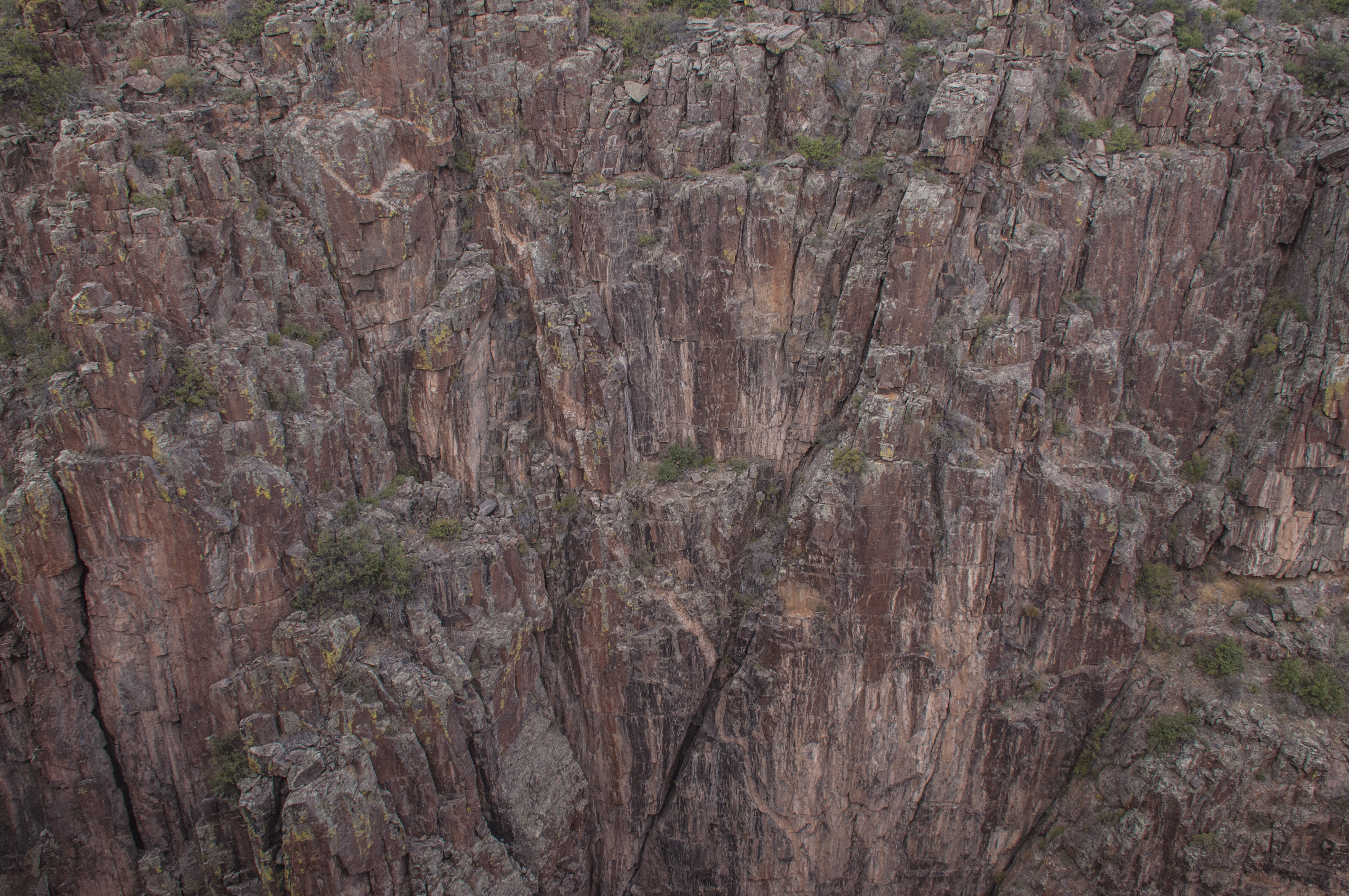
After our week in Durango we began our travels eastward. We began in the Rockies from a high point of 12,126′ at Cottonwood Pass on the Continental Divide while taking a day hike. For comparison that’s 42% up Mount Everest. From there it was all downhill to Charlotte, NC at approximately 750′. We spent 3 relaxing days at Elk Creek CG in Blue Mesa NRA before moving on to Boyd’s Lake SP in Loveland, Colorado

Our stop in Loveland was primarily for RV warranty work on our slides and stabilizing the refrigerator. We also wanted to see why our batteries were not charging while we are driving. That turned out to be a problem with the truck so off to the Chevy dealer. We are finding getting anything but emergency items addressed under the manufacture’s warranty while on the road difficult. Everyone is “too busy”. Maybe I’m getting cynical in my old age but I think it’s really because they don’t get paid for it. More work needs to be done but we’ll wait until this winter in Arkansas. Next was Opal’s overdue visit to Banfield for her yearly checkup. She’s doing great for a 12 year old dog. The visit was a pleasure for both Opal and the vet… NOT! Then there was laundry, groceries and Walmart. All work and no play? Not us! We took in The Bensen Sculpture Garden, enjoyed a 10 mile bike ride on the bike trail at the park and ate at 2 Triple D spots. The restaurants were 451 in Fort Collins and Foolish Craig’s in Boulder. 451 was an upscale spot with good food but more pricey than the usual Triple D places. Foolish Craig’s was an eclectic spot with delicious crepes and other main dishes.

We drove to Rocky Mountain NP twice hoping the pass was open but had to settle for short hikes around Bear Lake and enjoy the elk bugling. On our second trip we stopped at the Colorado Cherry Company and fell in love with their tart cherry juice. We found spots in the RV to carry four gallons with us. We also took a long drive around to the south entrance to RMNP through the Arapaho-Roosevelt National Forest. We stopped at the Forest Office and as luck would have it talked with the lead ranger who is also the volunteer coordinator. Turns out that his wife is the volunteer coordinator for RMNP too. We exchanged cards for a possible future work camp position.

Traveling East Fall 2016

Traveling East Fall 2016

Bear Lake At RMNP

Bear Lake At RMNP

Girls Day Out

Girls Day Out

Can you Hear Me Now?

Can you Hear Me Now?

Wanna Play?

Wanna Play?

Moving into eastern Colorado we left the beautiful mountains for the open plains. A dramatic contrast to be sure. Here we stayed at John Martin State Park on the Arkansas River. This park has the longest pull through sites we’d ever seen. There is electricity at the site but common water. Steve devised an easy way of refilling our water tank by immersing a marine bilge pump in a 10 gallon container then plugging it into the truck cigarette lighter port. BAM! Only 50 seconds to transfer water. We took time to select photos for our annual gift calendar and relaxed. We did visit 2 National Park sites: Sand Creek Massacre and Bent’s Old Fort. Both were very interesting. Sand Creek Massacre is a relatively new park and in the early stages of development. They have just received funding for a Visitor Center. We were fortunate to arrive just in time for a ranger talk about the event. He was one of the best interpreters we have heard. I wish more people would visit these smaller parks. They are hidden gems. Having been raised on the east coast we never studied or read about these formative events in our country’s history. Bent’s Old Fort was the first permanent settlement in the area and served as trading post and social gathering place in the first half of the 19th century. The building today is a recreation of the fort from plans sketched by a visitor. The rangers are not in the trademark uniform but wear period costumes and give informal talks. The two sites contrast each other: one a site of Manifest Destiny and military might overpowering native people and the other a thriving settlement where traders, mountain men and Native Americans coexisted peacefully.

Sand Creek Massacre Location

Sand Creek Massacre Location

Native American Monument At Sand Creek

Native American Monument At Sand Creek


View Of Bent's Old Fort NHS

View Of Bent’s Old Fort NHS

A Demonstration Of Knife Making

A Demonstration Of Knife Making

Trading Post At Bent's Old Fort

Trading Post At Bent’s Old Fort

Now we move on to Kansas. We found a fabulous place to stay at Cedar Bluff SP. Some sites offer full hookups for $19/night. It is a busy park in the summer however in late October only lightly used. For most of our stay we were the only RV in our loop. Opal enjoyed her off leash walks. Now, being the only dog in the park is the way I like it! (Opal) Many folks simply rush across Kansas. This is our third visit to the state and we have found interesting things to do each time. The closest town of any size is Hays, KS. On our way there for errands we noticed a sign for the Walter P. Chrysler Home Museum. We stopped in Ellis on our way back to see it. Turned out to be a great small town museum to their most famous son. We didn’t know much about him but after touring his boyhood home and learning about him we’d like to read a biography. Two of the most interesting displays were his own car (#6 off the line) complete with wooden wheels and his desk.  Another “self made man” story. 

Museum In Ellis, Kansas

Museum In Ellis, Kansas

Chrysler's Car

Chrysler’s Car


Desk Used By Chrysler

Desk Used By Chrysler

One More For The Reading List

One More For The Reading List


While in the central western area of Kansas we also visited the Santa Fe Trail Museum, Fort Larned NHS and Nicodemus NHS. The SFT Museum detailed travels of pioneer families during the westward migration of the mid to late 1800s plus those who used the trail before them. Well worth stop. Fort Larned is another of the NPS sites dedicated to the series of forts built as protection and evidence of ownership as what was thought of as “The West” moved onward. At first you look at all the names carved into the buildings as graffiti but later realize this is an archive of those who passed through here. Before the NPS took over and restored the site locals came here often to picnic so many names are post fort and early to mid 1900s. The site is large and beautifully equipped with all the items one would find at an active post of its day. Nicodemus is a relatively new NPS site about former slaves who formed settlements in the midwest and west post Civil War. There are 5 remaining buildings of which 2 are open to the public.

Fort Larned Architecture

Fort Larned Architecture

Graffiti Or History

Graffiti Or History


Larned Harness Shop

Larned Harness Shop

Fort Larned Hospital

Fort Larned Hospital

Quarter Master's Office

Quarter Master’s Office


Post Commissary

Post Commissary

nicodemus-vc

Nicodemus NHS

Our final stop was for dinner in Hays. The area was originally settled by German immigrants and still has strong ties to its heritage. We decided to try a local micro-brewery/restaurant called Gella’s Diner. Steve had sauerkraut soup and a bratwurst platter while I enjoyed a potato soup and local specialty called a bierock. What’s a bierock, you ask? It is a meat, cabbage and onion mixture in a pastry. It is served with a sharp cheddar/ale sauce. MMMmmm good! We certainly do a good job of traveling on our stomachs!

Gella's Diner In Hays, KS

Gella’s Diner In Hays, KS

Next stop: Oologah, Oklahoma. This is our first trip to the state of Oklahoma. Now we only have 4 states left in the lower 48 to have the RV. Our reason for coming here was to visit two of Steve’s cousins. Unfortunately one of them was in the process of moving and not able to come. We had planned to stay closer to Tulsa at a USACE park but at the last minute noted on the website a comment about low branches. Oh no! Been there, done that. So we chose Hawthorn Bluff USACE CG on Lake Oologah. We’d hoped to stay a week but the campground was closing down for the year on 10/31. So we quickly booked three nights at another USACE park on Lake Dardanelle in Arkansas. Besides seeing relatives we visited two sites about Oologah’s most famous son, Will Rogers. The first was his birthplace and the other was the Will Rogers Museum. I know who Will Rogers was but didn’t know much about him other than his witty sayings.  He began as a trick roper and later added his trademark humor and wit at the suggestion of his wife. He was always very proud of his Cherokee heritage. He progressed on to lectures and newspaper columns until perishing in an airplane crash in Alaska with Wily Post. The museum is huge and has some fantastic videos of his roping tricks. You can easily see why he “never met a man he didn’t like”.

He Never Met A Man He Didn't Like

He Never Met A Man He Didn’t Like

Will Rogers Birthplace

Will Rogers Birthplace

Will Rogers Statue

Will Rogers Statue

Will Rogers Museum

Will Rogers Museum


Extensive Exhibits Can Be Found Inside

Extensive Exhibits Can Be Found Inside


Of course we had to go when we found there was a Diners, Drive-ins and Dives spot nearby called Clanton’s. The owners are the fourth generation to run this Route 66 cafe since 1947. Known for their fried chicken and chicken fried steak, you best go early or plan on waiting in line. On our way home I spotted a sign for a Folk Art site. Steve asked “Do you REALLY want to go? He was hoping Chari would say no (meanwhile thinking of Lucas, KS). Yes she said. So off we went. The “artwork” by Ed Galloway was several concrete sculptures including the world’s biggest totem pole. The totem pole is 90′ tall, 18′ in diameter and displays 200 carved images. It took eleven years to build. We were there only a few minutes when the caretaker had to leave on a family emergency. Steve was VERY relieved!

Clanton"s Cafe On Route 66

Clanton”s Cafe On Route 66

This Is Triple D All The Way!

This Is Triple D All The Way!

He Liked It!

He Liked It!


The World's Largest Totem Pole

The World’s Largest Totem Pole

More Ed Galloway Art

More Ed Galloway Art

In The Eye Of The Beholder

In The Eye Of The Beholder


At Corinth, MS we finally caught up with our reservations made before leaving Utah. We were there visiting Chari’s relatives. Previously we had stayed at J. P. Coleman SP. However, knowing the park we felt our new trailer would have difficulty maneuvering into the sites even though they were technically long enough. So we chose Piney Grove CG, a USACE park on Bay Springs Lake. The lake is part of the Tennessee-Tombigbee Canal project built during the late 70s for barge traffic. While it has never seen the volume of traffic hoped for it does provide a wonderful recreation area. 700 acres of my first husband’s family farm was purchased for what is now called Crow’s Neck. There is an environmental Education facility there.  The RV sites at Piney Grove are large. The only downside is the thick tree cover making TV reception minimal.

We were lucky enough to have arrived for the Grand Illumination Celebration. This used to be an annual event in Corinth but with budget cutbacks it had not been held for three years. The Grand Illumination acknowledges casualties from the Battle of Shiloh and both Battles of Corinth for control of the railroad by placing 6,000 luminaries around town and at the NPS Civil War Interpretation Center. Each luminary is a casualty of the conflict. This year the Interpretation Center had a speaker on the topic of “The Role of Camels in the Civil War”. That’s right… camels. So here is the tale of Old Douglas. Old Douglas arrived by ship from the middle east in the 1850s. He was purchased to work on a plantation. When his master joined the Confederacy so did Old Douglas. Don’t get the idea he swept into battle Lawrence of Arabia style. His job was to carry the regimental band instruments. Old Douglas was in Vicksburg when he was shot and killed. Vicksburg had been under siege and soldiers were reduced to eating their boots. Let it be known Old Douglas did not die in vain. One thousand pounds of meat was a blessing to soldiers and civilians alike. We also visited two of the five Civil War era homes that remain in Corinth.

luminaries

Then we had the last two long driving days to get to the Charlotte, NC area. Our overnight stop just north of Atlanta was a very nice USACE park named McKinney CG on Allatoona Lake. We’ll remember this one for a future visit to the Peachtree state. Likewise our stay at Ebenezer County Park near Rock Hill, SC was great. We cleared out our storage unit. All of our worldly possessions now fit either in the RV, truck or a 3’x3′ storage cube.

Lastly we headed to Chambersburg, PA for Thanksgiving with Steve’s family. Our only non family activity was a visit to Gettysburg Military Park and the Eisenhower Farm. We didn’t know that this was a special weekend celebrating the anniversary of the declaration of Emancipation. The park had several authors of historical fiction on hand. Steve met one of his favorite authors, Jeff Shara. The town of Gettysburg had a parade with over 500 re-enactors dressed in a variety of uniforms and period dress.

Gettysburg Diorama Scene

Gettysburg Diorama Scene

Abe, Mary and Winfield Scott

Abe, Mary and Winfield Scott

Drummer Boy

Drummer Boy


A Long Parade

A Long Parade

Union Troops

Union Troops


The Confederates

The Confederates

women-in-parade

Women Marchers

Zouave Unit

Zouave Unit


We packed a lot into our trip east and hope you have enjoyed this leg of our travels as we visit the icons and hidden gems across the USA.

Make A Plan But Don’t Plan The Results

We left Flaming Gorge NRA after a fabulous summer in early September 2016. We made a straight shot with only two quick overnight stops at Cortez, CO and Winslow, AZ for our first camp host job at Parker Canyon Lake near Patagonia, AZ. We were supposed to be there for six weeks. To make a long story short, it was nothing like the job that had been described. We decided to leave after three days.

Now what? We had lots of unplanned free time. So we headed for Roper Lake SP in Safford, Arizona (southeast part of the state) to recoup and put together a revised plan. Our only constraint was that we needed to be in Corinth, Mississippi by the first weekend of November to connect with reservations already made. Here is our revised trip plan.

Google Earth, RV, travel

2016 Fall Trip Plan Revised

Safford, Arizona is in the San Luis Valley with the Pinaleno Mountains to the west and the Dos Cabezas Mountains to the south. It is mostly a ranching and farming area. The towns of Safford, Thatcher, Benson and Wilcox form the Arizona Salsa Trail. So the first thing we did was to eat at one of the restaurants on the trail. We chose Casa Mañana as many locals were eating there. The restaurant has been on the same site for sixty years. It began when a family started serving from their own kitchen. The original home was expanded as the restaurant grew and is still the center of the restaurant. The food was so good we went back for dinner another day. When they say a huge chimichanga, believe them! We had enough left over for another meal.

Arizona Salsa Trail, Mexican food

On The Arizona Salsa Trail

Casa Mañana In Salford, Arizona

Casa Mañana In Salford, Arizona


After catching up on errands we headed to Chirichacua National Monument. Once again we were saying “What else can they do with rock?” The scenic drive was wonderful. Of course we took many pictures.

Chirichaua NM, Arizona, geology

Balanced Rocks On Pinnacles

The Sea Captain Monolith

The Sea Captain Monolith

Scenic Drive At Chirichacua NM

Scenic Drive At Chirichacua NM

Steve At The Overlook

Steve At The Overlook


Another day we joined the tourist ranks and headed over to Tombstone for the Second Annual Territory Days Celebration. Yes we saw the OK Corral but declined to pay $8 for their daily gunfight. We enjoyed the parade through town and the Folklorico dancers. We did spend time in an oil and vinegar store where we purchased some tangerine balsamic and a tasty BBQ sauce.

Territorial Days Parade

Territorial Days Parade

Hickcock We Presume?

Hickcock We Presume?


Buffalo Soldiers

Buffalo Soldiers

Hanging Out In Tombstone

Hanging Out In Tombstone


Horsepower

Horsepower

Local No Kill Shelter "Cowboy"

Local No Kill Shelter “Cowboy”

And You Think You Had A Crappy Job?

And You Think You Had A Crappy Job?

Folklorico Dancers Performing

Folklorico Dancers Performing

Dancer In Motion

Dancer In Motion

Portrait Of A Dancer

Portrait Of A Dancer

The real surprise in the area was a drive into the Pinaleno Mountains along the Swift Trail. In only 35 miles you climb over 5,000 feet. The temperature when we started was ninety-two but at the top only a breezy fifty-one. Great tent camping here but only space for truck campers and popups around a lake. We stopped at a family run orchard and bought some apples which became apple pie and applesauce. They told us to feel free to pick some for eating then. We did! It’s been a long time since I’ve had an apple this juicy. For such a short distance we were surprised when it took us two and a half hours to get to the top. A nice change from the heat of the valley. There’s quite a bit more to do in this area and so we say “when we come back…”

A View From Swift Trail

A View From Swift Trail

apple-of-my-eye-72

He’s The Apple Of My Eye


Lake At The Top Of Swift Trail

Lake At The Top Of Swift Trail


For When We Come Back

For When We Come Back

Where Next? #10

It’s hard to believe that our wonderful summer in northern Utah is coming to a close. So where will the four winds blow us next?

First we are headed over to Laramie, Wyoming to visit friends who are volunteering at the Wyoming Territorial Prison State Historical Site. Then south to the Silverton/Durango area in Colorado. A brief stop at Petrified Forest NP to say hi to staff where we volunteered in 2014-2015. Lastly we turn south to try our hand at being camp hosts for the Coronado National Forest at Parker Canyon Lake about an hour south of Tucson, AZ. After 6 weeks there we make an almost straight through drive to Charlotte, NC. We know now that full timing is what we want so no use paying to store things for 15+ years. We’ll pare down to just a few memory pieces.

Then a much overdue trip to see Steve’s family in Chambersburg, PA for Thanksgiving. From there we meander for a month via Alabama, Florida and Louisiana to our next volunteer job at Hot Springs National Park in Hot Springs, Arkansas. We’ll be there from January-March 2017.

Our path this time looks a lot like a ricocheting bullet, doesn’t it? Thanks for traveling with us!

RV Travels From Flaming Gorge NRA, UT to Hot Springs NP, AR

RV Travels From Flaming Gorge NRA, UT to Hot Springs NP, AR

Where Next #9

Laguna Atascosa NWR, Flaming Gorge NRA, Texas, Utah, New Mexico, Colorado

From LANWR To Flaming Gorge NRA

It’s been a long time since we’ve posted on the blog. Guess we needed a vacation from having so much fun! Before we get too much further behind here are our travel plans when we leave Laguna Atascosa NWR and head for our summer volunteer position at Flaming Gorge National Recreation Area.

When we head out we will go north to the piney woods of northeastern Texas to see Big Thicket National Preserve, Cane River Creole National Historic Park in Louisiana and the area should be in bloom with azaleas and dogwoods. Now add local BBQ joints and fried catfish to the mix. We’ll be staying at Alley Creek Camp, a USACE campground on a lake with water and electric hookups. We bought fishing licenses but haven’t been able to use them. Maybe we will here.

Then we drop back south a bit where we’ll be 75 miles NW of Houston. Lots of small towns, Spring blossoms, the Texas Painted Church tour and hopefully getting to Galveston and sightseeing in Houston too. We’ll stay at Cagle Recreation Area, a USFS campground with full hookups.

On to the Hill Country where there is so much to do I know we won’t scatch the surface. We’ll be staying at Cranes Mill CG on Canyon Lake, a  USACE campground with electric and water hookups. We plan to visit Fredricksburg,  New Braunfels and San Antonio. There will be many drives through the famous blue bonnets and we’ll meet up with friends volunteering at the LBJ NHP.

On to west Texas via Amistead NRA (a reservoir on the Rio Grande), Guadalupe Mountains NP and El Paso. From there we turn north to New Mexico and hope to stay at Elephant Butte Lake SP. Using this as a base we will visit White Sands NP, Gila Cliff Dwellings, Salinas Pueblo Missions and Pecos NHP. If there is time we will stop to see fellow volunteers at Sevilleta NWR.

Hoping to make up for our missed visit last Fall, we will drive north to see friends in Los Alamos, NM. Other points of interest will be Santa Fe and possibly 5 more NPS sites. We haven’t camped that much in Colorado so we look forward to staying at Cheyenne Mountain SP near Colorado Springs. Our last leg will turn west toward Dinosaur NM and Fossil Butte NM. If we see all 17 planned NPS sites we will have seen 42% of all the parks.

We’ll put down roots (or as close as we come to it these days) for 3.5 months in NE Utah. Home is where you park it.

Where Next #7?

After a wonderful time at Petrified Forest National Park it’s time to hit the road again. Full time RVers can’t stay still long. When the need to get moving strikes we call it a case of “hitch itch”. So where do we go from here? We’ll be driving more than 2200 miles over the next three and a half months.

Google Earth, RV, travel

Our Route February-May 2015

It is too early to begin heading north so we will spend February in Arizona seeing the Verde Valley/Sedona area, Tucson and Lake Havasu. Then on to Las Vegas and the Lake Mead Recreation Area for a visit with a kayaking friend from North Carolina.  We plan to see one of several Cirque de Soleil shows playing in LV.  On to Death Valley NP and three weeks in the central valley of California. Using this area as our base we will explore Sequoia, Kings Canyon and Yosemite National Parks, Fresno and perhaps Monterrey. By the end of March we hope to finally camp along the Pacific coast. April will see us exploring the Oregon coast, Portland and the lower Columbia River region. By early May we should arrive in the Seattle area to spend time with relatives. Meandering along the Olympic Peninsula to Port Townsend we will take a ferry to Whidbey Island. At Anacortes we catch the ferry over to San Juan Island for our next volunteer stint at San Juan Island National Historic Park from late May until after Labor Day.

After traveling through Nevada, California, Oregon and Washington we will only have seven states we have not yet visited with the RV. Our map is filling up! So come along and see what lies ahead for the DreamChaser and the three of us.

A Visit To Wild Spirit Wolf Sanctuary

Google Earth

Location of Wild Spirit Wolf Sanctuary

With four days off each week we have plenty of time to explore northeastern Arizona and western New Mexico.  Located about forty miles south between Gallup and Grants, NM in the small town of Candy Kitchen is Wild Spirit Wolf Sanctuary. We went there for one of the four regularly scheduled tours given Tuesday-Sunday. On this particular Sunday we were the only people on the tour which was great and made it very personal. Just know that the area is very muddy so boots are recommended.

Before continuing about our visit at Wild Spirit we’ll mention a bit of how the town of Candy Kitchen got it’s name. During Prohibition the government kept a close eye on anyone buying sugar in large quantities. To provide a cover for his bootlegging operation, a local resident started making piñon nut candy. People came to buy candy and often also something to wash it down. The area became known as the Candy Kitchen and the name stuck.

The Sanctuary began in the early 90s when artist Jacque Evans bought a ranch in Candy Kitchen. Hearing about mistreatment of wolves and wolf dogs she decided to turn the property into a rescue facility supported by selling her artwork. Gradually the facility grew and became a non-profit organization. Wild Spirit Wolf Sanctuary is operated solely on donations and the efforts of a very dedicated staff. They care for wolves, wolf-dogs, coyotes, dingos and foxes. Some were trapped in the wild but most were rescued from inappropriate owners or illegal breeding situations. If you read about the wolf that was found recently at the Grand Canyon, he is at Wild Spirit as well. Had they not been able to take him, he would have been euthanized. Whenever possible they keep male/female pairs together because they are very social animals. All of the animals are neutered and no breeding occurs here. The only time they have pups is if a pregnant female is rescued. Why people think they can take a wild animal and turn it into a pet is beyond us. The illegal breeding of wolves with dogs goes on despite law enforcement attempts to prevent such cruelty. The story that got to me the most was about a coyote kept on a chain in the backyard and the collar and chain cut into his skin and became imbedded. When the animal was rescued the chain had to be removed surgically.

All of the animals appeared to be well cared for by their personal caretakers. Our guide talked about the behavioral differences between wolves and dogs. The percentage of wolf to dog determines whether an animal is called a high content wolf dog or a medium content wolf dog. They usually can classify them by behavior. We stopped by one cage with a medium content animal who would alternately howl and bark. We also saw coyotes, dingos and a fox. Ever hear of a New Guinea Singing Dog? Neither had we. They look like small dingos and have a high pitched howl. At one point every animal started to howl or bark. Hearing a pack of wolves and wolf dogs is enchanting. We only wish they could be free and wild.

Taking pictures through single and double wire cages leaves a bit to be desired. The Sanctuary does offer photo tours for one or two people at a time either inside the cages of their “ambassador” animals for $50/hour/pp or in an acre size enclosure for $150/pp. We hope to return sometime for one of these opportunities. Until then here are some pictures from our visit. For more information go to their website at http://www.wildspiritwolfsanctuary.org.

wolf, Wild Spirit Sanctuary, New Mexico

Arctic Wolf

wolf dog

High Content Wolf Dog


coyote

Coyote Pair

New Guinea Singing Dog

New Guinea Singing Dog


red fox

Photogenic Red Fox

What Else Can They Do With Rock #2? – Black Canyon Of The Gunnison

Black Canyon of the Gunnison Panorama

Black Canyon of the Gunnison Panorama

Now we move on to Colorado. Our original plan was to see both Dinosaur National Monument and the Black Canyon of the Gunnison but we made a last minute change in plans. We’d hold Dinosaur NM for a later trip. The drive to our campground at Curecanti National Recreation Area would be nine hours. We could make it a one day drive from Salt Lake and get there after dark. We hate setting up in the dark. Plan B would mean an overnight stay at Walmart in Grand Junction and on to Curecanti the next day. We are becoming Walmart people! As in other stays we were not alone. The lot was full of RVs.

Google Earth View of Curecanti NRA

Google Earth View of Curecanti NRA

Curecanti National Recreation Area is a National Park site on the Gunnison River with several campgrounds. We stayed at Blue Mesa where we had an electrical hook-up and tank water. At this time of year they have shut down shower rooms so we used our RV and were conservative on water. The campground does not take reservations but this is off season and there were lots of vacancies. We liked the area and hope to return again for some kayaking and fishing. On our last night after a rainy day we were treated to a gorgeous rainbow.

rainbow, Curecanti NRA

Curecanti NRA Rainbow

Black Canyon of the Gunnison National Park began like so many of our parks as a national monument in 1933 and became a park in 1999. The park contains fourteen miles of canyon out of the forty-eight miles the Gunnison River  has cut through the Gunnison Uplift. For years this gorge was considered impassable. It wasn’t until 1901 when five residents of the nearby Uncompahgre Valley made an exploratory float of the river on a rubber mattress that the canyon was deemed passable. It remains the steepest and narrowest canyon in the NPS. Some facts: 1) In 48 miles the Gunnison River looses more elevation than the entire 1,500 miles of the Mississippi, an average of 96 feet/mile. In one two mile section the river drops 480 feet 2) the narrowest point of the canyon is a mere thirty-eight feet across 3) the deepest point is 2,772 feet, approximately one and a half times the Empire State Building 4) the name Black Canyon was given because there are parts which never receive daylight. Long overshadowed by destination parks like the Grand Canyon and Yosemite, Black Canyon deserves more attention.

Graph Showing The Shape Of Black Canyon

Graph Showing The Shape Of Black Canyon

Graph Showing The narrowest Part Of Black Canyon

Graph Showing The narrowest Part Of Black Canyon


This is a place where a picture is worth a thousand words. Because of deep shadows on the canyon walls and bright sunshine it is a very contrasty situation for photography. Sit back and enjoy a few pictures from our time there. As always, to bring pictures to full screen just click on the picture.

scenic drive

Along The Scenic Rim Drive

On The Gunnison River At Canyon Floor

On The Gunnison River At Canyon Floor


More River Views

More River Views


Closeup Of Canyon Wall

Closeup Of Canyon Wall


Looking Into The Abyss

Looking Into The Abyss


dog, pets

Steve And Opal At Black Canyon NP


Chari's Best Dead Tree Shot

Chari’s Best Dead Tree Shot

Black Canyon As Seen From Google Earth

Black Canyon As Seen From Google Earth