One Of The Less Well Known NPS Sites
When we took our retirement trip in 2010 to Utah we were amazed at how many varieties and shapes of rock we saw. The phrase “what else can they do with rock?” became a common question. We are continuing to find ourselves saying this as we travel through other parts of the west. Our last stop in Idaho for this year is just one example.
We left Boise and headed south and east to the small town of Almo, Idaho and Castle Rock State Park which is adjacent to City of Rocks National Reserve. We’ve been to a national preserve but didn’t know the definition of a reserve. It was explained to us that the National Park Service oversees the area administratively and participates in decisions but the Idaho State Parks supply manpower and management.

A Panorama Of The Area
When we arrived at Castle Rock SP we headed for our reserved site but ran into a new glitch. The site was still occupied. Steve checked and there was no car and no occupants. So we pulled off the road and went in search of the Camp Host. She offered us another site in the equestrian portion of the campground but if we really wanted the reserved site the park would arrange to tow the other trailer away. The alternative site was lovely so we took that one. We never did find out why the people hadn’t vacated on time. Our Camp Host, Dottie, was a very interesting woman. She is a solo RVer and rock climber who was one of the first woman blackjack dealers in Las Vegas. Each winter she goes to Mexico where she and two other woman (a retired professor from Columbia University and a native New Zealander) have built an animal rescue and spay facility called Fiona Animal Rescue of Hidalgo to deal with the severe overpopulation and mistreatment of domestic animals in the area. To read more about this worthy effort go to http://www.potreropups.org.

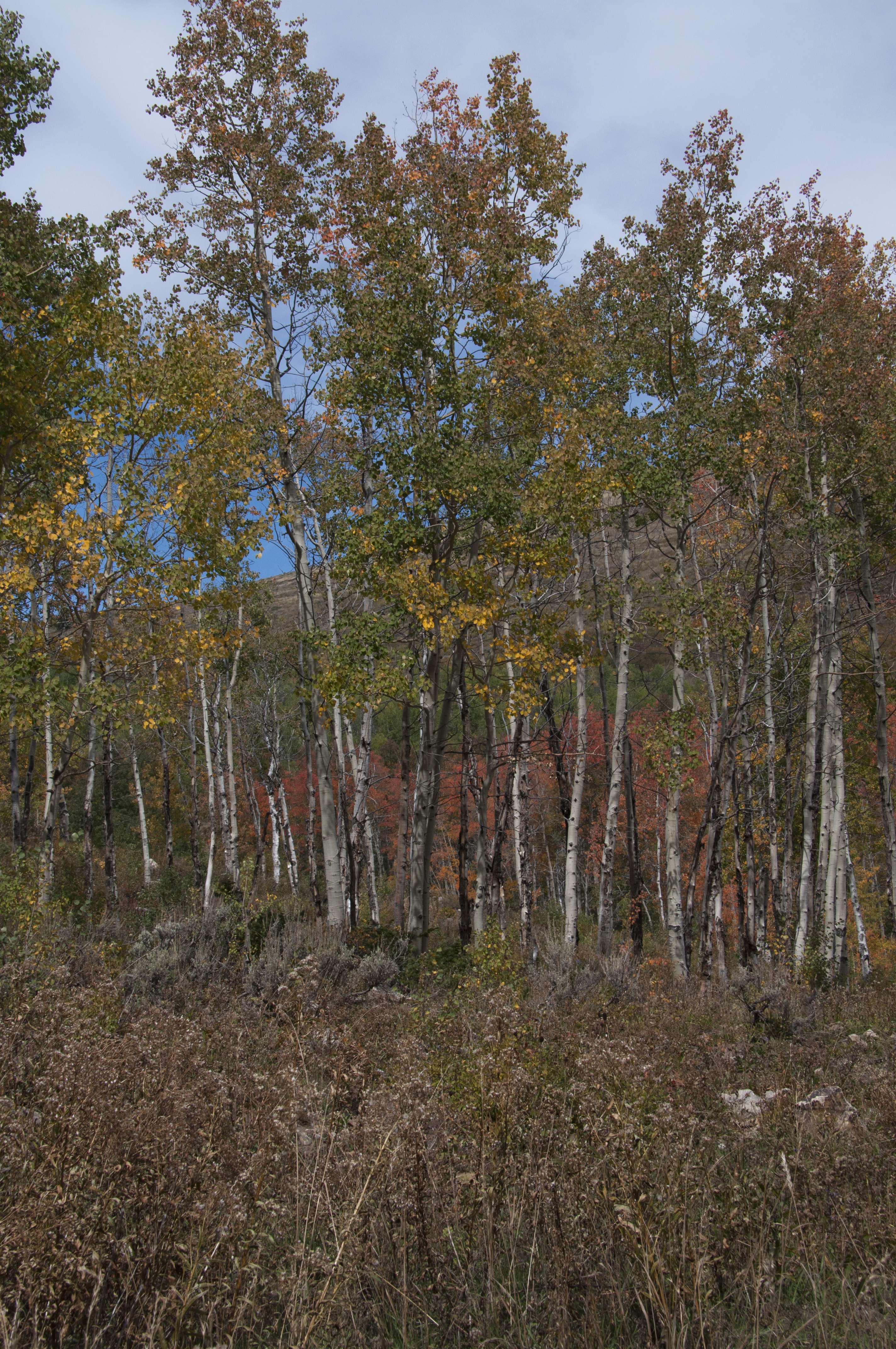
Fall Color At City Of Rocks
City of Rocks National Reserve is one of the newer National Park sites offering stunning granite formations, overlapping biological regions for 750 plants and animals, world class rock climbing, 22 miles of hiking trails, photography sites and one of the best preserved locations on the California Trail. The park offers training in basic rock climbing with their Rock Climbing Ranger. Nearby is the Sawtooth National Forest with more beautiful scenery, lakes and campgrounds. We spent the first two days driving and walking among the spires and formations. Dogs are allowed on the trails so Opal enjoyed seeking out trails of pioneer dogs.

Replicas Of Pioneer Wagons

A “Cityscape” In Granite

1890s Homestead Ruins

Rock Climbers Love This Park

Old Man In The Rock

Steve Standing By Rock Formation
Latter in the week we had an opportunity to go on a two hour tour with the park archeologist, Kristin. The tour is listed in the park brochure but must be scheduled ahead. She is an excellent guide and provided many stories about the history of the California Trail and people who had left their signatures on Camp Rock and Register Rock. The park is working on a booklet about these people. Hopefully it will be available next year. Most of the signatures were written in axle grease but a few were carved into the rock. We learned that axle grease had come in many colors; red, green and even yellow so that at one time these rocks were very colorful. Now time and weather has made them uniform and in some cases difficult to read. Some 200,000 settlers passed through City of Rocks along the California Trail making this the largest emigrant movement in the world. One of the best known formations is The Twin Sisters because it could be easily spotted by the pioneers at a distance.

A Homesteader’s Signature

One Of The Women Who Passed This Way

A Traveler’s Sketch

The Twin Sisters
Today the town of Almo remains a very small ranching community where the general store still serves as the post office just as it has since the 1890s. If you come here, plan on bringing all your groceries with you as the nearest large grocery is an hour plus away. For non-campers there is a resort and motel and a few local restaurants.

Old Photo Of Almo General Store
Our drive into the Sawtooth National Forest turned up a few more interesting rock formations and great Fall scenery. We found two NFS campgrounds with good accessibility and suitable for our trailer so we added them to our GPS database. Even though they are dry camp areas we would enjoy a few days of fishing and hiking here. There is a wonderful scenic overlook at the top of Cache Peak. The Raft River below and the peak were named by Peter Skeen Ogden, a fur trader for the Hudson’s Bay Company in 1826. The river was so named because beavers had it dammed and it could only be crossed by raft. Cache Peak got it’s name because it served as a landmark for trappers as to where they had cached their pelts. There is one overlook where you can see the location of a WWII aircraft training flight wreck. If you look closely you can still see a tire lying there.

Sawtooth NF Early Fall Foliage

Painted With Lichen

A Landscape That Looks Like A Painting

A Rainbow Of Color In Rock

Can You See The Elephant?

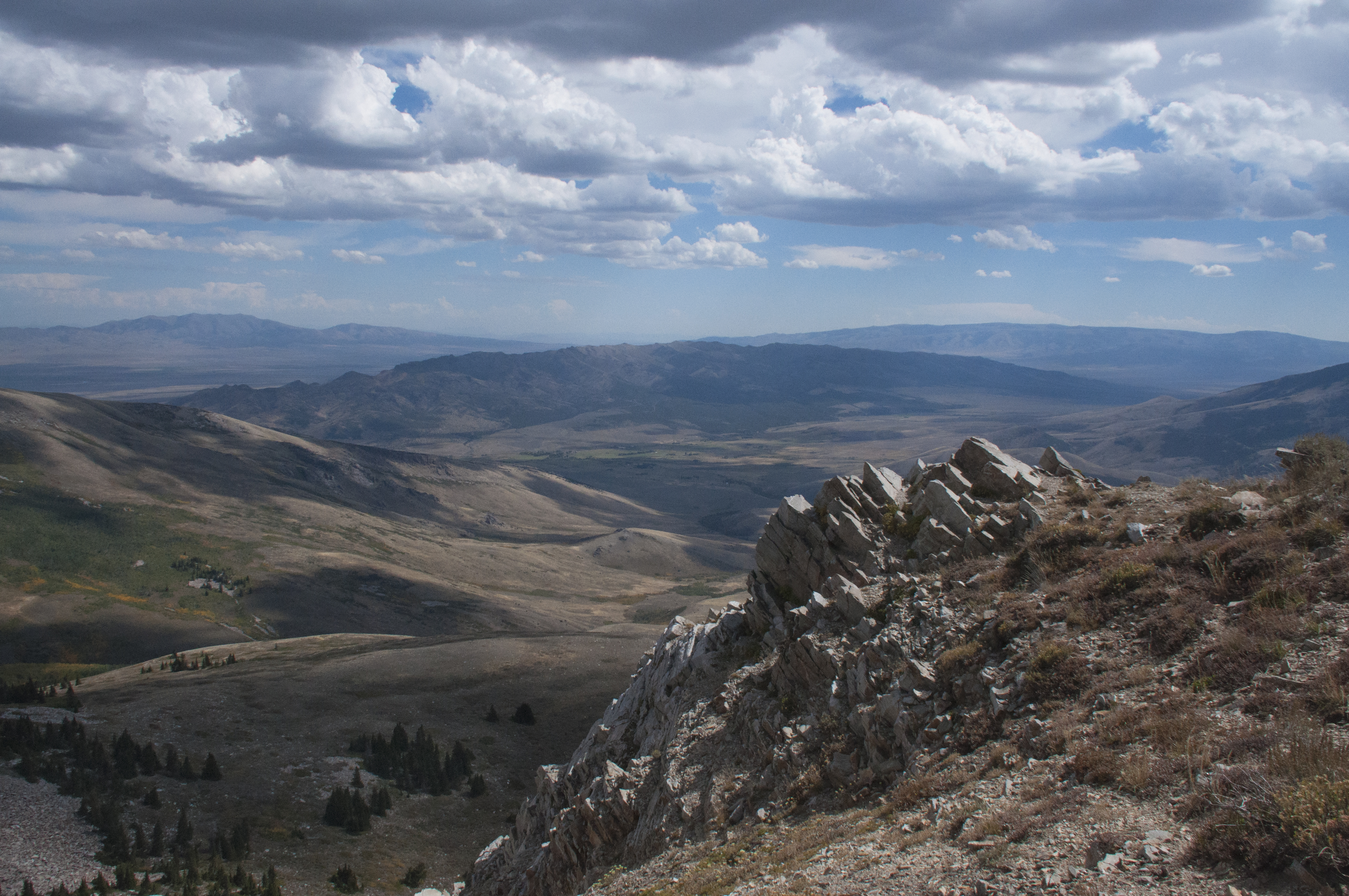
View From Cache Peak

On A Clear Day You Can See Forever
Two other National Park sites were within an hour’s drive; Hagerman Fossil Beds National Monument and Minidoka National Historic Site. When we put them into the GPS we didn’t realize they shared the same Visitor Center. so when we looked at the directions from one location to the other the GPS said “Drive six feet”. Who says machines don’t have a sense of humor. The Hagerman Fossil Beds are an extensive area of fossils along the Snake River Plain near Twin Falls, Idaho. The most famous are those of a herd of the earliest known horses called the Hagerman horse (Equus Simpicidens). They are more closely related to the Grevy’s zebra of Kenya and Ethiopia than the modern horse. Other fossils found here include mastodon and saber-toothed tigers. The small visitor center has good displays however the actual fossil sites are closed to the public. You can also see original wagon ruts of the California Trail passing close to the fossil beds.

Meet The Hagerman Horse

Snake River Canyon From Twin Falls Bridge
The Minidoka NHS was established in 2001 and tells the story about internment of Japanese Americans during WWII. I found the story and site to be moving, disturbing and educational. To realize that an entire segment of our population could be rounded up, deprived of their Civil Rights and freedom and imprisoned is shocking. It just shows what fear can do. Racial prejustice was already known to the immigrant Japanese (Issei) because as resident aliens they were prevented from owning land or obtaining citizenship. Their American born children (Nisei) were citizens. Following the attack on Pearl Harbor hostility increased and all people of Japanese ancestry were treated as spies and saboteurs. The impetus for internment was Executive Order 9066 in February 1942 which gave military commanders the power to exclude any persons from designated areas to secure national defense objectives. While the order could have been applied to anyone it was primarily used to remove 120,000 people of Japanese ancestry from the Pacific coast. Within five months ten relocation centers were built with 7,100 people being relocated to Minidoka. Here they faced barbed wire fences, armed guards and restricted movement. Faced with poorly constructed barracks and sanitation they had to endure temperatures from -21 to 104. However this was a resourceful group who went on to create gardens, publish a newspaper and create musical groups. Minidoka became almost a self sustaining community. By the time the camp closed in 1945 the residents had cleared and cultivated 950 acres of land. A questionnaire was used to determine loyal internees from dissenters. If they answered No to willingness to serve in the US Armed Forces in combat and to foreswear allegiance to Japan they were shipped to Tule Lake Camp in California. Minidoka became the camp for loyal internees. Minidoka had the largest number of men volunteering for military service. The 442nd combat unit served in France and Italy and had two Medal of Honor recipients. When the camp closed the newly reclaimed land was sold by lottery. Most of the former camp land remains privately owned today. A few structures from the original camp remain hopefully to keep this from ever happening again.

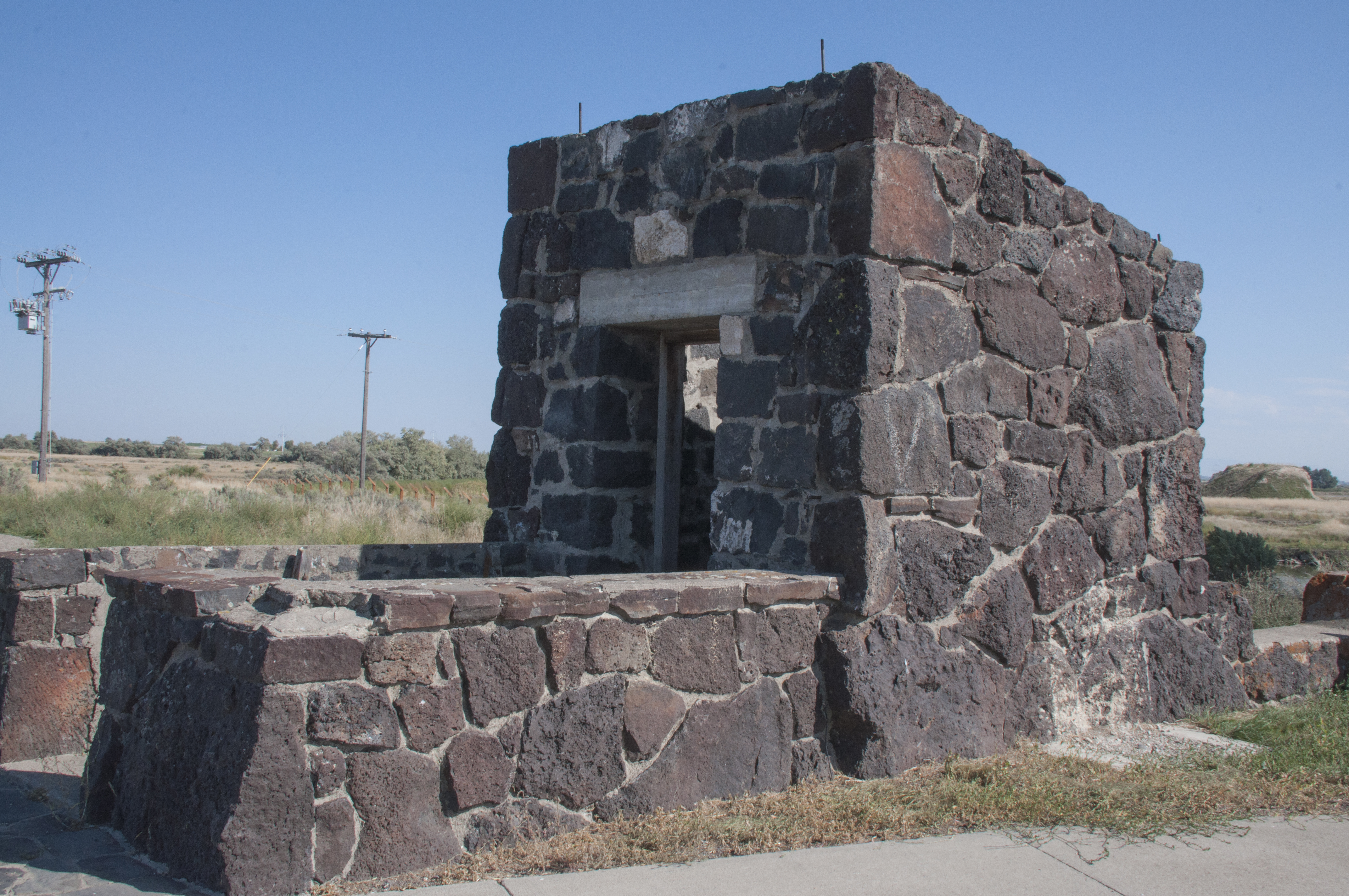
One Of The Remaining Structures At Minidoka NHS

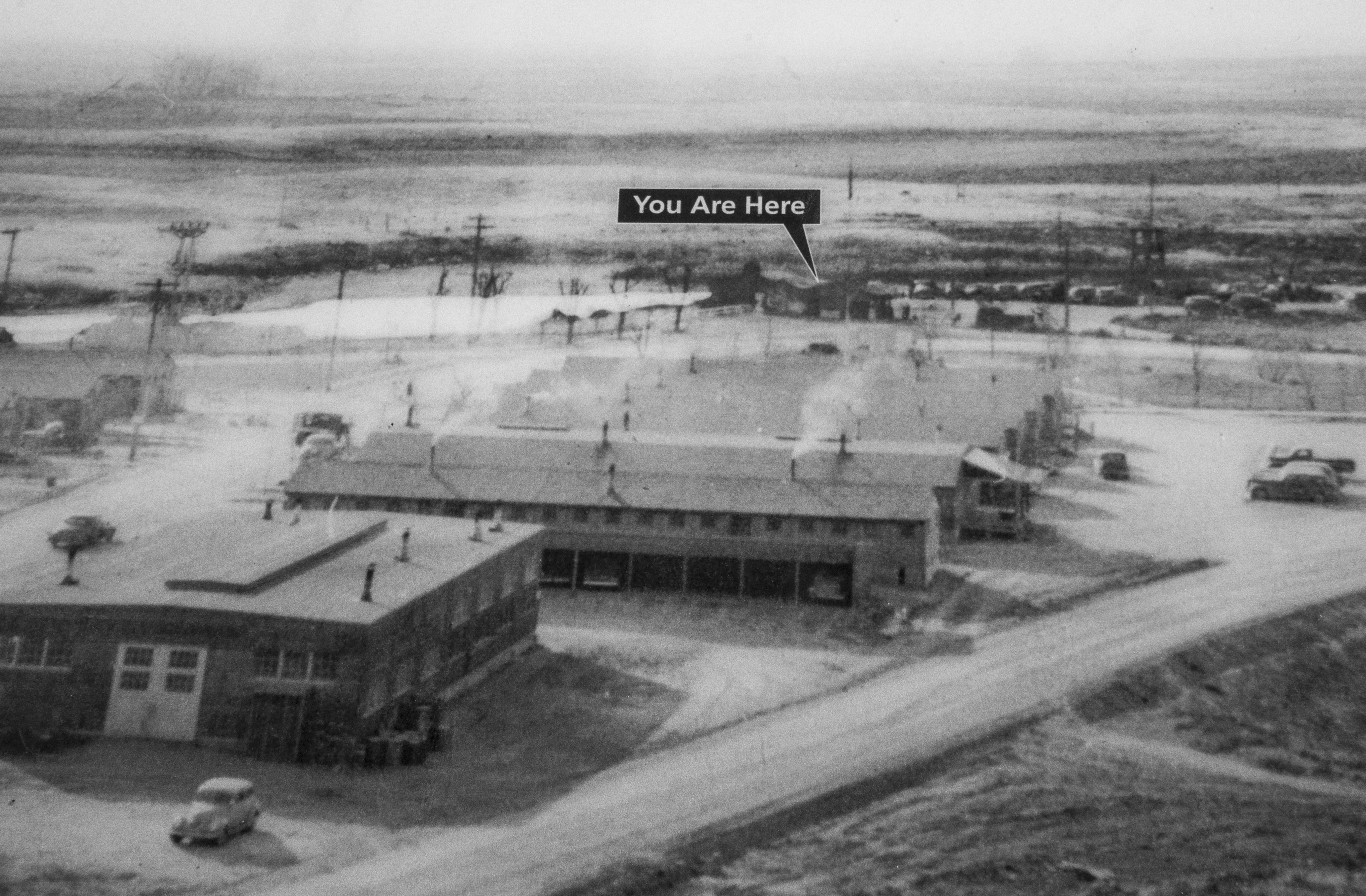
Minidoka Camp 1942-1945

Replica Of Guard Tower

Turning The Desert Into A Garden

The 442nd In Europe
With this we leave Idaho for this trip and head for Utah. There is so much more to see we will definitely be back!