Plans, What Plans (Part 2 of 3)

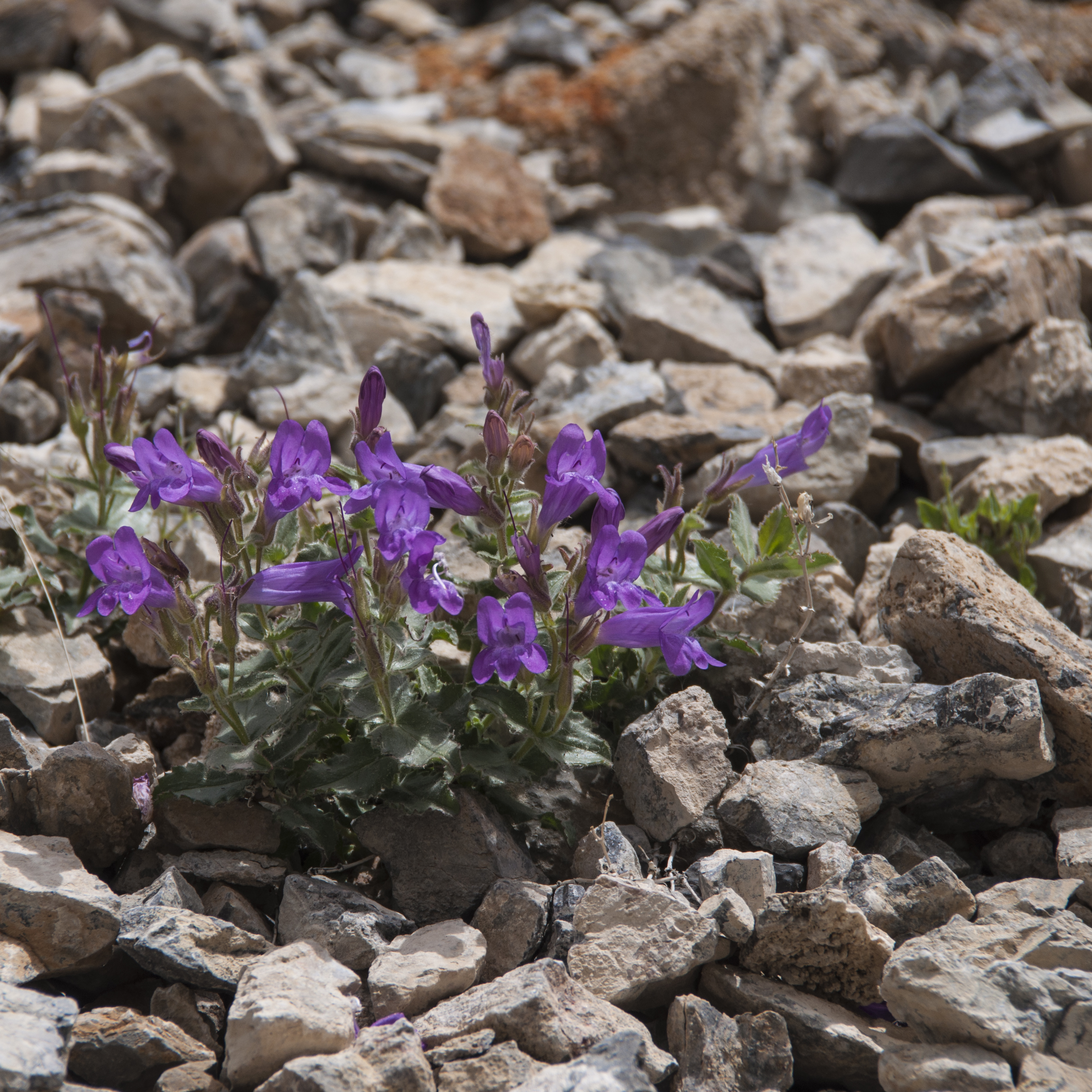
So we’re on the road heading to West Branch State Park in Ohio. We have driven through Ohio but never camped there. This stay will cross that state off the list and leave us with only 2 states in the lower 48 we have not stayed in (West Virginia and Connecticut). West Branch SP is a great park for exploring northeast Ohio and we’d come back here any time. We arrived in good weather but saw that would change so we headed to Cuyahoga National Park. This is one of the most urban of our National Parks. Maybe it’s because we were raised in very similar areas but we really didn’t see a whole lot that seemed special. The area does provide a green belt in an otherwise built up area and is heavily used by walkers and bikers so if for nothing else it is valuable. There is some important history about canal building as well. We used our visit to photograph some wildlife and enjoy a beautiful Spring day.

Blue Heron In The Rookery

Mallard Pair At Cuyahoga NP


Cuyahoga Waterfall

Some of the places we wanted to see (James Garfield NHS and Perry Victory and International Peace Monument)  either were not open or didn’t have their boat trips running for the season. We headed to Canton, OH to see the First Ladies NHS. A small Visitor Center has a few exhibits but the main reason for the site is a tour of President and Mrs. McKinley’s home. It was her family home as well. You access it only by guided tour.

McKinley Home At First Ladies NHS

McKinley Desk


Beautiful Staircase

On the way out, being the brochure collector that I am, I picked up a flyer for the Blue Water Majesty miniature ship museum. Steve had put up well with a morning of looking at women’s things so we decided to check this out. Even with the address and our GPS, when we got to the museum we weren’t sure it was the right place. No sign, no other cars and only a small handwritten sign on the door saying open. We went in and were greeted by the owner/model maker, Larry Pulka. We paid our $5 entry fee. That was $5 well spent! This turned out to be one of those hidden gems that we love to find!  He started building ships from kits over 40 years ago when his wife said “get a hobby!” Now he is an artist of the first magnitude crafting sailing ships from exotic woods and even bone. He uses no paint but scours the world looking for exotic colored wood. We never knew there was an exotic wood collectors society. He handcrafts every detail of the ships from original plans. Even the cannons have 51 separate parts!  The attention to detail is amazing. Each link of his chains are handcrafted. We can’t begin to tell you what a fantastic find this place is. Before you think maybe you’d like to take one home, they starting cost is $25,000 and up with a 2-3 year wait. We settled for a wonderful private tour and lots of photos. Rather than paraphrase information about the models we are posting the info cards on each ship shown. Click on the pictures for enlarged viewing and easier reading. This is but a small sampling of his work.

Tiny Cannons In My Hand

The Cutty Sark

Cutty Sark Info

Frigate Model


Frigate Info


Info On The Unicorn


The Unicorn


A Shipyard Diorama


Shipyard Info


Attention To Detail

Then the rain started.  Our newly repaired roof leaked worse than ever before! To say we were upset, distressed and just plain mad is an understatement. We checked to see how far away we were from the Prime Time factory in Elkhart, Indiana. Only 5 hours away. We called and told them we’d done everything we could to get this repaired without success. We wanted to come to the factory for repair. With our manufacturer’s warranty due to run out in 4 weeks we expected a run around. Much to our surprise they were very accommodating. The factory repair facility was booked but we were referred to John Klinge RV Repair who did their overflow work. He could take us the next week. So we lived with a bucket and towels and a leaky roof as best we could. Plans for visiting sights in southern Ohio were cancelled and we made plans to go to Indiana. Yes, we contacted the dealer in Pennsylvania and after working our way up the chain to the Service Manager, we eventually got reimbursement for everything spent on the roof “repair”.

By now we were in need of some fun and laughter. The Maier family never misses a Christmas without watching “A Christmas Story”. In Cleveland is the house used for part of the film. It has been turned into a very profitable tourist attraction. Even though it is very commercial, very kitchy and quite pricey, for real fans it is lots of fun. Everyone who goes immediately finds themselves acting out scenes such as sticking their tongue out at the flagpole, posing with the Red Rider BB Gun etc. We learned lots of little known info about the movie and had that well needed laugh.

A Christmas Story House

Triple Double Dare You!

You’ll Shoot Your Eye Out!


IT’S FRA-GEE-LEE!


The Cast

On to Elkhart, Indiana, RV Capitol of the USA. We dropped the trailer off. John Klinge turned out to be our newest Guardian Angel when he immediately diagnosed the problem as an improperly installed air conditioner. Water damage was extensive and would require removing the roof, removal of sheathing and roof framing, removal of insulation etc. Repairs would take about a week. We hung out in Elkhart for a few days to make sure all was going smoothly.

While in town we visited the RV/MH Hall of Fame. If like us you think MH stands for motor home… wrong! It stands for manufactured housing. This place is huge. We spent all of one afternoon looking at campers and RVs from early 1900s to the 70s. They have so many more RVs to display that an addition is planned. Among our favorites were the oldest known camper, the one owned by Lindberg where he hosted Thomas Edison and Henry Ford and Mae West’s chauffeur driven model.

RV?MH Hall of Fame

Vintage RVs On Display

Chari Poses With Mae West’s RV


Since we were here where Prime Time Manufacturing (makers of our Sanibel) is located, we scheduled a visit to the factory. Seeing the construction and quality control was enlightening. We talked at length with the sales rep and he made notes about our issues and suggestions. We viewed a 2019 Sanibel and they have made some good changes. However the separate wine fridge is a bit over the top for us. We followed this with a visit to Goshen, IN and dinner at a Triple D restaurant, South Side Soda Shop. The dinner was just OK but the pie was worth the visit.

South Side Diner

How Many Steve’s Do You See?

We also let our sweet tooth loose at the Wakarusa Dime Store known for their candy display. We had lots of fun doing interior photos of the “old time” candy. Ya, I know it’s what we ate as kids. The extra large jelly beans kept calling our names. So much for dieting!

A Selfie

Old Time Advertising

The Waukarusa Dime Store


Who Else Remembers These?

Thank Goodness for family when you truly find yourself “homeless”. Steve’s brother lives near Yipsalanti, MI so we spent the remaining time there. During our stay we visited River Raisin NHS and toured the old Hutchinson mansion. Anyone else remember sticking S&H green stamps into books as kids? Well Hutchinson was the H of S&H. The home is now the head office of an educational research group. Since our sister-in-law works there we had a tour. Normally this is not open to the public.

Hutchinson Mansion

Did Your Mother Save These?


We returned to Elkhart and picked up our 5er. John had identified some other issues that would be covered under warranty. Since we had a schedule to meet we arranged to return in the Fall. Lesson learned: unless you can’t move or the problem is a minor one, head to the factory for major repairs.

See you soon for the third and final segment.

An Interesting Mix In Year Six

Wow! Can we really be coming to the end of our sixth year on the road? We don’t feel we’ve even scratched the surface of things to do and see!

From May 2017-May 2018 we covered many miles as you can see in our route map below. We almost made a spoon shape route. We went from the Rockies to the Atlantic coast to the Great Lakes while juggling health and RV repair issues. Challenges… yes. Adventure galore! Drop dead gorgeous scenery… you bet! Good eats … mmmmm.

We are starting a new composite map for years 6-10 as continuing to layer our routes would make it unreadable. However just for fun we’ll post a composite so you can see what 180,000 miles looks like.

Join us for Year Seven as we explore summer in northern Minnesota, head back to Indiana for (we hope) our last major repairs and on to a glorious winter in Arizona. See you on the road!


Our 6th Year On The Road


Composite Of Our First Six Years

A Winter On The Crystal Coast

Oceana Pier On Atlantic Beach, NC

Winter On The Outer Banks

Along The Crystal Coast

We arrived at Cape Lookout National Seashore in early November 2017. This would be our home for almost 5 months while we volunteered as Visitor Center docents for the National Park Service. The main Visitor Center is located on Harkers Island, North Carolina and the National Seashore  protects the southernmost islands of the Outer Banks: North and South Core Banks and Shakleford Banks. The  iconic landmark for the Cape Lookout is its black and white diamond painted lighthouse. The seashore is also well known as a shellers haven and for the wild horses that live on Shackleford Banks. This part of the North Carolina coast is called the Crystal Coast because of the beautiful beaches, ocean access and numerous bays and rivers. East of the town of Beaufort to Cedar Island (where you catch the state ferry to Ocracoke Island) is referred to as “Down East” with a unique culture and way of speaking due to being isolated well into the 20th century. We don’t have space enough to detail all that we did here but we hope there is enough so you’ll come visit yourself.

Cape Lookout Lighthouse And Assistant Keepers Quarters

A lot of people ask “Why do you want to go to the beach in the winter?” Our reply is because everyone else doesn’t! The pristine beaches you can walk for miles and rarely see anyone else, after a storm the shells are washed up and ready for the taking and in town you can walk in to a restaurant or find free parking without the hassle. One other reason: Steve hates heat and humidity so he’d never go in the summer! I lived in North Carolina for 20 years and had gone to the northern Outer Banks but never to this area. I couldn’t believe what I’d missed!

CALO Visitor Center In Beaufort


Oil Shed And Summer Kitchen Near Lighthouse


When we started work as volunteers both the Harkers Island and Beaufort Visitor Centers were open so we had days at both. The Beaufort VC is located in the old post office building with some city offices. The building was a WPA (Works Progress Administration) project in 1937 during the Great Depression. In the lobby are four murals painted by Russian born artist Simca Simikovich representing life and history of this sea oriented area. One shows range markers used to guide ships into Beaufort harbor. Because of the shifting shoals and sandbars Cape Lookout and the Outer Banks were called “The Graveyard of the Atlantic”.

Mailboat Mural

Another mural shows a mailboat headed for Cape Lookout lighthouse. Due to rivers, bays and marshes the Down East area had no roads or bridges until the 1940s so all transportation and commerce came and went by boat. The mailboat was the link between the isolated communities and town.

Live Decoy Geese Mural

A third mural shows geese that were raised from eggs by the Ca’e Bankers of Portsmouth Village on North Core Banks. They imprinted on the villagers and stayed. The birds were used as live decoys to bring in migrating wild geese for hunters.

Shackleford Ponies Mural

Of course there is one of the Shackleford ponies. At an average of 44-48″ at the withers they are between pony and horse so both terms are used. DNA tests link these horses to Spanish horses but no one knows just how they got here.

The last mural depicts the famous wreck of the Chrissie Wright. It is placed over a doorway. When this ship foundered on the shoals  off Shackleford Island during a winter storm all but one of the crew froze to death while islanders watched helplessly from shore. This tragedy led to the establishment of a lifesaving station on Cape Lookout two years later. Even today locals will refer to a cold stormy day as a “Chrissie Wright Day”.

Chrissie Wright Mural

The town of Beaufort was the third town established in North Carolina and dates to 1713. History abounds all through the area and we took full advantage of learning as much as we could from tours, special events and lectures. 2018 is the 300th anniversary of Blackbeard’s capture and the sinking of his ship, The Queen Anne’s Revenge, nearby. One of the most interesting locations was the Ann Street Cemetery. If you love old cemeteries this is one you need to see. The self guided tour brochure details many stories from the unmarked graves of settlers killed in the Tuscaroran War in the early 1700s to the little girl buried in a cask of rum when she died at sea to area privateer turned statesman Ottway Burns.

Chari At The Veterans Day Parade

Shortly after we arrived Cape Lookout was represented in the Morehead City Veterans Day parade. So we rode in one of the NPS boats and showered the kids with candy. We learned that because of the area being home to several military bases this parade is one of the longest in the country. We also did the Down East Christmas parade and served as Santa’s sleigh!

Have You Been Naughty Or Nice?

Another holiday event was the Beaufort Candlelight Home Tour through private homes and buildings in the historic district. The Beaufort office was open that night. We worked a few hours and also had time to tour. On Christmas Eve we attended services at the Ann Street Methodist Church built in the 1750s and still in use.


Christmas On Harkers Island


Crab Trap Christmas Tree At Core Sound Museum

We enjoyed touring Harkers Island to see the holiday lights. Several of the homes displayed the area’s symbolic anchor outlined in lights. We decorated the interior of our Visitor Center and strung lights on the anchor from the Olive Thurlow, a shipwreck near cape Lookout, that greets visitors to the Harkers Island location. The Cape Lookout lighthouse is normally open for climbing mid May to mid September. So we were very excited when a New Years Day climb was scheduled and we were to be working. In preparation, we learned the history of the lighthouse, interpretive points and climbed it – all 207 steps! The view is fantastic! Unfortunately Mother Nature didn’t cooperate and the climb was cancelled.

Hackers Island Visitors Center


View From The Top Of The Cape Lookout Lighthouse

For Thanksgiving we took a harbor cruise aboard The Crystal Lady around Beaufort Harbor and had Thanksgiving dinner. A great way to spend the holiday when you are in a new area. A special holiday celebration was our trip to New Bern, NC to take the city tram tour and visit Tryon Palace. We highly recommend the tram tour. Our guide was excellent and gave us insight into this historical city. It is said that houses have moved more in this city than anywhere else as the city expanded and developed. As we observed several times when the guide would say “This house used to be over there.”  One house has been moved 5 times! The original Tryon Palace burned down and the current structure is a replica built from the original plans. New Bern was the capitol of the colony of North Carolina and Tryon Palace served as the Governor’s palace. Each December for two weekends they hold a candlelight tour of the palace with living history skits done in several locations. Outside on the grounds are tents with period entertainment and in front of the palace black Americans perform the traditional song and dance of enslaved people called Jonkonnu.

Thanksgiving Day Dinner Cruise


Tryon Palace Living History Dancers


Jonkonnu Singer


Jonkonnu Dancers


Performer Signora Bella Does A Comedy Juggling Routine

During the winter the North Carolina Maritime Museum in Beaufort holds monthly lectures on Wednesdays. Since we were off the lectures became a highlight of our time here. We attended four lectures on topics from Native people of the area and the Tuscaroran War, whaling on Shackleford Island, the story behind the sperm whale skeleton and heart on display at the museum and Churchill’s Pirates (a British fleet sent to the USA to patrol the Outer Banks against German U-boats). There are three NC Maritime Museums but the Beaufort location is the largest. It houses displays and relics from the Queen Anne’s Revenge, about the Civil Air Patrol in WWII, the Menhaden fishing industry and sea chanteys, and boating/recreation in the area.  After the lecture about the sperm whale Steve and I got to hold the plastinated heart which weighed in at 55 lbs. This museum is a must see if you visit.

That’s A Whale Of A Heart!

Speaking of must see brings us to another wonderful museum, the Core Sound Waterfowl and Culture Museum. The museum is dedicated to preserving the history and folkways of the Down East communities. The Core Sound is the body of water between the mainland and the Outer Banks. Each November the CSM and the Decoy Carvers Guild sponsor the Core Sound Decoy Festival. Thousands of folks attend. We worked one day at a NPS table with a kids fishing activity and one day in the VC but we did have time to see the festival for a few hours. I never realized there were so many types of decoys! Decoy carving is still active and the best carvers are true artists. The second floor of the museum is dedicated to telling the story of the independent and hardworking people who lived on the islands and mainland Down East communities. They were a self reliant, closely knit and religious people whose way of life is but a memory. Don’t miss this either.

Jellyfish Dancing

The Aquarium Dive Show


Other great places to visit are the North Carolina Aquarium in Pine Knolls Shores and Fort Macon State Park. Fort Macon has a wonderful beach area and provided a place for us to go when the ferries weren’t running. The Fort itself has a lengthy history from the mid 1800s thru WWII. Rooms are set up with interactive audio and displays of the various historical periods. The Pine Knolls Shores Aquarium features fish and reptiles of the NC coast. It is one of three NC aquariums. Both Fort Macon and the Aquarium have extensive programing so be sure to check the website before your visit.

Fort Macon

We’d be remiss if we didn’t talk about the great restaurants in the area. Seafood lovers rejoice! Not only in the restaurants but we found fish markets galore. We ate our fill and then some of red and black drum, sea trout, shrimp, scallops and oysters. However once in a while we took a break and pigged out at Grumpy’s in Morehead City. Known for the in house cured corned beef, we highly recommend the corned beef hash and reuben sandwiches. Another seafood break spot was the Seaside restaurant at the Citgo station on Harkers Island for the best fried chicken. We toured areas up to two hours away. When we went to Kinston, NC to see a Civil War era ironclad we also dined at The Farmer and The Chef of Food Network fame. A higher class restaurant than we normally frequent, it was a superb meal. Another trip took us south to see Moore’s Creek National Battlefield. They were renovating the Visitor Center and we had postponed the trip hoping it would reopen before we left. That didn’t happen but we did walk the trail and read interpretive signs. That gave us an appetite (doesn’t everything?). We looked on the GPS and picked a spot called Something Fishy just based on its name. When we walked in we saw Guy Fieri’s poster on the wall. This was a DDD spot he’d been too just 3 weeks prior. The evening I am writing this blog we saw the episode including Something Fishy. Let’s just say we never had a bad meal!

Dinner At The Farmer And The Chef

Moore’s Creek National Battlefield

January and February are the slow months for the national seashore and we worked 2-3 days a week. This, according to locals, was the coldest winter they had had in 30 years. We had not one but two snowstorms albeit not more than four inches of snow. However for this area that was a lot and we got “snow days” off from work. There were several days when winds would be too high and the ferries to the islands wouldn’t run. On the days they did run we took advantage and enjoyed combing the beach without crowds. A home school group came and the equine biologist did her Horse Sense tour for them to Shackleford Island. Did we want to go along and take photos for the park? How fast do you think we said yes? Dr. Sue is so informative and gave a great tour. This tour is given monthly in the summer and fall. We highly recommend it. You need to sign up for it as space is limited. During our workdays Steve and I enjoyed doing research and read extensively. We were able to develop some outlines for Shade Shelter talks to be given by staff during the summer. Topics we learned about were the history of lighthouses, types of sailing ships, WWII along the Outer Banks, the Menhaden fisheries, the Winter of 1918 when Core Sound froze over and stories of Down East plus a great book called The Paper Canoe.

The Welcoming Committee

Banker Horse

Snow At The Seashore

That’s Not Sand!

When we arrived five months seemed a long time but oh, it went so quickly. We had a wonderful time and best of all the staff said we were welcome back anytime. OK, twist our arms! We take with us wonderful memories! So long Cape Lookout! So long Crystal Coast!

Worth Getting up Early To See

Steve At The Top Of Cape Lookout Lighthouse

South Core Banks Pier


Leave Only Footprints


Morehead City, NC Celebrates Veterans Day 2017

Just a quick post so that we are more timely than our usual posts. We have just begun a 5 month volunteer position at Cape Lookout National Seashore. As our first activity we participated with two park rangers and other volunteers in the Morehead City Veterans Day Parade. Some communities have big parades for July 4th or Christmas but in Morehead City the big parade is on Veterans Day. It is the type of parade where you are either in it or watching it. We were entry number 152 and I don’t know how many more there were behind us.

Yes, of course we took pictures! Steve made a short (4 minute) video of the event. We are both veterans and proud to have served even if we were not in combat situations. Thanks to all who have served.

Starting Our Summer At Flaming Gorge NRA

Canyon, Flaming Gorge

Firehole Canyon On Wyoming Side Of Flaming Gorge

We drove from Fuita, Colorado to the Ashley National Forest in northeastern Utah where we will be volunteering at Flaming Gorge National Recreation Area. The drive through the mountains just north of Fruita was beautiful as was the drive from Moab through Vernal. Much of this route is part of the Dinasaur Diamond National Scenic Byway. We reached a maximum height of 8500 feet. We are planning a third trip to Fruita as there is still much to explore.

In Vernal we headed north on US 191 also known as the Uintas-Flaming Gorge Scenic Byway. If we hadn’t been pulling the trailer we’d have pulled over at the many overlooks and interpretive signs detailing the geology of the area. The area is known for its geology and paleontology. Dinosaur National Monument is only an hour and a half away and Vernal has a museum that’s part of University of Utah’s paleontology collection. As you drive north you pass from the youngest geological layers to the oldest ones at a billion years old. There are 10 switchbacks and several 5-8% grades but we had no trouble even with the new 40’ rig.

Red Canyon, Flaming Gorge, Ashley National Forest

Red Canyon From The Rim Trail

We arrived at the Red Canyon Complex where 15 RV volunteers will be housed in RVs and a duplex. We settled in. The volunteers work in different areas of the forest from fee collection/boat ramp management, the historic Swett Ranch and the Red Canyon Visitor Center. The USFS provides us with an RV site and full hookups, uniforms including pants and reimbursement for propane and mileage. We are even being given 350 miles to explore the area so we can talk knowledgeably to visitors.

Steve At Dowd Mountain Overlook

Steve At Dowd Mountain Overlook

Uinta mountains, landscape

Snow Capped High Uintas Wildness

As if that’s not enough they provide a day on the river at Volunteer Appreciation Day. Our days off will be spent driving scenic back roads, hiking, paddling/rafting and fishing. Besides the reservoir there are some 600 lakes in the Uintas (pronounced U – win – taz) although only a few are accessible by car. There are numerous campgrounds and lots of dispersed camping in these, Utah’s highest and oldest mountains. Last winter was the snowiest one on record in 25 years so the High Uinta Wilderness with peaks to 13,000 feet still have four feet of snow. In anticipation of the melting snow the dam began releasing water from the reservoir to the Green River at 6600-8600 cu. ft./sec. for 24 hours a day for at least two weeks. A float trip on section A of the river that normally takes 2.5 hours now takes just 45 minutes. Quite a show.

Flaming Gorge Dam Releasing Water

Flaming Gorge Dam Releasing Water

Green River Below The Dam

Green River Below The Dam


So far we have walked a portion of the Canyon Rim Trail, climbed the historic Ute Fire Tower (just reopened after being closed for 8 years), visited Dowd Mountain Overlook, driven Sheep Creek Geological Loop and the Red Cloud Scenic Backway, toured Flaming Gorge Dam, visited the Utah Natural History Field House, observed a cattle branding at Swett Ranch and put the kayaks in the water once. Is it any wonder we’re behind in posting? Weather for our first 2 weeks was cool and rainy. Now temperatures have warmed up with sunny days but pleasantly cool nights. This is going to be a fabulous summer.

wildlife, pronghorn

Pronghorn In Aptly Named Antelope Canyon

Bighorn sheep

Rams Rest Under A Tree At The Volunteer village


Just Add Water

Lake Mead NRA, Boulder Dam, Boulder Beach CG, kayaking, photography, RV, camping, Nevada

Lake Mead Panorama Showing Low Water Line

What do you get when you take a desert, a river and tons of cement? You have Boulder Dam. By just adding water to a beautiful desert landscape you make it possible for one of America’s biggest playgrounds to exist. Without water from Lake Mead courtesy of Boulder Dam, Las Vegas would not exist. During our four days here we were aware of how much the lake level has fallen (15 feet or more) and this is a huge lake. You’d think that there would be moratorium on building so development won’t outstrip resources. Alas no, new homes and businesses are popping up all over.

We’d planned to stay a week at Lake Mead National Recreation Area. Then we learned that a friend’s sister was married to the museum director at Manzanar NHS. Our original plans were to head that way after seeing Death Valley NP. We wanted to visit with them however they’d be away on vacation at that time. So we cut our time back to four days and would head to Lone Pine and still be able to keep our reservations at Death Valley.

The campgrounds at Lake Mead NRA are all dry camping but the sites are paved. Even though they don’t take reservations we easily found a beautiful drive through spot for less than $10/day with the Senior Interagency Pass. Every once in a while we spy an unusual RV. Here we found the “Gypsy House” from Canada. The owners had built it and have lots of folks drop in for a look. It serves them as a hard sided tent with totes for storage.

Homemade Gypsy Wagon

Homemade Gypsy Wagon

We were able to get out on the water in our kayaks for the first time in several months. Eight miles later we were pooped! We paddled from near our campsite over to Boulder Dam. Quite impressive from the water looking up. We’d hoped to do the tour but with our time cut short we had to push that to “when we come back”.

View From Chari's Kayak

View From Chari’s Kayak

The remaining days were much too windy for paddling so we toured the Visitor Center, took Opal on a long walk and drove about 80 miles to the far end of the lake. This area is about 100 miles from the Grand Canyon and retains much the same coloration. Absolutely beautiful at sundown.

Steve And Opal On A Hike

Steve And Opal On A Hike

On A Clear Day ...

On A Clear Day …

Sunset At Lake Mead

Sunset At Lake Mead


Our time went by too quickly to catch up with a friend from North Carolina or to get to see a Cirque de Soleil performance. Next time for sure. We did have breakfast at a Diners, Drive-ins and Dives spot in Boulder City called The Coffee Cup. Another night we met Terry and Alice, RVers who had volunteered at San Juan Island NHP last summer. They were volunteering at a rifle club near Las Vegas and we had previously chatted online through an Escapees website. We did add Nevada to our states we have camped in map. By the time we reach the San Juan Islands we will have the western states filled in. Now we head off for California.

Up, Up and Away: The Albuquerque Balloon Fiesta 2014

Fiesta Balloon

Fiesta Balloon

Festivals are one of the activities we enjoy as we travel along in our RV. The Albuquerque Balloon Fiesta held every October is one of the largest balloon gatherings in the world. It had been on our Bucket List for a long time. Finally we were here. They do have RV sites in a field adjacent to the Fiesta but they are rather close together. If you’ve read our blog before then you know being crammed in is not our style. We chose to stay about 30 minutes north at Cochiti Lake in the electric and water loop. The park is located on land owned by the Cochiti Pueblo and the lake is a Corps of Engineers project.  It was a very easy commute to the Fiesta Park down I-25.

Keeping Track Of Steve

Keeping Track Of Steve

Coffee Now!

Coffee Now!


Balloon Truck Logo

Balloon Truck Logo


Another Balloon Truck Logo

Another Balloon Truck Logo


Balloon Crew Humor

Balloon Crew Humor

Another Day Begins

Another Day Begins

The Albuquerque Balloon Fiesta is one of the few balloon festivals that allow spectators to mingle with participants on the field throughout the event. This allows you to watch and ask questions. We talked with pilots, crews and chase teams and learned from them. Most hot air balloons are made in Brazil. The simplest balloons cost $25,000-50,000 while the special shape balloons are well over $100,000. Each balloon team is assigned a spot on the field marked with a letter and number. The field is huge. Steve paced it off and we estimated it was four football fields wide by twelve football field long. The reason the festival is held here at this time of year is the appearance of favorable winds which allow them to fly “the box”. They generally launch and fly south at one altitude then with a blast of the burner increase altitude and fly north back to the starting area where they come back to the original altitude. Repeating this cycle allows them to stay aloft for a long time. Each balloon waits for directions from the “Zebra” overseeing their launch. These are the launch directors wearing black and white shirts. They are responsible for keeping the balloons safely separated in the air. Not an easy task when you have over 300 balloons aloft! Hot air balloons must have an inside temperature one hundred degrees higher than the outside temperature to launch. That’s one reason they fly early in the day or towards evening. The chase teams follow the balloons when they begin final decent. Pilots try not to fly too far north of the field as this could cause them to land on an Indian Reservation. Chase teams are not allowed to enter reservation property without a native guide. Waiting for a guide when a balloon does come down on a reservation can add hours to the recovery time. The entire festival is dependent on volunteers and is so well organized that you are unaware of the complexity involved.

Balloon Pilot

Balloon Pilot

The Hot Air Balloon Museum

The Hot Air Balloon Museum


A Carnival Atmosphere

A Carnival Atmosphere


Albuquerque Balloon Fiesta, hot air balloon

The Dawn Patrol

A few things we learned from our first visit to the Albuquerque Balloon Fiesta are:

1) Plan on attending for the entire festival as cancellations due to high winds or inclement weather mean on average 6 out of 10 events will go as planned. We came for 5 days and both evening glow and farewell mass ascension events were cancelled. Not that we need an excuse to return but when we come back….

A Favorite Of The Fiesta -  The Kissing Bees

A Favorite Of The Fiesta –
The Kissing Bees

2) If you can arrive for morning events by 5am and afternoon events by 4pm then there is ample parking ($10) at Fiesta Park. Otherwise plan on using free satellite parking and the shuttle.

Early Liftoff

Early Liftoff

3) The online ticket purchasing site is a bit confusing for first time users. We had purchased specific tickets but with hindsight if you are attending multiple events the package of 5 general admission tickets would work better. Also in the future we will plan on one event each day as there is little going on mid day.

Early Morning Play

Early Morning Play

Bubble Fun

Bubble Fun


The Balloon Fiesta Museum is well worth a visit and is open year round. The festival also provides free activities for kids (of all ages), the Woodcarvers Championships, an information tent run by NASA and a variety of street performers. As we were leaving one day we stopped at a ventriloquist. He (the puppet) started talking to me. As I stepped up to have my picture taken he “jumped” and screamed as if I’d “goosed” him which, of course, made me laugh just as Steve snapped the picture!

She Did WHAT?

She Did WHAT?

4) Plan to dress in layers including hats, gloves etc. as it is quite cold both early and late in the day but warms quickly so you’ll be shedding and lugging the extra clothes. Wear comfortable shoes as you’ll be walking miles by the time you finish wandering from place to place. You won’t care though as you’ll feel like a kid in a candy store.

5) Bring your own food if possible. There are numerous food outlets but the cost is very high for what you get and in our opinion not all that great. There are tons of souvenir booths too but again we felt $35 for a T-shirt was a bit much.

Balloons Everywhere!

Balloons Everywhere!

There is no way we could give you the true experience of being here. We’ll try our best via a 16 minute video. This is one festival you need to see.

Beware Of Pirates

Beware Of Pirates

Puff The Magic Dragon

Puff The Magic Dragon


Humpty Dumpty Sat On A Wall .....

Humpty Dumpty Sat On A Wall …..


Ribbitt!

Ribbitt!


Now On With The Show!

Now On With The Show!

Glacier National Park – Sculpted By Ice

Montana, Glacier National Park, waterfalls

Arrowhead Fal

We settled in for a long drive of about six hours from east of Butte, Montana to Big Creek Campground in the Flathead National Forest near the west entrance to Glacier National Park. Montana is a big state and distances on a map can be very deceiving. We chose to stay at the National Forest rather than at a campground in the park as we are on the upper limit for the park campgrounds. After looking at the sites later we were very glad we made that decision. Our site at Big Creek was large, wooded, private and offered lots of free firewood. The only downside was a two mile stretch of very rough road. Later we found another way in that while longer only had a short stretch of rough road. We are still dry camping but came in with a full tank of water. Good thing as the water connection was a long way from the trailer. The campground is along Big Creek, a major tributary of the Flathead River. The Flathead is a National Wild and Scenic River. The whole area is a fisherman’s and rafter’s dream.

Glacier National Park, Going-To-The -Sun Road

Along The Going-To-The-Sun Road

Glacier NP is half of what is called the Glacier-Waterton International Peace Park. This is the only park in the world dedicated to long standing peace between two countries. We didn’t get to Waterton this time but “when we come back… Glacier NP has been on my bucket list longer than I care to admit. I wasn’t disappointed. While I haven’t been to Machu Pichu (not yet anyway!) this is what I imagine it will look like. At over a million acres this is a huge park. There is only one road running through the park from east to west, The Going-To-The-Sun Road. It is 50 miles of the most gorgeous scenery we’ve seen since the Beartooth Highway. Completed in 1932 it is considered an engineering marvel and is a Civil Engineering National Landmark. On average it opens about mid June and is passable until mid or late September. This year it had opened only to be closed again by 2′ of snow, the same snow storm on June 17 that gave us a dusting at Red Rock Lakes NWR. The park averages 25′ of snow a year so plowing the GTTS is difficult and dangerous. Just east of the high point at Logan Pass drifts can be 80′ deep!

The drive , if you don’t stop, would take about an hour and a half. So for us, it was an all day trip on day one and about 3 hours on subsequent drives. From an area called The Loop to Rising Sun the road is cut into overhanging rock on one side and a low (18″) guardrail overlooking a steep (1,000-2,000′) valley on the other. I felt so small and insignificant in this vast wilderness. So you tend to crowd the middle line. We didn’t think about pulling in our mirrors and there was no warning sign. On the way back to camp we clipped mirrors with another truck and the driver’s side mirror shattered. From then on we pulled mirrors in! A bit like closing the barn door after the horse is out! Fortunately we were able to get repairs made in Whitefish about 20 miles away.

forest fire, black and white photography, Glacier NP

Silent Sentinels From Fires In 2003

wildflowers

Fireweed In Bloom


glaciers, lakes, Montana

Glacier Blue

mountain stream, photography

Soft Water


wildflowers

Late Summer Wildflowers At Glacier


Black Bear

Our Only Bear

View Looking Up Lunch Creek

View Looking Up Lunch Creek

We’d expected gorgeous scenery but we weren’t expecting so many fabulous waterfalls. Lunch Creek is a favorite stopping spot both for a hike uphill to the falls and for sitting, wading and picnicking. Day two we had planned to take a boat ride on St. Mary’s Lake to other falls and go on a Ranger led hike. I say planned because after we got there and got unpacked, Steve couldn’t find the car keys. He tore the truck apart. Realizing we were not going to make the trip today, I changed reservations to the next day. He was going crazy and still not finding the keys when I returned. I started looking too. I went through my purse and…you guessed it, there they were. I don’t remember picking them up but obviously I did thinking they were my set. You know your husband loves you if ……. I do love her EVEN when she does things like this!

waterfalls

Swiftcurrent Falls

So what to do the rest of the day? We drove over to another area that is not on the GTTS Road called Many Glacier. Glacier NP is not named for the glaciers that used to be there but for the action of the glaciers on the landscape. As of now, it is expected that all of the glaciers will have melted by 2030. A glacier by definition must be 25 acres in area, 100 feet deep and be moving. We spent time along rushing streams, took photos along Swiftcurrent Creek and walked part of the Ptarmigan Trail. We’d started too late to get all the way to Iceberg Lake but met several people who were on their way back. All said it was well worth the hike. Another thing for when we come back. By the time we got to the truck it was dinner time and we still had a two hour drive back. It was getting dark and rainy. So we grabbed pizza to go and took the “long” way around rather than drive the GTTS in the dark and fog. We kept saying “bet this is beautiful if we could see it!” Opal was very glad to see us after 12 hours in the trailer. They keep telling me how beautiful it is but all I see is the inside of the trailer.”

Scenery In Many Glacier Area

Scenery In Many Glacier Area

Steve On The Ptarmigan Trail

Steve On The Ptarmigan Trail


Glacier National Park, photography

Against The Wind

We made the drive back to St. Mary’s Lake on Friday and took the 2pm boat trip. A ranger was on board and explained a lot of park history. We especially liked learning about the early period when the railroad had built an exclusive resort on the lake.  We cruised by Little Goose Island. There is an overlook for the island on the GTTS that is the most photographed place in Glacier NP. We tried to get sunset pictures after the cruise but Mother Nature only gave us thick clouds and no sun. After docking we took a 3 mile hike to two waterfalls; Barring Falls and St. Mary’s Falls. The scenery from the trail was spectacular! On the ride back we saw Triple Divide Peak. This is only one of two places in North America where water flows in three directions: to the Mississippi on the east, to the Pacific via the Columbia River on the west and to Hudson’s Bay to the north.

boat, St. Mary's Lake

Cruise Aboard The Little Chief

cruise, St. Mary's Lake

Beautiful Day On The Water


Barring Falls

Barring Falls

waterfall

St. Mary’s Falls


Glacier NP, boat ride, St. Mary's Lake

Approaching Little Goose Island

Ranger Talks About Medicinal Use Of Plants

Ranger Talks About Medicinal Use Of Plants


triple divide

Triple Divide Peak


hike

View From Waterfall Hike


We finally got to Logan Pass for the much heralded hike to Hidden Lake. Believe them when they say that the parking lot fills early. When we arrived at 9:45 we got one of the last parking spots. After that, getting a spot is like going to the mall the week before Christmas. Logan Pass is the highest point on the GTTs road. If you do no other hike, plan on this one. It’s about 3 miles to the Hidden Lake Overlook and 7 to the lake roundtrip. The scenery, the wildflowers and most of all the symbol of Glacier itself, the mountain goats make it very special. I only wish the guy that made the boardwalk had thought about people with short legs when he built the steps! At about 8,000 feet it was much colder. I was glad I had a pair of fingerless mittens in my camera bag.  Just when we reached Hidden Lake a few raindrops fell. We didn’t stay long as we could see the storm coming. About halfway down it really began raining and sleeting. Sleet doesn’t feel good on a bald head! Steve cut a black plastic trash bag and slid it over himself and his camera. Fine except that it was so tight he couldn’t move his arms. If he’d fallen he’d probably kept bouncing all the way to the bottom! My jacket was water resistant but by the time I got to the Visitor Center I was soaked through to the skin and very, very cold. I made a quick stop at the bathroom and when I came out the sun was shinning. People just arriving looked at me like I’d just gone overboard and been rescued. It was a long, cold ride back to the trailer.

Logan Pass, wildflowers

Wildflowers At Logan Pass


hiking, Glacier NP, landscape

Hiking To Hidden Lake


mountain goat

Ahhhhhhh!!


Columbian ground squirrel, wildlife, Montana

Time For A Snack

nature, mountain goats, Logan Pass

Three Mountain Goats Along A stream

hike, Logan Pass, Hidden Lake

Hidden Lake Overlook

We’d hoped to do some kayaking but by the time we finished sightseeing and hiking the weather had become overcast and rainy with a “winter comes early” feel to the air. Guess we will just have to come back! We did drive up to one of the smaller lakes on the west side called Bowman Lake. The access is good until you start up toward the campground. This is suitable only for tents and truck campers. A rough, narrow dirt road but worth the effort as the lake is gorgeous. The rocks just below the water at the lake’s edge have so many colors. On the way back we stopped at the Polebridge Mercantile, a general store/bakery. We loaded up with cinnamon huckleberry bread (made great french toast), huckleberry bear claws and eclairs. Polebridge was one of the first commercial enterprises near Glacier NP. It still has cabins and a bar/restaurant with local musicians. A few buildings are from the original homestead.

Bowman Lake, Glacier NP

Bowman Lake

Color Under The Surface

Color Under The Surface


Delicious Bakery!

Delicious Bakery!


These pictures barely do this park justice. You really need to come see for yourself. Have we just found a new favorite national park?

The View From Here #1

panorama, photography, Montana

A View With Room

We’ve seen so many gorgeous places in southwestern Montana and we are sure that’s only the start that this post is a new category for us. On one of our days off we climbed a steep ridge that gave us a breathtaking view of the Centennial Valley. Just a bit of history on how the valley got it’s name. One of the homesteaders moved into the valley in 1876. Thinking this place summed up what the USA represented his wife called it the Centennial Valley as that year was our country’s centennial. So it has been called ever since.

hiking, nature, national wildlife refuge

Looks Like A Long Way Up

The day was sunny but very, very windy. At times when we were on top of the ridge we had to crouch down so the gusts wouldn’t blow us off balance. The air was hazy and we wondered if more wildfires in Oregon, Washington and Idaho were the cause. Later we learned that a small fire known as the Fish fire was burning in the Centennials near the Sheep Research Station.

Steve Leading The Way

Steve Leading The Way

I’m not a strong hiker on inclines so this off trail climb was, at least for me, a strenuous one. On the lower level the sagebrush was high enough for it to hit me mid thigh. There were places where the rocks were loose and made our footing difficult. We were climbing to a bit over 7,000′ so rest breaks were definitely needed. I was glad to reach the alpine area where I could easily step over the sage. About 80% of the way up I began to wonder if I could make it and found myself humming the theme to “Rocky”. So when I finally got to the top, yup, just had to do a “Rocky” pose.  It was just a “little walk” for me. 


hiking, achievement, theme from "Rocky"

YES I CAN!!!

The view was definitely worth the effort as you can see. Lichen covered rocks and butterflies offered intimate photo ops as well.

orange butterfly

rabbitbush

The way back down was tricky because of the steepness and the loose rock. We had to zig-zag back and forth. So glad we brought the hiking sticks along. Happy and tired we returned home. The Centennial Valley is a very special place indeed.

Scenic Drive: Big Sheep Creek National Back Country Byway

scenic drive, Big Sheep Creek National Back Country Byway, BLM, Montana

A Panorama Of The Big Sheep Creek National Back Country Byway

Montana

Changing Plans On A Frontage Road Just Off I-15

What happens when you put three adventurous, self confessed photography buffs in a truck and send them off to Bannack State Park? They stop for gas near Lima, Montana and take a look at the map. Their eyes wander over to a car symbol indicating a scenic drive. They look at each other and take about ten seconds to change plans for the day. After all the Big Sheep Creek National Backcountry Byway is only two miles up the road.


BLM, scenic drive, Montana

Entering The Big Sheep Creek National Back Country Byway

This 55 mile scenic drive begins a mile and a half south of Dell, Montana. It swings west/southwest then heads north ending at Clark Canyon Reservoir with easy access to I-15. This is BLM land mixed with private ranches. There are several BLM campsites and hiking trails throughout the route. We checked two of the campgrounds and our trailer would fit some sites so we saved the location on the GPS. These are free campgrounds without facilities and are on a first-come-first serve basis.

As you will see in the photos the weather was sunny when we first started the drive. By the time we reached the end in the late afternoon it was overcast with threatening storms. That’s not unusual for Montana. The weather can change several times in a single day.

We drove along a valley with sage and tree covered hills on one side and a fast running Big Sheep Creek on the other. In one I used Steve to give you an idea of scale for the height of the hills (back East we’d call them mountains). The texture and colors were beautiful. We didn’t need the sign to tell us to go slow since we were stopping for photos every few minutes.

A Long And Winding Road

A Long And Winding Road


Our Truck On The BSCNBB

Our Truck On The BSCNBB


Big Sheep Creek Rushing Down The Canyon

Big Sheep Creek Rushing Down The Canyon


Steve Gives Scale To The Rocky Landscape

Steve Gives Scale To The Rocky Landscape


Along the way we found wildflowers, what appeared to be an abandoned eagle nest and an unidentified structure built into the hills: An old mine shaft? A root cellar? A sod house? Then there was a talus field from what we think was an avalanche area.

cactus, wildflowers

Pear Cactus Were Blooming Profusely

penstemon, wildflowers

Penstemon Growing Among The Rocks


What Type Of Structure Is This?

What Type Of Structure Is This?


photography, Montana, scenic drive

A Talus Field


mountains, landscape photography

Nature Is An Artist


Winding Our Way Along The Byway

Winding Our Way Along The Byway


A Slower, Meandering Section Of Big Sheep Creek

A Slower, Meandering Section Of Big Sheep Creek


As we drove further the canyon flattened out to a fertile valley full of cattle ranches with mountains in the distance. Before leaving the scenic drive we passed an elk ranch with some large bulls showing off new antlers.  The last leg of our trip brought us around Clark Canyon Reservoir where Lewis and Clark camped. This was where Sacajawea realized she was back in Shoshone country and was reunited with her brother. The park offers some historical information, a life-size model of a Corps of Discovery dugout canoe, fishing, boating and camping. If you ever are heading through Montana on I-15, take time to get off the interstate and enjoy this scenic drive.

Entering The Valley

Entering The Valley

A Handsome Bull Elk

A Handsome Bull Elk


Clark Canyon Reservoir

Clark canyon Reservoir