An Interesting Mix In Year Six

Wow! Can we really be coming to the end of our sixth year on the road? We don’t feel we’ve even scratched the surface of things to do and see!

From May 2017-May 2018 we covered many miles as you can see in our route map below. We almost made a spoon shape route. We went from the Rockies to the Atlantic coast to the Great Lakes while juggling health and RV repair issues. Challenges… yes. Adventure galore! Drop dead gorgeous scenery… you bet! Good eats … mmmmm.

We are starting a new composite map for years 6-10 as continuing to layer our routes would make it unreadable. However just for fun we’ll post a composite so you can see what 180,000 miles looks like.

Join us for Year Seven as we explore summer in northern Minnesota, head back to Indiana for (we hope) our last major repairs and on to a glorious winter in Arizona. See you on the road!


Our 6th Year On The Road


Composite Of Our First Six Years

A Winter On The Crystal Coast

Oceana Pier On Atlantic Beach, NC

Winter On The Outer Banks

Along The Crystal Coast

We arrived at Cape Lookout National Seashore in early November 2017. This would be our home for almost 5 months while we volunteered as Visitor Center docents for the National Park Service. The main Visitor Center is located on Harkers Island, North Carolina and the National Seashore  protects the southernmost islands of the Outer Banks: North and South Core Banks and Shakleford Banks. The  iconic landmark for the Cape Lookout is its black and white diamond painted lighthouse. The seashore is also well known as a shellers haven and for the wild horses that live on Shackleford Banks. This part of the North Carolina coast is called the Crystal Coast because of the beautiful beaches, ocean access and numerous bays and rivers. East of the town of Beaufort to Cedar Island (where you catch the state ferry to Ocracoke Island) is referred to as “Down East” with a unique culture and way of speaking due to being isolated well into the 20th century. We don’t have space enough to detail all that we did here but we hope there is enough so you’ll come visit yourself.

Cape Lookout Lighthouse And Assistant Keepers Quarters

A lot of people ask “Why do you want to go to the beach in the winter?” Our reply is because everyone else doesn’t! The pristine beaches you can walk for miles and rarely see anyone else, after a storm the shells are washed up and ready for the taking and in town you can walk in to a restaurant or find free parking without the hassle. One other reason: Steve hates heat and humidity so he’d never go in the summer! I lived in North Carolina for 20 years and had gone to the northern Outer Banks but never to this area. I couldn’t believe what I’d missed!

CALO Visitor Center In Beaufort


Oil Shed And Summer Kitchen Near Lighthouse


When we started work as volunteers both the Harkers Island and Beaufort Visitor Centers were open so we had days at both. The Beaufort VC is located in the old post office building with some city offices. The building was a WPA (Works Progress Administration) project in 1937 during the Great Depression. In the lobby are four murals painted by Russian born artist Simca Simikovich representing life and history of this sea oriented area. One shows range markers used to guide ships into Beaufort harbor. Because of the shifting shoals and sandbars Cape Lookout and the Outer Banks were called “The Graveyard of the Atlantic”.

Mailboat Mural

Another mural shows a mailboat headed for Cape Lookout lighthouse. Due to rivers, bays and marshes the Down East area had no roads or bridges until the 1940s so all transportation and commerce came and went by boat. The mailboat was the link between the isolated communities and town.

Live Decoy Geese Mural

A third mural shows geese that were raised from eggs by the Ca’e Bankers of Portsmouth Village on North Core Banks. They imprinted on the villagers and stayed. The birds were used as live decoys to bring in migrating wild geese for hunters.

Shackleford Ponies Mural

Of course there is one of the Shackleford ponies. At an average of 44-48″ at the withers they are between pony and horse so both terms are used. DNA tests link these horses to Spanish horses but no one knows just how they got here.

The last mural depicts the famous wreck of the Chrissie Wright. It is placed over a doorway. When this ship foundered on the shoals  off Shackleford Island during a winter storm all but one of the crew froze to death while islanders watched helplessly from shore. This tragedy led to the establishment of a lifesaving station on Cape Lookout two years later. Even today locals will refer to a cold stormy day as a “Chrissie Wright Day”.

Chrissie Wright Mural

The town of Beaufort was the third town established in North Carolina and dates to 1713. History abounds all through the area and we took full advantage of learning as much as we could from tours, special events and lectures. 2018 is the 300th anniversary of Blackbeard’s capture and the sinking of his ship, The Queen Anne’s Revenge, nearby. One of the most interesting locations was the Ann Street Cemetery. If you love old cemeteries this is one you need to see. The self guided tour brochure details many stories from the unmarked graves of settlers killed in the Tuscaroran War in the early 1700s to the little girl buried in a cask of rum when she died at sea to area privateer turned statesman Ottway Burns.

Chari At The Veterans Day Parade

Shortly after we arrived Cape Lookout was represented in the Morehead City Veterans Day parade. So we rode in one of the NPS boats and showered the kids with candy. We learned that because of the area being home to several military bases this parade is one of the longest in the country. We also did the Down East Christmas parade and served as Santa’s sleigh!

Have You Been Naughty Or Nice?

Another holiday event was the Beaufort Candlelight Home Tour through private homes and buildings in the historic district. The Beaufort office was open that night. We worked a few hours and also had time to tour. On Christmas Eve we attended services at the Ann Street Methodist Church built in the 1750s and still in use.


Christmas On Harkers Island


Crab Trap Christmas Tree At Core Sound Museum

We enjoyed touring Harkers Island to see the holiday lights. Several of the homes displayed the area’s symbolic anchor outlined in lights. We decorated the interior of our Visitor Center and strung lights on the anchor from the Olive Thurlow, a shipwreck near cape Lookout, that greets visitors to the Harkers Island location. The Cape Lookout lighthouse is normally open for climbing mid May to mid September. So we were very excited when a New Years Day climb was scheduled and we were to be working. In preparation, we learned the history of the lighthouse, interpretive points and climbed it – all 207 steps! The view is fantastic! Unfortunately Mother Nature didn’t cooperate and the climb was cancelled.

Hackers Island Visitors Center


View From The Top Of The Cape Lookout Lighthouse

For Thanksgiving we took a harbor cruise aboard The Crystal Lady around Beaufort Harbor and had Thanksgiving dinner. A great way to spend the holiday when you are in a new area. A special holiday celebration was our trip to New Bern, NC to take the city tram tour and visit Tryon Palace. We highly recommend the tram tour. Our guide was excellent and gave us insight into this historical city. It is said that houses have moved more in this city than anywhere else as the city expanded and developed. As we observed several times when the guide would say “This house used to be over there.”  One house has been moved 5 times! The original Tryon Palace burned down and the current structure is a replica built from the original plans. New Bern was the capitol of the colony of North Carolina and Tryon Palace served as the Governor’s palace. Each December for two weekends they hold a candlelight tour of the palace with living history skits done in several locations. Outside on the grounds are tents with period entertainment and in front of the palace black Americans perform the traditional song and dance of enslaved people called Jonkonnu.

Thanksgiving Day Dinner Cruise


Tryon Palace Living History Dancers


Jonkonnu Singer


Jonkonnu Dancers


Performer Signora Bella Does A Comedy Juggling Routine

During the winter the North Carolina Maritime Museum in Beaufort holds monthly lectures on Wednesdays. Since we were off the lectures became a highlight of our time here. We attended four lectures on topics from Native people of the area and the Tuscaroran War, whaling on Shackleford Island, the story behind the sperm whale skeleton and heart on display at the museum and Churchill’s Pirates (a British fleet sent to the USA to patrol the Outer Banks against German U-boats). There are three NC Maritime Museums but the Beaufort location is the largest. It houses displays and relics from the Queen Anne’s Revenge, about the Civil Air Patrol in WWII, the Menhaden fishing industry and sea chanteys, and boating/recreation in the area.  After the lecture about the sperm whale Steve and I got to hold the plastinated heart which weighed in at 55 lbs. This museum is a must see if you visit.

That’s A Whale Of A Heart!

Speaking of must see brings us to another wonderful museum, the Core Sound Waterfowl and Culture Museum. The museum is dedicated to preserving the history and folkways of the Down East communities. The Core Sound is the body of water between the mainland and the Outer Banks. Each November the CSM and the Decoy Carvers Guild sponsor the Core Sound Decoy Festival. Thousands of folks attend. We worked one day at a NPS table with a kids fishing activity and one day in the VC but we did have time to see the festival for a few hours. I never realized there were so many types of decoys! Decoy carving is still active and the best carvers are true artists. The second floor of the museum is dedicated to telling the story of the independent and hardworking people who lived on the islands and mainland Down East communities. They were a self reliant, closely knit and religious people whose way of life is but a memory. Don’t miss this either.

Jellyfish Dancing

The Aquarium Dive Show


Other great places to visit are the North Carolina Aquarium in Pine Knolls Shores and Fort Macon State Park. Fort Macon has a wonderful beach area and provided a place for us to go when the ferries weren’t running. The Fort itself has a lengthy history from the mid 1800s thru WWII. Rooms are set up with interactive audio and displays of the various historical periods. The Pine Knolls Shores Aquarium features fish and reptiles of the NC coast. It is one of three NC aquariums. Both Fort Macon and the Aquarium have extensive programing so be sure to check the website before your visit.

Fort Macon

We’d be remiss if we didn’t talk about the great restaurants in the area. Seafood lovers rejoice! Not only in the restaurants but we found fish markets galore. We ate our fill and then some of red and black drum, sea trout, shrimp, scallops and oysters. However once in a while we took a break and pigged out at Grumpy’s in Morehead City. Known for the in house cured corned beef, we highly recommend the corned beef hash and reuben sandwiches. Another seafood break spot was the Seaside restaurant at the Citgo station on Harkers Island for the best fried chicken. We toured areas up to two hours away. When we went to Kinston, NC to see a Civil War era ironclad we also dined at The Farmer and The Chef of Food Network fame. A higher class restaurant than we normally frequent, it was a superb meal. Another trip took us south to see Moore’s Creek National Battlefield. They were renovating the Visitor Center and we had postponed the trip hoping it would reopen before we left. That didn’t happen but we did walk the trail and read interpretive signs. That gave us an appetite (doesn’t everything?). We looked on the GPS and picked a spot called Something Fishy just based on its name. When we walked in we saw Guy Fieri’s poster on the wall. This was a DDD spot he’d been too just 3 weeks prior. The evening I am writing this blog we saw the episode including Something Fishy. Let’s just say we never had a bad meal!

Dinner At The Farmer And The Chef

Moore’s Creek National Battlefield

January and February are the slow months for the national seashore and we worked 2-3 days a week. This, according to locals, was the coldest winter they had had in 30 years. We had not one but two snowstorms albeit not more than four inches of snow. However for this area that was a lot and we got “snow days” off from work. There were several days when winds would be too high and the ferries to the islands wouldn’t run. On the days they did run we took advantage and enjoyed combing the beach without crowds. A home school group came and the equine biologist did her Horse Sense tour for them to Shackleford Island. Did we want to go along and take photos for the park? How fast do you think we said yes? Dr. Sue is so informative and gave a great tour. This tour is given monthly in the summer and fall. We highly recommend it. You need to sign up for it as space is limited. During our workdays Steve and I enjoyed doing research and read extensively. We were able to develop some outlines for Shade Shelter talks to be given by staff during the summer. Topics we learned about were the history of lighthouses, types of sailing ships, WWII along the Outer Banks, the Menhaden fisheries, the Winter of 1918 when Core Sound froze over and stories of Down East plus a great book called The Paper Canoe.

The Welcoming Committee

Banker Horse

Snow At The Seashore

That’s Not Sand!

When we arrived five months seemed a long time but oh, it went so quickly. We had a wonderful time and best of all the staff said we were welcome back anytime. OK, twist our arms! We take with us wonderful memories! So long Cape Lookout! So long Crystal Coast!

Worth Getting up Early To See

Steve At The Top Of Cape Lookout Lighthouse

South Core Banks Pier


Leave Only Footprints


High Above The San Juan Islands

Those of you who follow us on Facebook know that we celebrated our 6th anniversary by taking a biplane ride over the San Juan Islands. We have put together a 10 minute video covering the highlights of our trip. There are pictures of both sites making up San Juan Island NHP, American Camp and English Camp. This summer Steve and Chari have been volunteering at the English Camp Visitor Center.

As with our previous videos you will get the best results by playing at full screen and allowing the show to load completely before hitting the play button.

Enjoy the ride!

Make That Two For The Road

RV, fulltimers, travel,

Chari And Steve’s Travels For Year Two On The Road

WOW!!  Can it really be two years since we pulled out of our driveway in Charlotte, NC leaving life as we’d known it for a modern day Travels With Charlie or in our case Opal? The answer is yes. We have 65,500 miles on the truck to prove it. In 2014 we stayed in 39 campgrounds and travelled 33,500 miles with about 30% of the time pulling the trailer. If you want to look at the map above in full screen just double click over the picture.

The Gypsy And The Vagabond

The Vagabond And The Gypsy

We made our first international trip to the Canadian Maritime Provinces. Chari has learned to hook up and disengage the truck and trailer. As of last week she now has driven interstates, backroads and into a truck stop. Learning to back into a campsite is a goal for year three. Real women drive RVs! After eighteen months of being east of the Mississippi River we’ve now crossed over to explore the west for a few years.

We’ve also experienced the down side of mechanical failure and accidents. Even this hasn’t caused us to question our decision to continue the RV lifestyle. We love it. We’ve seen and done so much only to discover we’ve barely scratched the surface.

We are officially SoDaks now, that’s residents of South Dakota. This is one of the most popular states for full timers to use for residency.

Most of all we hope you’ve enjoyed traveling with us. What will Year Three bring our way? You’ll just have to pack your virtual bags and come along.

And now we return you to your regularly scheduled blog…

blog, travel, RV, explore

We’ve Come A Long Way, Baby!
(Year 1 Yellow and Year 2 Red)

Best Of Times, Worst Of Times In Key West

Off we go to the southernmost point on the continental US, Key West, Florida. Finding an RV site nearby was a challenge.  We really wanted to stay at Bahia Honda State Park but that’s like winning the lottery. So we reluctantly settled for a commercial park, Boyd’s Campground, on Stock Island just north of Key West. This turned out to be every reason we hate commercial parks: overcrowded, expensive, unpleasant neighborhood and noisy. Had it been just us, we might have cancelled and walked away from our deposit but we had a good friend from Charlotte flying in to join us.

Boyds Campground in Key West

Too Close For Comfort

The site we were given was so tight that it took three park employees to guide Steve in and at least twenty back and forth moves to get in place. At one point our rig was so close to a palm tree that only the fronds kept us from rubbing against the trunk. If the site across from us hadn’t been empty we would never have gotten in. Once in our site, the box on the rear was in the bushes. We couldn’t have gotten our bikes off even if we wanted to ride them. The site was unpaved and unlevel. The “sitting area” barely held three chairs and our slide was only 18″ from our neighbor’s sewer connection. Oh yes, to add to the ambiance we were in the flight path for the Key West International Airport and Boca Chica Naval Air Station where they train the Top Gun pilots. The surrounding neighborhood was industrial buildings mixed with rundown mobile home parks (slums). Finding a place to walk Opal was a challenge for sure.  All this for four time so what we normally pay.

Having gotten most of “the bad” covered, we’ll go on to the “the best” part.

birds, Audubon, Key West

Audubon Print Of White Crowned Pigeon

birds, Audubon, print

Original Audubon Print Of A Cormorant

Key West today is geared to tourists but still has the flavor of bygone pirate and starving artist days mixed with “Margaritaville” and grand old homes. When you find a parking place (all are paid spaces) you stay there and walk…and walk…and walk. One of our first stops was the Audubon House. John James Audubon stayed here during his trip through Florida in 1832. At that time the property was owned by a wealthy harbor pilot and master wrecker, John H. Geiger. The property remained in the family for four generations but fell into disrepair by 1958 as the family fortune dwindled. When the last owner, a Howard Hughes type of recluse, died the property was scheduled for demolition. Through the efforts of a local benefactor the property was restored and now showcases life circa 1850 with eighteen original Audubon prints on display. One, the white crowned pigeon, was painted using the tree that still stands in the front yard. This painting had special memories for me as my Mother, an avid bird lover, had this print and the one of wild turkeys in the dining room of my childhood home. The gardens around the house are beautiful and a wonderful introduction to subtropical plants of the area. There is a brief docent lecture then you continue on a self-guided tour. Photography is allowed but no flash inside the home.

Audubon, Key West

Audubon’s Workshop

Audubon, garden, orchid, photography

Orchid In bloom In Audubon House Garden

Audubon, garden, fern

Backside Of Fern Leaf In Audubon House Garden

bromeliads, garden, Key West

Bromeliads In Bloom In Audubon House Garden

Key West, Mel Fisher, museum

Mel fisher Museum In Key West

Stop number two was the Mel Fisher Treasure Museum. Located in an old firehouse near the cruise ship pier it is a must see stop for anyone who has ever dreamed of finding buried treasure. Two ships of the Spanish treasure fleet, the Nuestra Señora de Atocha and the Santa Margarita were enroute from Havana to Spain in 1622 laden with gold and silver bars, coins and wealthy colonial passengers.  Their treasure was desperately needed by the royal treasury to offset the cost of the Thirty Years War and Court expenses. The two ships carried over a million and a half pesos which in today’s dollars would be over 400 million. The Atocha was fitted with twenty cannon and sailed in last position.  The fleet sailed in September, six weeks late, at the height of hurricane season. Caught in a storm just off present day Key West they sank taking their treasure with them. Of 265 passengers only five survived. The Atocha treasure would not see the light of day until relocated by Mel Fisher and his team on July 20, 1985, sixteen long years after the search started. If you want to read more about Mel Fisher or the treasure ships visit http://www.melfisher.com. If you are a certified scuba diver perhaps your bucket list would include the vacation package to dive The Atocha.

Atocha, sunken treasure

Photo Of Diver At Atocha Treasure Site

Mel Fisher, Spanish Treasure Fleet

Drawing of Mel Fisher At Work

For us landlubbers, a visit to the Mel Fisher Maritime Museum must suffice. There you will find conserved artifacts of gold, silver, porcelain, emeralds and religious items along with maps and photos of the recovery site. But we went further than just seeing the artifacts behind glass. We took the behind the scenes tour to the conservation lab. It costs ten dollars in addition to museum entry and is offered Monday-Friday. Schedule your visit ahead as only small groups are taken into the lab on each tour.

shipwreck, treasure, museum, behind the scenes, tour

Artifacts In Conservation Lab Tank

conservation lab, Mel Fisher museum

A Cast Being Made From A Horseshoe

shipwreck, artifact, tour

Tour Guide With Brain Coral Encrusted Hammer Artifact

No visit to Key West is complete without playing tourist as you stand in line waiting to take a picture of yourself at the Southernmost Point in the USA Marker. While there we learned about the cable hut in the same location. This was transported to Key West by Flagler’s railroad. Its job was to protect the connection between the land line and the 125 mile underwater telegraph line between Key West and Havana, Cuba.

Old Town is filled with funky shops, restaurants, sidewalk vendors and the ever present Key West chickens. Everyone gathers at Mallory Square and Sunset Pier for the spectacular orange sky sunsets.

Southernmost Point, Key West, Florida

Chari And Steve At The Southernmost Point

Key West ,Telegraph

Telegraph Cable Hut

lighthouse, Key West

Key West Lighthouse

KW Street Musician (aka "No, I don't know where you can get pot!."

KW Street Musician (aka “No, I don’t know where you can get pot!.”

museum, Key West

Hustle And Bustle In Old Town Key West

Key West, Mallory Square

Pier At Mallory Square In The Evening

jet ski, Key West

Jet Skis Along Harbor In Key West

Old Town Key West Evening

Old Town Key West Evening

Key West Cigar Store Indian

Key West Cigar Store Indian

sunset, Key WestView From Sunset Pier

Everyone Crowds Sunset Pier

Everyone Crowds Sunset Pier

Chari And Steve Swimming In January At Bahia Honda SP

Chari And Steve Swimming In January At Bahia Honda SP

The Wharf, Florida Keys, restaurant

Steve At The Wharf

To give ourselves a break from walking, we took a day and drove to Bahia Honda State Park. This is the closest state park to Key West and Florida’s most visited state park. The water temperature was listed as 73 but oh it felt a lot cooler than that going over your stomach. However we were not going to come to the Keys and not go in the water. Mind over matter!! Once in it wasn’t bad at all. We drove over to the campground and checked it out for future visits. On our way out we asked the gate volunteer for a restaurant suggestion. He said a place called The Wharf was good. We can second that. After a relaxing day on the beach a good meal on an outdoor terrace was the cherry on the sundae. We even watched an iguana have dinner on leftover veggies from the restaurant.

iguana, Florida Keys

Iguana Joined Us For Dinner

More sightseeing took us to the Truman Little White House and Ernest Hemingway’s home. The Truman Little White House is located in the Truman Annex neighborhood of upscale homes and condos in Old Town Key West. Originally the home was built as officer quarters for a submarine base. Although it bears Truman’s name because he visited here more than any other President he was not the only President to come here. President Taft came enroute to his inspection tour of the Panama Canal. Taft was known for his love of driving the countryside. Each year the museum crafts an original Christmas ornament. One year it used the car Taft drove loaded with presents.  Thomas Edison stayed for 6 months while developing new weapon systems. FDR visited here several times. The Department of Defense was created here by the Key West Agreement. President Eisenhower stayed here to recuperate from his heart attack in late 1955-early 1956. President Kennedy visited twice in 1961 and 1962. The base was closed in 1974. Other Presidents who have stayed here after their term of office include Presidents Carter and Clinton. The property was deeded to the State of Florida and opened as a museum and historic site in 1990. A list of the most popular Presidents was posted and Truman ranked #5 after Lincoln, Washington, FDR and Teddy Roosevelt. Rounding out the top ten were Kennedy, Thomas Jefferson, Dwight Eisenhower, Woodrow Wilson and Ronald Regan. Bringing up the five least popular were Harding, Harrison, Pierce, Andrew Johnson and  Buchanan. We were given guest passes because of our connection with Dr. Watson that we mentioned in an earlier post. The tour was very informative. Having read Truman’s biography, we enjoyed our visit very much.

Truman, Key West

Truman At Dedication Of Everglades NP 1947

Truman, Little White House

Truman At Little White House

Kennedy, Hugh McMillan, Key West

Kennedy And McMillan Meet In Key West

Jimmy Carter, Key West

The Carters Spend Christmas At Little White House

Our last sightseeing stop was at the Hemingway House. This was the best tour we took. The stories the guide told were funny and informative. Hemingway was an enigmatic character: handsome, hard drinking, outdoorsman and philanderer. His books are classics as are the movies made from them. His home is also the home of over thirty six toed cats. One of the stories told is about the cat’s water bowl. Hemingway was a frequent face at Sloppy Joe’s Bar. When the bar moved from its original location he brought home a urinal from the bar stating “he’d pissed enough of his money down it to buy it.” His then third wife took it and after cleaning it up made it the cat’s water dish. Another story relates to a penny buried in concrete at the home. When his wife (can’t remember if it was number 2 or 3) installed a pool over his objection he threw a penny into the concrete saying she now had his last cent. This visit made me want to read more about Hemingway and his books.

Hemingway, author

Portrait Of Hemingway At Age 35

Hemingway's Writing Studio

Hemingway’s Writing Studio

The Hemingway House In Key West

The Hemingway House In Key West

Hemingway, Old Man And The Sea

A Painting Of Hemingway’s Old Man And The Sea

The Unique Garden Fountain And Cat Water Bowl

The Unique Garden Fountain And Cat Water Bowl

We decided to have dinner at Sloppy Joe’s and enjoyed the fish tacos and nachos but the key lime pie was terrible. It was prepackaged and the sugar wasn’t dissolved giving it a granular texture. Find your key lime pie elsewhere. Be sure to locate the web cams and call a friend who can go online and see you.

restaurant, Key West

Restaurant Poster At Sloppy Joe’s

Sloppy Joe's, restaurant

Sloppy Joe’s Is A Key West Icon

Hemingway, Sloppy Joe's

Painting Of Hemingway Fishing

restaurant, sailfish

Mounted Sailfish At Sloppy Joe’s

Now we return to “the bad” part of our visit. Steve had realized that Boyd’s Campground was so crowded we would not be able to exit following the proper direction of the road. That should speak a bundle about the poor design and crowded conditions at Boyd’s. We spoke to two employees who after looking at the situation agreed we’d need to go out the “IN” route. They said “don’t worry, we’ll get you out OK. We do it all the time.” The next morning when we were ready to leave we got them to assist us. One man drove a golf cart ahead to make sure no one entered while we were exiting. The other employee walked ahead of our RV and at each and every turn faced our rig and gave Steve verbal and hand signals to ease us through the tight turns. We’d made it to the last turn but there were times we’d missed cars by just inches. The last turn took us out of the campground and past the office. There were two RVs parked on the left in the waiting area and another car parked on the right at the laundry. This forced us to make a sharper turn than we would have preferred. At no time did the employees try to open up space by asking the RVs to back up, move the parked car or ask campers to move the cars in front of their rigs parked just inches from the road.  Any one who knows anything about trailers knows the tighter the turn the more the rear end of the trailer will swing. We were 90% through the turn when we heard the sickening sound of metal scraping. The right corner of the box on the back of our trailer had sideswiped a car. We stopped of course. Police were called but no citation given because the accident occurred on private property. We claim that we were under the direction of the park employee and that the park is at fault for not giving enough clearance for safe exit. They are claiming no responsibility. How this will end is unknown. We can only warn anyone considering a stay at this park, DO NOT COME!

RV accident, Boyd's Campground, RV parks Key West

Running The Gauntlet Through Boyd’s Campground

RV accident

RVs To The Left Of Us

RV accident

Cars on The Right Of Us

RV accident, Boyd's Campground

All We Needed Was A Few Inches To Get Through Safely

A Little Piece Of Heaven – The Cape Breton Highlands

white point panoramic

We are not still in Canada but we wanted to finish our last few posts before moving on to fun in the sun. I have already decided one of my New Year’s Resolutions will be to get caught up and stay caught up!  It seems a fitting finale to Nova Scotia to write about the Cape Breton Highlands.  We delayed this post thinking we’d have time to make a video.  OK, on to Plan B.

shore at CBHighlands NP 4 copy

Have we died and gone to heaven? One would think so as we start our 10 day stay at Broad Cove Campground in Cape Breton Highlands National Park. All of this beautiful scenery and full hookups too. Wahoo! Plus the rainy weather has ended and throughout our stay we basked in sunny weather.  Now, how to share the high points of our stay with our readers?

Cape Breton Highlands National Park occupies most of the northern half of the island. The Cabot Trail circles almost 2/3 of the park and then meets the Ceidlah Trail. Our campground was located near the small town of Ingonish. You can get basic supplies and services here but count on coming fully stocked. The one problem we did have was that the park would not accept our mail drop and to have it sent to General Delivery at Canada Post could take longer than our planned stay. Well, we could wait until our next stop. We did find good wifi available at the library. We even “climbed” Mt. Smokey, a long, twisting 14% grade to get to Broad Cove campground. The trailer did fine but our speed dropped to 30 mph. Already I was was wondering about the return trip. We’d never taken the Dreamchaser down such a steep grade. Steve, as usual, was very confident saying “It won’t be a problem” and fortunately he was right.

Cape Breton Highlands, Ingonish

Boats At Ingonish

Opal And Steve On The Beach In Ingonish

Opal And Steve On The Beach In Ingonish

The town of Ingonish, as with most of the towns in the area, is an active fishing harbor with colorful lobster boats. The town beach was uncrowded and offered Opal some great “roll in the sand” time off leash. We decided to spend one sunny afternoon on a Zodiac tour. While we didn’t see any wildlife, it was a great way to enjoy the beautiful coastline.

hiking, White Point, Cape Breton

Our Family Hiking White Point Trail

Much of the time we drove the Cabot Trail in sections and went on explorations along scenic backroads. One of our favorite backroads led to Neils Harbor, White Point and Bay St. Lawrence. Talk about photo ops. We were in shutter happy heaven. While in White Point we met a couple who shared one of the best insider tips with us. “Did we know where the crab plant was?” “No, we didn’t.” We certainly found out. You could get fresh Atlantic Snow Crab for $3/pound or flash frozen and cooked for $6/pound. We made several visits… and had some in the freezer when we left.

Finger Lickin' Good!

Finger Lickin’ Good!

While in White Point we saw a dirt road that led to a small trailhead parking area. The trail went to White Point, one of the most beautiful areas we’d ever seen. “You can throw my ashes out here. I wouldn’t mind staying forever.” (Steve)  After walking to White Point we decided to return the next day with a picnic and walk the entire trail. This was just one of the reasons we named this entry “A Little Piece of Heaven”. Opal gave us a scare on the way back. She disappeared. We called. We clapped. No Opal. She never strays far away so we were getting worried. More calling and clapping. Finally Steve found her under a bush. Apparently she’d just gotten hot and tired and decided to take a rest. Haven’t they ever heard of a siesta? (Opal)

Meat Cove, crab, Nova Scotia

Dinner With A View

Another day we headed for Meat Cove, the most northern point in Nova Scotia that you can reach by road. The last 7 or so miles are on a dirt road and you know how we “hate” that. There is a tent only campground there and a small restaurant. A picnic table was free so we claimed it. We bought fish chowder, crab and lobster to eat while enjoying the million dollar view. We asked the lady at the restaurant if she lived here year round. “Yes”. “How cold does it get in the winter?” “Around zero but with the wind maybe -30 or -40.” “Not my cup of tea!” (Chari)

Cabot Trail

On The Cabot Trail

Looking Down On Green Cove

Looking Down On Green Cove

On one of our trips along the Cabot Trail heading toward Pleasant Bay we met two young bicyclists who were resting at an overlook. We started chatting and found out they were on a 2,000 mile trip from Ottowa to Newfoundland and back. The Cabot Trail has some very steep hills. They’d just come down one. “It was pretty scary. We were on our brakes the whole time, whipping around the curves. We’re pretty heavy.” Even when we were their age we couldn’t have done a trip like that. Later we drove the hills they’d just biked up and shook our heads in amazement. I’d asked if they’d done a lot of training for the trip. No, we bike a lot at home and figured the trip itself would be training enough. We saw them again at our campground a few days later. They’d taken a rest break for a day by hiking one of the more strenuous trails. I felt like a wimp. We wished them well as they headed for the Newfoundland ferry.

Pleasant Bay, photography

Pleasant Bay Harbor

Pleasant Bay was another small town we felt was aptly named. After driving around we found a great picnic spot behind a church overlooking the harbor and beach.  As we ate our lunch we watched gannets dive bomb the water for fish. There is a Buddhist Abbey on the outskirts of Pleasant Bay and they offer free tours. We were just in time for the 1:30pm tour. Neither of us had ever been in a Buddhist place of worship and knew very little about their beliefs. Our guide was a woman from the USA who had been studying there for the past year. There are ten permanent monastics and ten temporary scholars living at the abbey. The temporary scholars can stay up to three years as they determine whether to take vows and become permanent residents. Our guide explained the basics of their day, meditation and how jobs are divided amongst the residents. There was a feeling of quietness and serenity. We were briefed in the use of various gongs and drums during the service as well as tenets of their beliefs. A very interesting excursion we found unexpectedly.

Buddhist Abbey

Buddhist Abbey

Meditation Room

Meditation Room

Buddhism, Meditation

Sounding The Gong

One of the things we enjoy most about Rving is the varied people we meet.  Of course most of them we will never see again but that doesn’t keep us from short but sweet interactions. This was the case with a couple across from our site in Broad Cove.  We saw they had a rental RV and were sitting at the picnic table.  We asked if they’d like to share our campfire.  It turns out they were from Switzerland. Each year they take a trip so they can practice their English.  They’d been to the USA several times, western Canada, the United Kingdom, South Africa, New Zealand and Australia.  Steve and I thought about all the Spanish we’d had in high school.  What had we done with that? Nada!

dragonfly

Beauty In The Bog

Pitcher Plant In Bloom

Pitcher Plant In Bloom

Cheticamp

Cheticamp Wharf

On our fourth try we finally made it all the way (+/- 65 miles) to Cheticamp on the opposite side of the Cabot Trail. This is the French speaking area on Cape Breton. I’d always thought that the Acadians had been in one general area but after my time in Nova Scotia I realize the culture is spread throughout the area. We dined at an Acadian restaurant that was frequented by locals so we knew it must be good. It was. On this day we spotted 5 moose: 1 bull, 2 cows and 2 calves. The bull we saw peeking out of the trees at the roadside. He had a huge rack and was just beautiful. Of course, the camera was still in my case! The others we saw at dusk running across the highway.  You need to take those moose crossing signs seriously. 

Acadian Flag

Acadian Flag

Fishing Boat in Black and White

Fishing Boat in Black and White

Cheticamp

Cheticamp

kayaking, Cape Breton

Kayaking At South Harbor

Chari and Steve Enjoying The Water

Chari and Steve Enjoying The Water

View Near South Harbor

View Near South Harbor

Other days we hiked the Middle Head trail, a bog boardwalk or kayaked near South Harbor. We’d hoped to hike the Skyline trail at sunset but time ran out. We did enjoy the sunset from an overlook just outside Cheticamp. Without a doubt this is one of our very favorite places. We hope you get to experience the Cape Breton Highlands for yourself.  It’s as if Skyline/Blue Ridge Parkway was moved to the Outer Banks with sections of the Maine coastline thrown in for special effect.  A Bucket List item for sure!

hiking, Cape Breton

Hiking The Middle Head Trail

Steve On The Middle Head Trail

Steve On The Middle Head Trail

Middle Head Scenery

Middle Head Scenery

photography

Bunchberries With Dead Wood

Peggy’s Cove Is Pretty As A Picture

PC landscape panorama copy

Time for another drive along the southern shore of Nova Scotia. Heading east from Lunenburg is the Lighthouse Route (Rt. #3) through another picture book town, Mahone Bay, past million dollar coastal views and on to the classic lighthouse and village of Peggy’s Cove.  The Peggy’s Cove lighthouse has the distinction of being the only lighthouse in the world that is also the town’s post office.

Scene Along Route #3

Scene Along Route #3

Another Scene From The Lighthouse Route

Another Scene From The Lighthouse Route

Ah, but there are more hidden gems here.  As we were driving we spotted a sign for a lighthouse.  Like many of the lighthouses we saw it was very functional but not very picturesque.  However, had we not turned down this road, we would have missed an artist’s display of stone and driftwood sculptures . He saw Steve and I stop and came out to talk.  He started doing his art as a hobby.  Now it has turned into a very successful business.  He gave us a card but it is now buried deep in my “save” pile.  If I ever do retrieve it, I’ll come back and update with his name and location. He uses  natural materials to make yard art and smaller sculptures that are sold locally.  He graciously allowed us to photograph his sculpture garden.

Stone Sheep

Stone Sheep

Stonehenge Rt. 3 Style

Stonehenge Rt. 3 Style

Time For Tea

Time For Tea

Driftwood Christmas Tree

Driftwood Christmas Tree

Why Peggy’s Cove became such a tourist attraction we are not sure.  That’s the only drawback to visiting.  It can be very crowded.  We were in luck as we came mid-week about 3pm when the crowds were waning .  Still, we often had to wait for people to move away before clicking the shutter.  Walking on the smooth boulders and along the marshy paths requires good, sturdy footwear for safety.  Be prepared to get your feet wet if you want photos from unique angles.

Signature Lighthouse At Peggy's Cove

Signature Lighthouse At Peggy’s Cove

landscape, ocean, Nova Scotia

On The Rocks Has A Different Meaning Here

photography, HDR, Canada

Boats In A Row

Peggy's cove panorama 2 copy

Peggy’s Cove Panorama

fishing boats, Peggy's Cove

Posing For Her Picture

Peggy's Cove Landscape

Peggy’s Cove Landscape

Meet The Local Folk

Meet The Local Folk

Buoy Collection

Buoy Collection

An Enjoyable Afternoon At Peggy's Cove

An Enjoyable Afternoon At Peggy’s Cove

Whales Don’t Care If It’s Raining

Since we’ve gotten things out of sequence I guess it doesn’t matter what order we use to post the rest of our Canadian Maritime adventures. Both Steve and I had independently done whale watching trips from the Digby and Brier Island area (western end) of Nova Scotia on previous trips to Nova Scotia. Both of us had fabulous experiences. On my trip we’d seen 10 Humpback whales and Steve saw the endangered Right whale. While there were other places we could have done whale watches we chose to wait and come back to this area.

We were camped in Kejimkujik NP (more about that in another post) and had made reservations with Mariner Cruises. This company had been recommended by the couple who joined us for dinner at the Red Shoe Pub on Cape Breton. They didn’t mislead us. It was a great day … except for the weather. As we drove the hour and a half from camp to Brier Island the weather went from overcast, to drizzle, to a steady rain and raw wind. Fortunately we carry rain gear in the car and had dressed warmly for the open water. I was complaining about the weather when Steve said “Whales don’t care if it rains, they’re already wet!”  With that I perked up and had a great time.

Brier Island, Nova Scotia, whales

Google Earth Map Of Brier Island

Brier Island is a small island off the tip of Digby Neck. The road to it is a designated scenic highway. You need to take two very short ferries as well. Being on time for the ferries is critical to reaching the island in time for the trip. When you call to make reservations they will tell you to be at the second ferry by a certain time in order to make the whale watch on time. There is a twenty minute drive from the second ferry to the wharf. The boat left Brier Island and headed into the Bay of Fundy with about 16 passengers. The owner of the company comes along and acts as naturalist and guide. Even after years of doing this you can tell she loves whales by the excitement in her voice. It wasn’t long before we spotted some in the distance and headed their direction. They were demonstrating tail slapping behavior. As we approached they stopped slapping. Later we hit the jackpot with a family of humpbacks: Mom, Dad and baby. While I’ve yet to see a breach these three whales entertained us for over an hour. They stayed very close to the boat. The baby was especially curious and came over to spy hop and check us out. Then he dove under the boat and resurfaced on the other side. Mom kept a sharp eye on her little (10-12′) baby. Who was watching whom? Rain or no rain our cameras were clicking away. We also saw Greater Shearwaters out fishing for their dinner and a few dolphins. There is another whale watch company that offers whale watching by Zodiac and they came over our way to watch these three whales perform. We’d considered doing this but Steve felt our photo ops would be better from a boat. On a raw day like this we were glad to be a bit drier and warmer. Mariner served us hot beverages and homemade cookies too. Boy did that feel good!

whale, Bay of Fundy, Humpback

Baby Humpback Approaching Our Boat

whale watching

Adult Humpback Diving

spyhopping

Curious Baby Spyhopping

pectoral fin

A Humpback Greeting

birds

Flock Of Greater Shearwaters

Zodiac, whale watch

Zodiac Whale Watchers

HDR, photography

Looks Like An Illustration Right Out Of Moby Dick

As we headed back to shore the skies cleared and the day turned sunny. We spent another hour or so roaming the island and photographing the working harbor and other scenic spots. When I’d visited here in 2004 it was the first time I’d been to a rural fishing village. I was enchanted. At that time I had only a basic digital point and shoot with 3 megapixels. This time we found several picturesque scenes. Don’t you think the colored ropes would make a good jigsaw puzzle?

Nova Scotia, Brier Island

Fishing Wharf On Brier Island

Fishing Ropes For A Puzzle

Fishing Ropes For A Puzzle

Steve has put together a video of the trip with some of the commentary and background music by Judy Collins singing “Farewell to Tarwathie”. There are sounds of whales in the background.

Sunrise, Sunset And More At Campobello

Campobello Island header

Most of us have heard of Campobello Island.  Other than the fact that it has something to do with FDR, I don’t think many of us know much about it.  How many of us realize that it isn’t even in the United States?  Actually, it’s just across the border, in New Brunswick, Canada, separated from the US mainland at Lubec, Maine  by less than a quarter mile via the Franklin Delano Roosevelt Bridge.  The only way off the island onto the Canadian mainland, is by ferry.

Lubec, Maine

Lubec, Maine

It isn’t a large island, maybe five kilometers or so across by sixteen long (remember, we’re in Canada now, so we measure things by kilometers…  klicks…  a bit less than 2/3 of a mile).    There are a few residential communities there, but not much in the way of services.  A small IGA type grocery store, a post office, a small local library, and that’s about it.  Not even a gas station. We hadn’t thought about our cell phone service until we approached the border. We had to make a quick change to our plan so we could make and receive calls in Canada.  After all of that when we got to the campground we found out we had no service anyway!  We found out our internet hotspot would be ridiculously expensive so we put that on hold. As we are dependent on free wifi now our posts especially those with video may be delayed or out of order as some free spots are too slow to upload these files.

Opal And Steve On Campobello

Opal And Steve On Campobello

Campobello Island

Iris Blooming At Cranberry Point

Evidence Of Island's Rise From The Ocean Floor

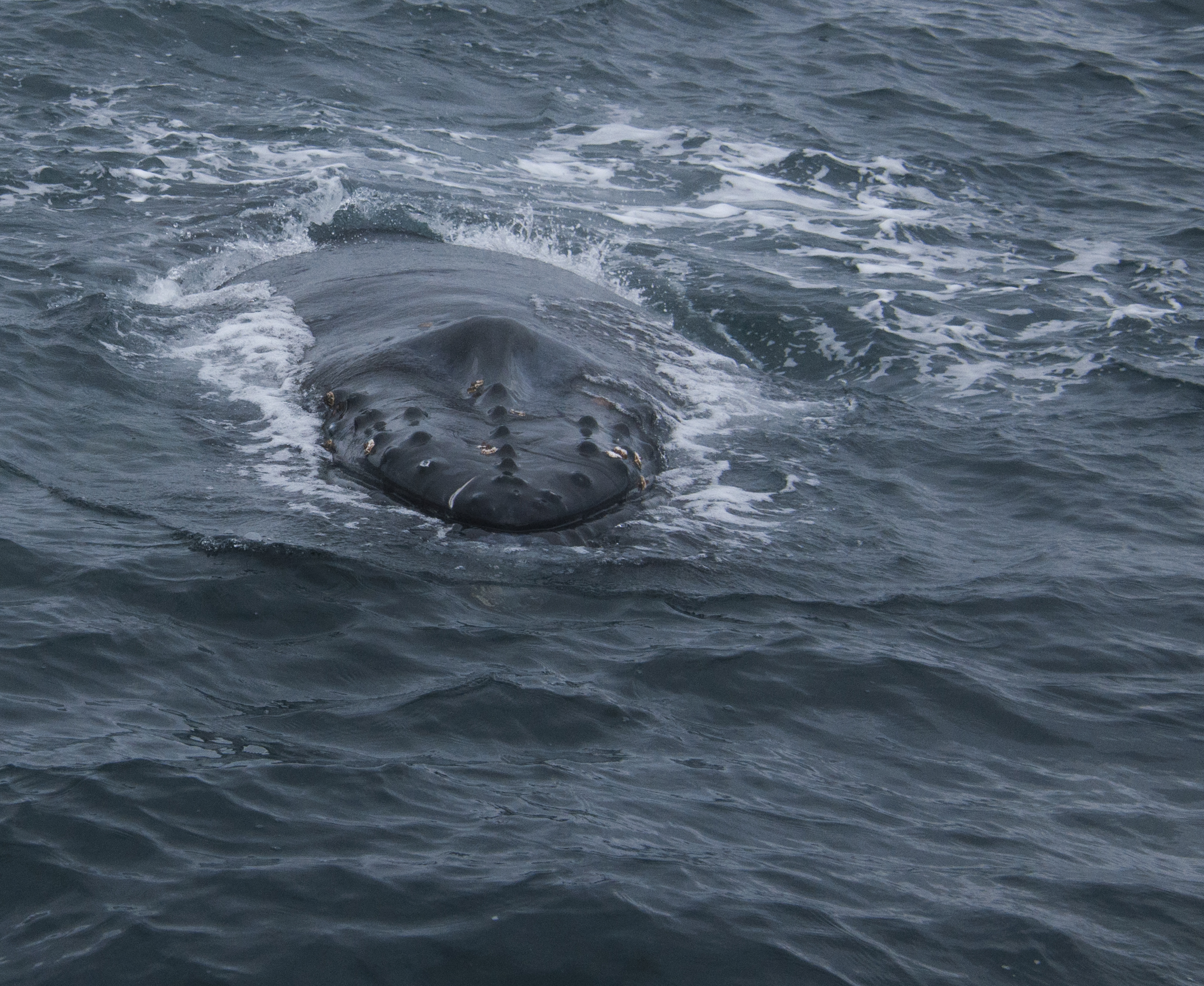
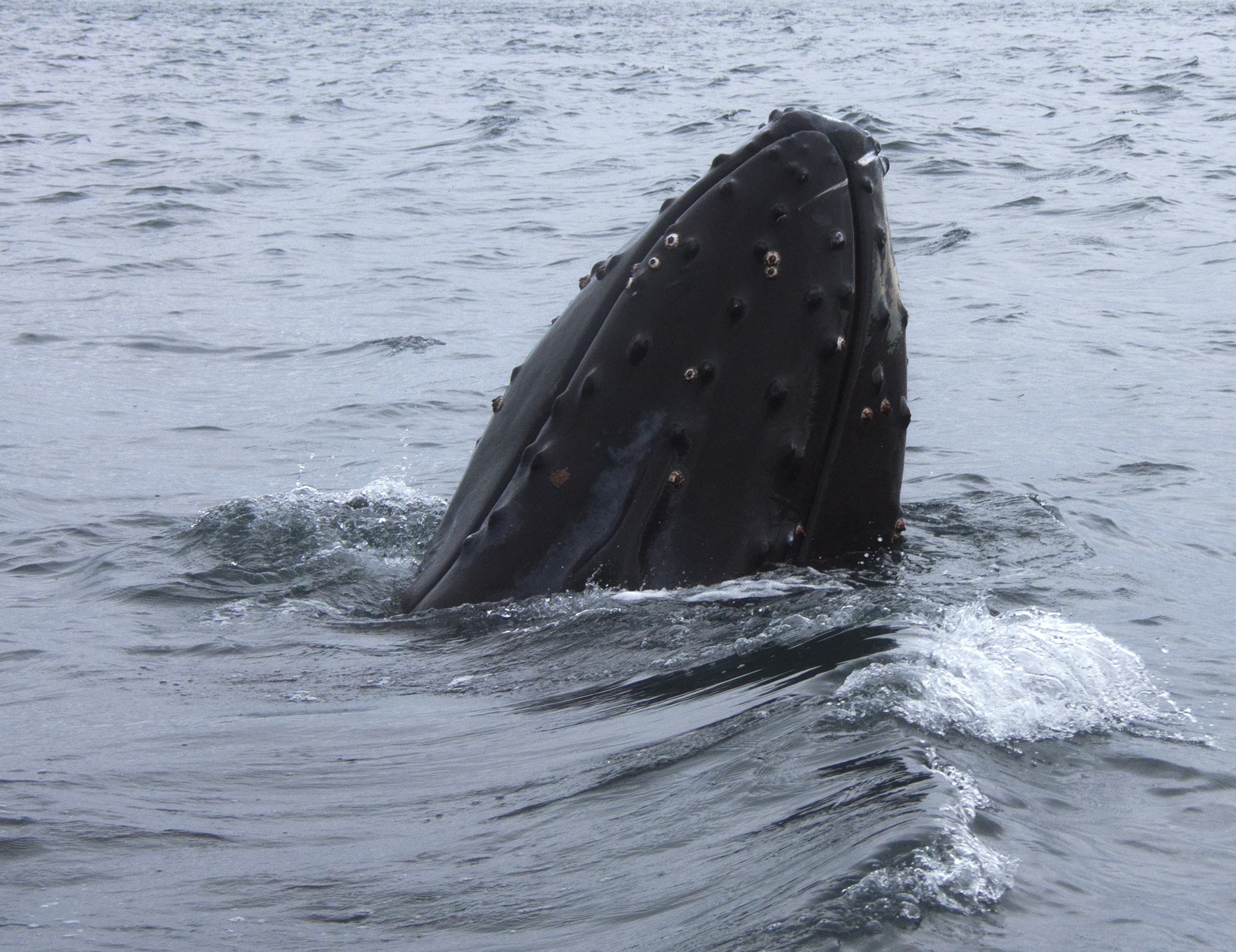
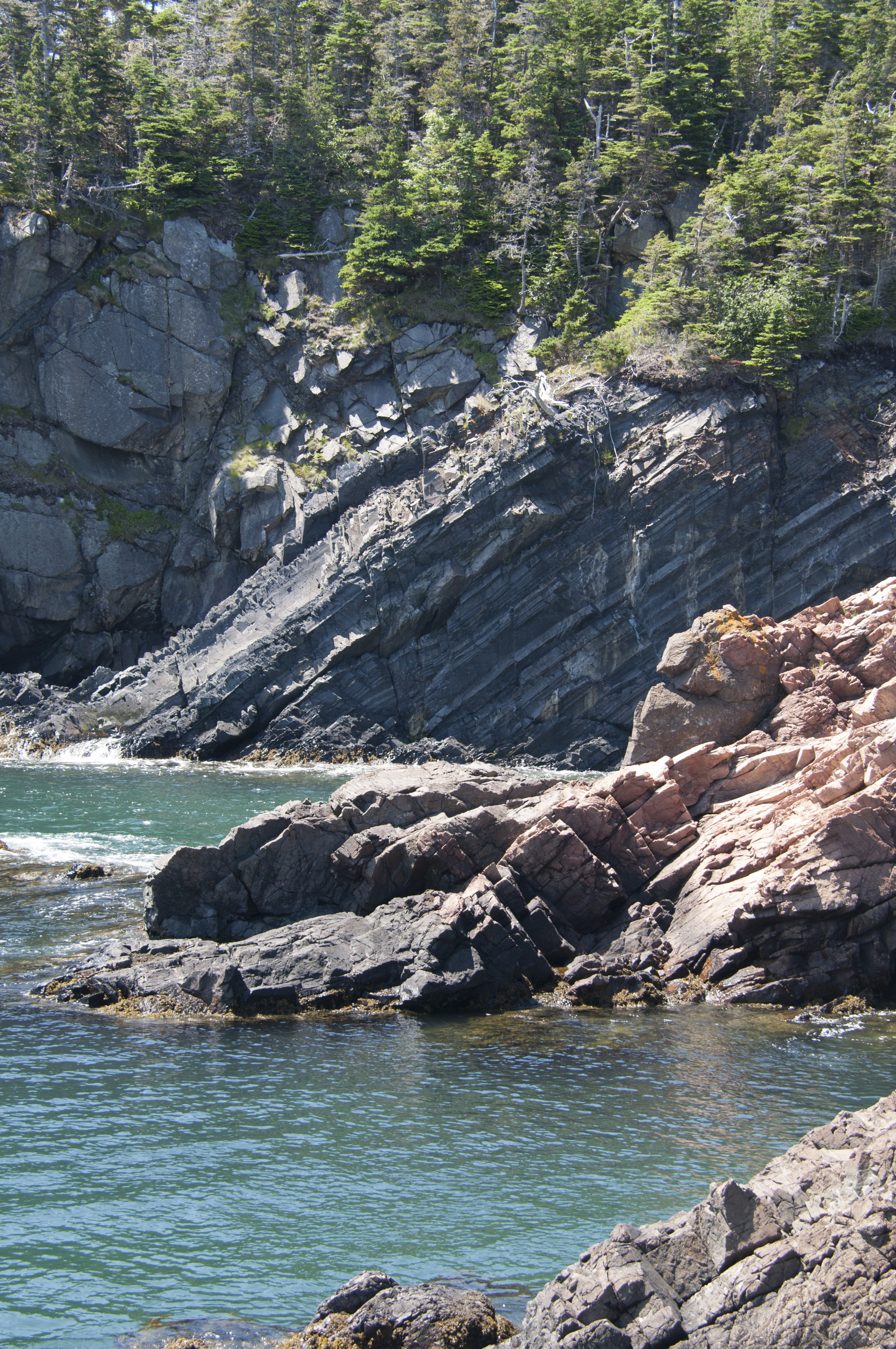
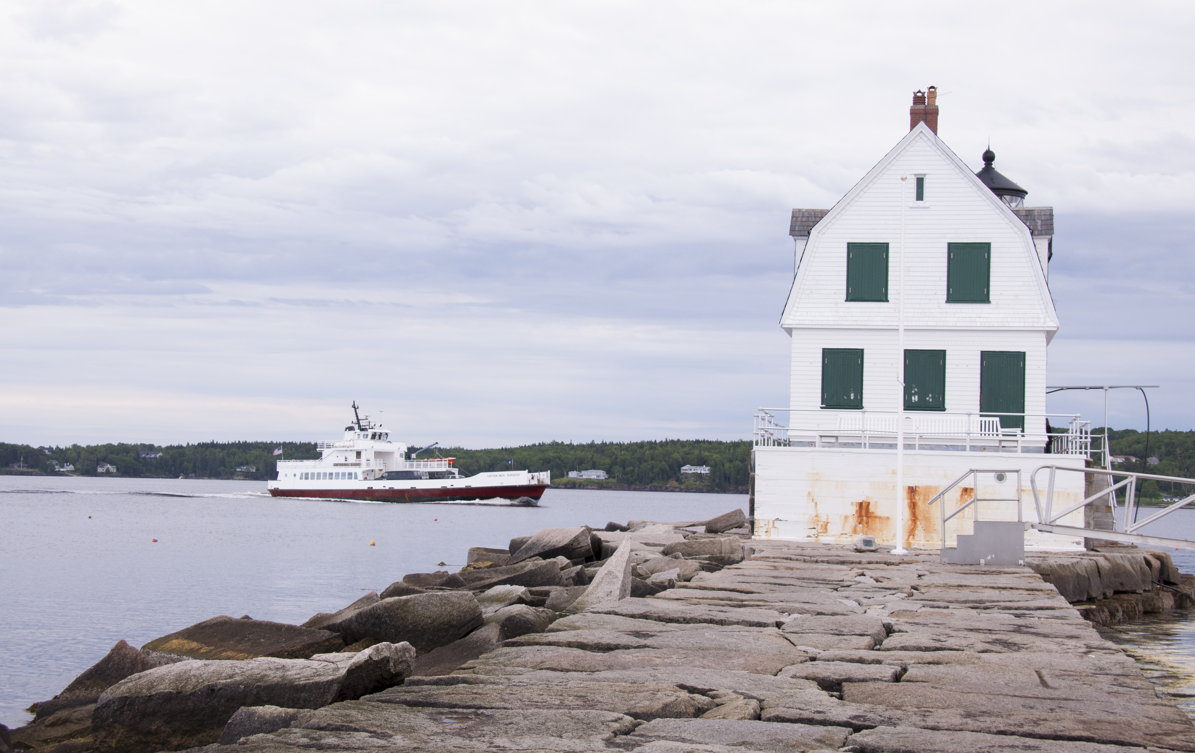
Evidence Of Island’s Rise From The Ocean Floor

What it does have, is beautiful coastlines, a couple of very picturesque lighthouses, Herring Cove, a New Brunswick Provincial Park with RV camping facilities and the only International Park in the world completely within the boundaries of one country.  The Campobello International Park is run jointly by the United States and Canada, but located totally within Canada.  At Herring Cove we had a very comfortable pull-through campsite, surrounded by red spruce and birch trees, with electric connection, but no water or sewer at the site.  There was a water spigot about a hundred feet (thirty meters?) from our site, so we had no problem filling up our fresh water tank.

Being surrounded by trees, we didn’t even try our Direct TV antenna, which we were told might work in Canada as long as we are fairly close to the border.   But the farther north we go, the lower in the sky the satellite is, so for our duration in Canada, we probably won’t be seeing much television.  We do have several things recorded, and we still get Netflix movies, so we’ll still have something to watch on those evenings when we don’t feel like sitting outside at the fire or going in to play dominos or cribbage.  One nice thing about the red spruce woods around us is the firewood supply.  I had no trouble finding small dead trees or branches, which I dragged back to the site and cut into small pieces for the campfire.  The spruce caught quickly and burned nicely… perfect wood for a fire.

Logo Of Campobello International Park

Logo Of Campobello International Park

Back in the late 1890s, when Franklin Roosevelt was a year old, his parents vacationed on Campobello.  There were a few resort hotels there, trying to attract the well-to-do from both the US and Canada.  The Roosevelts fell in love with the island’s beauty and serenity. They bought land and built a summer “cottage” on the island.   As young Franklin grew up, he also loved Campobello, hiking and swimming, canoeing and learning to sail.  He brought his bride, Eleanor and she also was smitten.

The original house, the one bought by Franklin’s parents, no longer exists.  A neighbor’s will allowed Franklin’s parents to buy her home and gift it to Eleanor and Franklin.  They expanded the house to become what is now known as the “Roosevelt Cottage”. Eleanor’s and Franklin’s children also spent their summers here.  And it was here that Franklin, now a young man and up-and-coming politician, contracted polio. Most of the pictures you see of FDR are in his post polio years so I was fascinated to see pictures of him as a young athletic man golfing, sailing and playing with the children.

Their property and 34 room summer “cottage” are now part of the International Park and open to tours most days.  Across the road from the cottage is a large natural area of carriage roads for drives or biking, hiking trails and beaches for clamming or walking.  Also available, at neighboring “Hubbard House” is “Tea with Eleanor”, a free event, held twice daily.  Tea and cookies are provided while two park docents discuss Eleanor and her fascinating life.  Eleanor Roosevelt has always been a special hero to Chari, so I’ll let her take over for a while here.

Having Tea "With Eleanor" At Campobello

Having Tea “With Eleanor” At Campobello

View From The Hubbard House Where The Tea Was Held

View From The Hubbard House Where The Tea Was Held

FDR is remembered here for his long residency and political accomplishments.  After contracting polio he returned to Campobello only 3 times. Eleanor returned every summer. She bonded with the local residents and is remembered for her warmth and sincere interest in the well being of local families. I’ve always thought that if I could invite people from history to a dinner party, Eleanor Roosevelt would be one of the guests. The two Interpreters (their name for Rangers), Carolyn and Violet, who spoke at the tea offered different views of Eleanor. One talk focused upon her achievements as First Lady, UN Ambassador and writer of her My Day column. The other related stories of a personal nature, many were stories that had been shared by visitors to the park. One of the most touching was a woman who as a child was being abused by her stepfather. She had written to Eleanor when she was First Lady. The envelope was just addressed Mrs. Roosevelt, The White House, Washington, DC. It was delivered. Three weeks later social service workers were at the home and took the children into protective custody. When that woman visited Campobello she had said if Mrs. Roosevelt hadn’t intervened she doesn’t know what would have become of her. FDR credited her for making him aware of the plight of the average man. I’m sure this led to his aggressive programs during the Depression of the 1930s.

Famous Depression Era Photo

Famous Depression Era Photo

FDR Sign Social Security

FDR Sign Social Security

FDR With Churchill And Stalin

FDR With Churchill And Stalin

FDR Funeral Procession

FDR Funeral Procession

Another interesting story is that when the bridge from Lubec, Maine to Campobello Island was just about finished, but not yet opened, around 1960, Eleanor arrived just after the ferry to Campobello had closed down for the evening.  Bridge workers escorted her car across, and she became the first person, other than construction workers, to cross the bridge named for her husband.

West Quoddy Lighthouse

West Quoddy Lighthouse

We took a short drive back into Maine one afternoon to see the West Quoddy Lighthouse, the easternmost point in the United States.  West Quoddy, the easternmost point?  Is there an East Quoddy?  Well, yes there is, but that’s in Canada.  And there’s a lighthouse there as well.  At the West Quoddy lighthouse, there is a wall display mentioning the northernmost, southernmost, westernmost, and centralmost (is that really a word?) points in the US.  Any clue where these places might be?  The answers will be at the end of this post.

Sunsweep Scullpture

Sunsweep Scullpture

Back on Campobello, we took a few scenic drives and spent a lot of time just relaxing.  On one drive, we went out to Cranberry Point and while out there, decided to take a bit of a hike to see a portion of a special sculpture.  Sunsweep is an international art project, spanning the US/Canadian border.  One portion of the sculpture is at the Roosevelt Campobello International Park, the center of the sculpture is at American Point Island, Lake of the Woods, Minnesota, and the far end is at Boundary Bluff, Point Roberts, Washington.  From the brochure describing the sculpture:   The human scaled units at each site are aligned to specific solar and stellar conditions.  Facets of the sculpture correspond to solstices and equinoxes, and portray the path of the sun from east to west, from dawn to dusk.  They were all carved from one slab of Canadian black granite, and are laser etched with a contour line of a woman’s hand that topographically evolves into a circle (sun symbol). 

I guess visits to Minnesota and Washington will be in the cards.  I only hope they don’t include what happened here at the eastern point of Sunsweep.  After hiking about a mile to get there, Chari stepped into a hole in the ground hidden by the grass and badly twisted her ankle.  It didn’t help the ankle any, but she was able to walk back to the truck before it stiffened up.  As I write this, a couple of weeks later, it’s almost back to normal, but it still swells up a bit at night.

We had made friends with another camper, a lady named Joyce, a few sites away from us.  She joined us for dinner and a campfire that evening, and while we were sipping on a glass of wine before dinner, we met another family, Nancy, Roger, and their daughter, Emma, who were just pulling in.  Before setting up camp in their Class A motor home, they were filling up their fresh water tank from the spigot alongside us.  We talked for a bit, and asked them to join us at the fire after dinner.  Later, around the fire, Roger and Emma joined us, and Joyce was talking about how much she enjoys clamming on the beach.  The next morning, Joyce took them all out to teach them.  We would have gone, but with Chari’s foot, we decided to sit it out.  Much to our surprise (and delight), when they returned, Joyce came over with a bucket of about three dozen soft shells for us. The following night we were invited to dinner by the Virginia family. We hope to keep in touch with all of them.

What a treat that was!  Before dinner that evening, we steamed them and had a delicious appetizer of steamers dipped in garlic butter with a glass of beer.  Ahhh…  Life is Good!

East Quoddy Lighthouse

East Quoddy Lighthouse

Friar's Head Harbor At Sunset On Campobello Island

Friar’s Head Harbor At Sunset On Campobello Island

Answers to Trivia Questions

Well, the answers depend on if you are speaking of all fifty states, or just the “lower forty-eight”.  Speaking of all fifty, the northernmost point is Point Barrow, Alaska.  Westernmost is Cape Wrangell, Alaska.  And southernmost would be Ka Lae, Hawaii.  The geographical center of all fifty states is a point seventeen miles west of Castle Rock, near Belle Fourche, South Dakota.  If, you are interested in the “lower forty-eight”, Cape Alava, Washington is the farthest west,  Key West, Florida the farthest south, and Northwest Angle, Minnesota the farthest north.  A point two miles northwest of Lebanon, Kansas is the geographic center, but forty-two miles south of Lebanon is the geodetic (following the curve of the earth) center.  Confused?  So is the U.S. Geodetic Survey, which no longer calculates “centers” due to the imprecise nature of such measurements.  According to the sign at West Quoddy, Oscar S. Adams, Senior U.S. Mathematician, said that since there is no definite way to locate such a point, it’s best to ignore it entirely.


Lighting The Way

Nothing indicates the Liberality, Prosperity or Intelligence of a nation more clearly than the facilities it affords for the Safe Approach of the Mariner to its shores. 

From the 1868 report of the United States Lighthouse Board

lighthouse, museum

Lghthouses As Art

With its long maritime history and spectacular but rocky coast Maine offers lighthouse aficionados a rare treat. You can purchase a lighthouse passport book and attempt to collect stamps from all of the ones open to the public. Or perhaps join the annual Lighthouse race when hundreds of people dash along the coast to see all of them in one 24-hr period. We spent time at a much more leisurely pace at four lighthouses: Owls Head, Rockland Breakwater, Bass Harbor and West Quoddy Head.

A great place to start your lighthouse education is at the Maine Lighthouse Museum in Rockland. The museum consists of several rooms with exhibits and on demand videos. Whether your interest is in the technical and architectural area or in the stories of those who lived and worked at the light stations, you won’t be disappointed. Plan to spend at least 2 hours here. Of course we were there over four hours! Many people have worked very hard to preserve our coastal heritage but none more than Connie Scoville Small. She and her husband were lighthouse keepers along the New England coast from 1920-1948.  In her ‘retirement’ years she gave hundreds of lectures, appeared on television and wrote newspaper articles all aimed at preserving lighthouses and a way of life that no longer exists. She wrote a book called The Lighthouse Keeper’s Wife.

Alexander Hamilton

Alexander Hamilton

The museum exhibits began with the history of the United States Lighthouse Establishment created by Congress when it federalized all lighthouses in 1789. The first man in charge of the service was Alexander Hamilton when he was our first Secretary of the Treasury.  We were fascinated by the story of Stephen Pleasonton.  Never heard of him? Neither had we. When you hear what he did you’ll wonder why. We’ve all heard about Dolly Madison saving George Washington’s portrait when the British burned the capital during the War of 1812. Stephen Pleasanton was auditor of the Treasury in 1814. Among his numerous duties was overseeing and staffing lighthouses. Under instructions from Secretary of State James Monroe who saw the British land in Maryland, Pleasanton and his staff sewed linen bags and filled them with important documents and books.  The documents were taken by wagon to a mill in Georgetown for safekeeping. Then Pleasonton realized the mill was near a munitions depot and moved the documents a second time to a farmhouse in Leesburg, VA. He kept the documents secure while watching Washington burn on the horizon.  Just what were these documents? The bags contained George Washington’s letter of resignation as General of the Continental Army, the original Declaration of Independence, The Constitution of the United States and The Bill of Rights.  Throughout his 32 year civil service career Pleasonton  was known as a “tight wad”.   Eventually public outcry and congressional investigation put an end to his budgetary constraints.  In 1852 a nine member U. S. Lighthouse Board was created to take over the operation of our lighthouses.  The nation was divided into twelve lighthouse districts each with a Lighthouse inspector responsible for construction, operation and staffing of the navigational aids. The Board was proactive in construction and modernization of lighthouses. By 1860 Fresnel lenses had been installed in all lighthouses. The Lighthouse Board was dissolved in 1910 when the civilian run Lighthouse Service was created.  Under the leadership of George Putnam the United States went from sixth place in navigational safety to second place, surpassed only by the Netherlands. In 1939 the Coast Guard assumed responsibility for lighthouse operation by merging with the U. S. Lighthouse Service.

Another place where lighthouse history could have changed the world was when William Rosecrans was asked to be Abraham Lincoln’s second term Vice President. Besides a military career Rosecrans had invented the odorless oil lamp used in many lighthouses.  Rosecrans took an extended time to accept the offer. Lincoln thought the delay was Rosecrans way of declining and then asked Andrew Johnson to be his running mate. Had Rosecrans answered in a timely fashion, he would have been President after Lincoln’s assassination.

  Manticus Rock Lighthouse


mannticus Rock
Manticus Rock Lighthouse

There were stories about several women who made significant contributions to lighthouse history. One of the most widely publicized is that of 14 year-old Abbie Burgess when her family manned the remote Manticus Rock lighthouse in the Fall of 1856. The supply ship had not arrived on schedule and by December stores were at a critical level. Her father left to row the five miles to Manticus Island. A severe storm developed. Abbie moved her ailing mother and sisters from the wooden house to a granite building only minutes before the home was flooded. Then she scrambled along the rocks to rescue her pet chickens.  The storm raged for twenty days. Abbie kept the lights burning in the lighthouse, rationed supplies of one cup of cornmeal and one egg to each of her family members. The story ended happily with all surviving and her father’s safe return. Two books that might be of interest are The Original Biography of Abbie Burgess, Lighthouse Heroine or a children’s book Keep The Lights Burning Abbie.  Three years later her father was replaced by another lighthouse keeper but Abbie stayed on to assist with the transition. She fell in love with the new keeper’s  son and was married in 1861. Except for a short period when they tried ‘civilian’ life the couple served in the Lighthouse Service. Abbie died just before her 54th birthday and is buried at Forest Hill Cemetery in Spruce Head, Maine where her grave is marked with an aluminum replica of a lighthouse.

Barbara Mabrity

Barbara Mabrity

Stories are not limited to lighthouses in Maine. Barbara Mabrity became keeper of the Key West lighthouse in 1832 upon the death of her husband who’d been lighthouse keeper. She was one of the first women appointed to the Lighthouse Service. Later on it became common for widowed women to assume their husband’s position. In 1846 a severe storm destroyed the lighthouse and all who sought shelter there including the six Mabrity children. Mrs. Mabrity resumed her duties in the new lighthouse in 1847 and remained until her retirement at age 82. Then there is Ida Lewis who at age 16 assumed lighthouse keeper duties at Lime Rock in Newport Harbor, Rhode Island when her father suffered a stroke. She performed many rescues and was the first woman to receive the Congressional Lifesaving Medal.  Her fame spread and she received visits from President Grant, Susan B. Anthony and Mrs. William Astor.  Andrew Carnegie became concerned over her lack of funds for her later years and set up a retirement fund. The first Coast Guard bouy tender was named after her. The next time you think you’ve had a hard day at the office, think about Katherine Walker who at 4’10” and 100 lbs. assumed keeper duties at Robbins Reef Light in New York Harbor when her husband died. She performed over fifty rescues, operated the fog bell and lantern as well as rowing her children to and from school in Bayonne, New Jersey. Life at a light station was not always bleak as shown by Emily Fish at Point Pinos Light in Pacific Grove, CA. She became keeper at age 50 after being widowed but continued to decorate and entertain with style using antiques, paintings and fine china. This earned her the title of “The Socialite Keeper”. The last civilian woman lighthouse keeper was Fannie Mae Salter at Turkey Point, MD. She served from 1925-1947.

Last Woman Lighthouse Keeper

Last Woman Lighthouse Keeper

The Four Types Of Lighthouses

The Four Types Of Lighthouses

On the more technical side the museum has displays showing the four types of marine light alerts; lighthouses, lightships, beacons and lighted buoys. Lighthouses were constructed from wood, cast iron, rubble stone, dressed granite and brick depending on the location.  A 55-page manual listed the keeper’s duties beginning with the instruction “to be conversant with all apparatus.”  This was closely followed with the admonition that “Ignorance upon any point will not be considered as a reason for neglect of duty.” Keepers stood watches of 12 hours at night to make sure the lights operated properly. If weather conditions required it a foghorn was sounded manually and often required operation for several days at a time.  The keeper was responsible for all medical care at the station until he could signal a passing ship for assistance. Children were home schooled through the elementary grades unless they were close enough to attend shore-based schools. In the later years children would live with friends or relatives off island to attend school. After 1918 the Lighthouse Service paid teachers to go to the larger stations or built one room schoolhouses. An extensive display of Fresnel lenses, clothing, rescue equipment and artifacts will keep the technology oriented visitor interested.  Lighthouses are used as symbols by many organizations. A display of badges and patches using lighthouses was on display. One shown here uses The Statue of Liberty, our most recognized lighthouse. There’s even a bit of roadside humor in the Elvis patch.

Maine Lighthouse Museum Artifacts

Maine Lighthouse Museum Artifacts

Fresnel Lens

Fresnel Lens

How Fresnel Works

Statue Of Liberty Patch

Statue Of Liberty Patch

Elvis Has Left The Lighthouse

Elvis Has Left The Lighthouse

One of the last displays discussed lighthouses in other countries such as Canada, Great Britain, Russia and Japan. Japan has over 3300 lighthouses. The father and uncle of author Robert Louis Stevenson were lighthouse designers and builders in Scotland. They built the northernmost lighthouse in Great Britain, Muckle Flugga.  This ties in with the Wyeth exhibit as N. C. Wyeth illustrated many of Stevenson’s books.

If you aren’t overdosed on seafaring history also plan a visit to the Penobscot Maritime Museum in Searsport, Maine. We stopped one Sunday afternoon not realizing the extent of the museum. We saw about half of the exhibits that are devoted to shipbuilding, trading and seamanship. We look forward to another longer visit when we come back.

Here are the four lighthouses we visited:

Owls Head lighthouse is located just south of Rockland at Owls Head State Park. This is a day use park with picnic facilities and a beach. The lighthouse is managed by the American Lighthouse Foundation and staffed by volunteers. Many of the properties under their umbrella were badly deteriorated with the USCG doing only operational and structurally required maintenance when ALF stepped in. By using the funds from tours and gift shops they have restored them to period condition. We went on a Saturday but I’m not sure about operating hours on weekdays. There is a nominal charge to enter the lighthouse but no fee for the grounds or small museum. This is one of the few lighthouses that has an original Fresnel lens. Most of them have been broken or ceased working and were replaced with a plastic lens. Unlike lighthouses in the south that must be several stories tall for ships to see them, Owls Head is short and built on a rocky hill. This means an easy climb to the top. While there we met a couple from New Hampshire who asked us to take their picture and then reciprocated by taking ours. Later we met again at the beach. We sat and talked for an hour finding many things in common. They had their RV at Camden Hills too so we continued our conversation at our site that evening. We hope to meet them at a New Hampshire State Park in September on our return loop.

Maine, Lighthouse

Chari And Steve At Owls Head Light June 2013

Steve Inside The Lighthouse

Steve Inside The Lighthouse

View From Owls Head Light

View From Owls Head Light

Spot Lived Here

Spot Lived Here

Rockland Breakwater Lighthouse is at the end of a granite barrier in a city park. The Breakwater is almost a mile long, seven stories high and is constructed entirely of granite (700,000 tons that is). It was constructed between 1881 and 1902. You really have to see it to appreciate the size of the blocks of granite. The closest thing I’d seen were the huge blocks used at the Pyramids in Giza. As you walk along the breakwater you must watch the uneven surface and the 6-12” cracks between the blocks. There is a campaign running between June and September 2013 to make this the 8th Wonder of the World. The lighthouse wasn’t open when we were there in the evening. We did see some shorebirds and our first eider duck. On the way back I’d put my camera in my backpack. Apparently I’d forgotten to zip one half. All of a sudden the camera fell onto the stone. Could I have picked a grassy spot…no. I held my breath as I picked it up. The polarizer was smashed but my new 18-300mm lens appeared OK. The camera worked. Yes, I did deserve the HOW COULD I BE SO STUPID AWARD that day. I think Nikon should use this like Samsonite used the gorilla to demonstrate the durability of their product.

A Long Way To The Light

A Long Way To The Light

Reflecting On Rockland Breakwater

Reflecting On Rockland Breakwater

A Working Harbor

A Working Harbor

While we were in the Bar Harbor area we drove to Southwest Harbor to see the Bass Harbor lighthouse. It was a foggy afternoon but this gave us a different view of the lighthouse probably one similar to that of fishermen in the area. This lighthouse is not open to the public and access is only by scrambling along the rocks. Steve’s always much braver than I am about going out to the edge.  As this was just before July 4th, there were lots of people crawling all over the rocks so getting a people free picture was a challenge.

Bass Harbor Lighthouse

Bass Harbor Lighthouse

The fourth Maine lighthouse we visited is West Quoddy Head. This is the easternmost lighthouse in the USA. So why is the easternmost lighthouse called West Quoddy Head, you ask? It’s because East Quoddy lighthouse is on Campbobello Island in New Brunswick, Canada. We saw that too and will cover it in an upcoming post. Quoddy Head State Park offers 5.5 miles trails through forest and bog down to the rocky shore. and an interesting museum. Here we learned that the body of XXX, father of the Coast Guard was buried until his body was exhumed and moved to New London in XXX. The red and white striped lighthouse built in 1808 has been painted with six or eight alternating stripes at various times. Right now there are eight. It was the first to use a fog bell and later a steam powered foghorn. The light was automated in 1988. Unfortunately the tower is not open. The view of Grand Manan Channel and Sail Rock is worth a visit by itself. The black cliffs are a type of rock called gabbro. You’ll hear more about this when we post our Catching Up #2 about Saugus Iron Works.

West Quoddy Head Lighthouse

West Quoddy Head Lighthouse